Stewartville, Minnesota facts for kids
Quick facts for kids
Stewartville
|
|
|---|---|

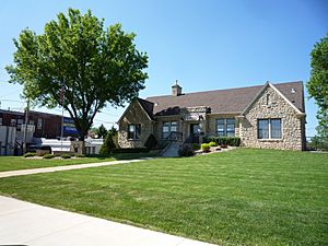
Stewartville City Hall
|
|
| Motto(s):
"The Future Is Bright"
|
|

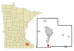
Location of Stewartville, Minnesota
|
|
| Country | United States |
| State | Minnesota |
| County | Olmsted |
| Area | |
| • Total | 3.24 sq mi (8.38 km2) |
| • Land | 3.24 sq mi (8.38 km2) |
| • Water | 0.00 sq mi (0.00 km2) |
| Elevation | 1,191 ft (363 m) |
| Population
(2020)
|
|
| • Total | 6,687 |
| • Density | 2,065.80/sq mi (797.70/km2) |
| Time zone | UTC-6 (Central (CST)) |
| • Summer (DST) | UTC-5 (CDT) |
| ZIP code |
55976
|
| Area code(s) | 507 |
| FIPS code | 27-62806 |
| GNIS feature ID | 2395968 |
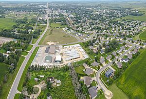
Stewartville is a city in Olmsted County, Minnesota, United States. It is located just south of the Rochester International Airport. This airport is about 10 miles south of the city of Rochester. In 2020, Stewartville had a population of 6,687 people. By 2023, the population was estimated to have grown to 6,906.
Contents
History of Stewartville
Stewartville was started in the 1850s. It was named after its founder, Charles Stewart. A post office has been open in Stewartville since 1858. This means people have been sending and receiving mail there for a very long time!
Geography and Location
Stewartville is a city in Minnesota. It covers a total area of about 3.09 square miles (8.00 square kilometers). Most of this area is land, about 3.04 square miles (7.87 square kilometers). A small part, about 0.05 square miles (0.13 square kilometers), is water.
Two important roads run through Stewartville. These are U.S. Route 63 and Minnesota State Highway 30. Also, a big highway called Interstate 90 is just north and west of the city. Stewartville is part of the larger Rochester, MN Metropolitan Statistical Area. This means it's connected to the bigger city of Rochester.
People and Population
Stewartville has grown quite a bit over the years. Here's how its population has changed:
- 1900: 830 people
- 1910: 794 people
- 1920: 941 people
- 1930: 793 people
- 1940: 1,025 people
- 1950: 1,193 people
- 1960: 1,670 people
- 1970: 2,802 people
- 1980: 3,925 people
- 1990: 4,520 people
- 2000: 5,411 people
- 2010: 5,916 people
- 2020: 6,687 people
Stewartville in 2010
In 2010, there were 5,916 people living in Stewartville. There were 2,318 homes. About 38% of these homes had children under 18 living there. The average age of people in the city was about 34.6 years old. About 28% of the people were under 18. About 14% were 65 years old or older.
Famous People from Stewartville
Many interesting people have connections to Stewartville. Here are a few:
- John Robert Beach: A farmer and state legislator from Minnesota.
- Jill Billings: A member of the Wisconsin State Assembly.
- John Paul Goode: A geographer and cartographer, who makes maps.
- Jason Hammel: Half of the Indie-Pop music group Mates of State.
- David C. Hodge: A former president of Miami University.
- Richard Warren Sears: The person who started the famous company Sears, Roebuck & Company.
Climate and Weather
Stewartville has a "Humid Continental Climate." This means it has warm summers and cold, snowy winters. The weather changes a lot between seasons.
| Climate data for Stewartville, Minnesota | |||||||||||||
|---|---|---|---|---|---|---|---|---|---|---|---|---|---|
| Month | Jan | Feb | Mar | Apr | May | Jun | Jul | Aug | Sep | Oct | Nov | Dec | Year |
| Mean daily maximum °C (°F) | −6 (22) |
−3 (27) |
4 (39) |
13 (56) |
20 (68) |
26 (78) |
28 (82) |
27 (80) |
22 (71) |
15 (59) |
5 (41) |
−3 (27) |
12 (54) |
| Mean daily minimum °C (°F) | −16 (4) |
−13 (8) |
−6 (21) |
1 (34) |
8 (46) |
13 (56) |
16 (60) |
14 (58) |
9 (49) |
3 (38) |
−4 (24) |
−12 (11) |
1 (34) |
| Average precipitation mm (inches) | 20 (0.8) |
20 (0.8) |
43 (1.7) |
69 (2.7) |
91 (3.6) |
110 (4.5) |
99 (3.9) |
99 (3.9) |
81 (3.2) |
53 (2.1) |
41 (1.6) |
25 (1) |
760 (29.8) |
| Average precipitation days | 8 | 7 | 9 | 10 | 12 | 11 | 9 | 9 | 9 | 8 | 8 | 8 | 108 |
| Source: Weatherbase | |||||||||||||
See also
 In Spanish: Stewartville (Minnesota) para niños
 | Dorothy Vaughan |
 | Charles Henry Turner |
 | Hildrus Poindexter |
 | Henry Cecil McBay |


