Stony Run (Little Catawissa Creek tributary) facts for kids
Quick facts for kids Stony Run |
|
|---|---|

Stony Run
|
|
| Physical characteristics | |
| Main source | Little Mountain in Union Township, Schuylkill County, Pennsylvania 1,460 to 1,480 feet (450 to 450 m) |
| River mouth | Little Catawissa Creek in Union Township, Schuylkill County, Pennsylvania 912 ft (278 m) 40°52′53″N 76°13′57″W / 40.88128°N 76.23256°W |
| Length | 2.2 mi (3.5 km) |
| Basin features | |
| Progression | Little Catawissa Creek → Catawissa Creek → Susquehanna River → Chesapeake Bay |
| Basin size | 2.24 sq mi (5.8 km2) |
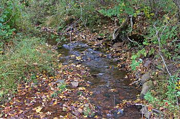
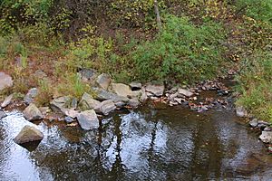
Stony Run is a small stream, or "run," located in Schuylkill County, Pennsylvania. It flows into Little Catawissa Creek. This stream is about 2.2 miles (3.5 km) long. It flows mostly through Union Township.
The area of land that drains into Stony Run is called its watershed. This watershed covers about 2.24 square miles (5.8 km2). Sadly, the water in Stony Run is not very clean. It is also quite acidic. Even so, it is known as a coldwater fishery. This means it's a place where fish that like cold water could live. However, no fish currently live in Stony Run.
The rocks under the stream are mainly the Mauch Chunk Formation and the Pocono Formation. The soil around the stream is mostly Leck Kill soil and Hazleton soil.
Contents
Where Does Stony Run Flow?
Stony Run starts high up on Little Mountain. This mountain is in Union Township.
The stream first flows east for a short distance. Then, it turns southeast. It leaves Catawissa Mountain and Little Mountain behind. After that, it turns northeast for a bit. Then it flows east-northeast.
Further downstream, it crosses Ridge Road. Soon after crossing the road, it turns east-southeast. Almost immediately, Stony Run meets Little Catawissa Creek. This meeting point is about 1.96 miles (3.15 km) upstream from where Little Catawissa Creek ends.
What is the Water Quality Like?
Stony Run has some water quality issues. The stream is very acidic. This is mainly because of acid precipitation. Acid rain makes the water more acidic than it should be.
The pH level of Stony Run is 6.0. A pH of 7 is neutral, so 6.0 is slightly acidic. The water has 0 milligrams per liter of alkalinity. Alkalinity helps water resist changes in pH. It also has 0 milligrams per liter of water hardness. This means the water is very soft.
On a warm day in July 1997, the air temperature near the stream was 26 °C (79 °F). The water temperature was 14.4 °C (57.9 °F). The specific conductivity of the water was 19 umhos. This measures how well water conducts electricity.
What is the Land Around Stony Run Like?
The land around Stony Run changes in height. The stream's mouth, where it joins Little Catawissa Creek, is about 912 feet (278 m) above sea level. The source of the stream, where it begins, is much higher. It is between 1,460 feet (450 m) and 1,480 feet (450 m) above sea level.
Most of Stony Run flows over rocks from the Mauch Chunk Formation. However, the very beginning of the stream flows over rocks from the Pocono Formation. The lower parts of the stream are on Leck Kill soil. The rest of the stream is on Hazleton soil.
About half of the lower part of Stony Run is in an area that can flood. This means it could be underwater during a very big flood, like a 100-year flood.
Stony Run is a small stream. It is only about 1.7 metres (5.6 ft) wide. It also flows downhill very quickly. This is called a high gradient. It drops 47.5 meters for every kilometer it flows.
Who Lives Near Stony Run?
The watershed of Stony Run covers about 2.24 square miles (5.8 km2). Most of this area is in Union Township. A small part of the watershed is in Roaring Creek Township in Columbia County. A tiny bit is also in North Union Township.
Some land in the watershed belongs to clubs or associations. There is also a special forest area in the upper part of the watershed. This area is important for nature. The land in the watershed includes both forests and farmland.
About 9 percent of Stony Run's length is very close to a road. About 35 percent is within 300 metres (980 ft) of a road. And about half of the stream's length is within 500 metres (1,600 ft) of a road. In 1990, about 40 people lived in each square kilometer of the watershed.
Stony Run is shown on maps called quadrangles. These maps are from the United States Geological Survey. The quadrangles for Stony Run are Shumans, Nuremberg, Ashland, and Shenandoah.
Can Fish Live in Stony Run?
The Pennsylvania Department of Environmental Protection considers Stony Run a Coldwater Fishery. This means it has the right temperature for fish that like cold water. However, a report from 1997 suggested that the stream's water quality was too poor for fish. Because of this, they advised against trying to manage the stream for fishing.
The stream cannot support fish life. This is because it has been affected by acid precipitation. The acidic water makes it impossible for fish to survive there. The 1997 report also said that Stony Run was not a good place for fishing.
 | Tommie Smith |
 | Simone Manuel |
 | Shani Davis |
 | Simone Biles |
 | Alice Coachman |


