
Stratmoor, Colorado facts for kids
Quick facts for kids
Stratmoor, Colorado
|
|
|---|---|

The sign for the Stratmoor Hills subdivision in Stratmoor.
|
|

Location of the Stratmoor CDP in El Paso County, Colorado
|
|

Stratmoor, Colorado
Location in the United States
|
|
| Country | |
| State | |
| County | El Paso County |
| Government | |
| • Type | unincorporated community |
| Area | |
| • Total | 2.654 sq mi (6.874 km2) |
| • Land | 2.633 sq mi (6.819 km2) |
| • Water | 0.021 sq mi (0.055 km2) |
| Elevation | 5,787 ft (1,764 m) |
| Population
(2020)
|
|
| • Total | 6,518 |
| • Density | 2,455.9/sq mi (948.21/km2) |
| Time zone | UTC-7 (MST) |
| • Summer (DST) | UTC-6 (MDT) |
| ZIP Code |
Colorado Springs 80906, 80910, and 80911
|
| Area code(s) | 719 |
| GNIS feature | Stratmoor CDP |
Stratmoor is a community in El Paso County, Colorado, United States. It is often called Stratmoor Hills. It is an unincorporated community, which means it's not officially a city or town with its own local government. Instead, it's managed by the county.
Stratmoor is also a census-designated place (CDP). This is a special area defined by the United States Census Bureau just for counting people. It helps us know how many people live there.
Stratmoor is part of the larger Colorado Springs area. In 2020, about 6,518 people lived in Stratmoor. The local post office in Colorado Springs serves the area, using ZIP Codes 80906, 80910, and 80911.
Contents
History of Stratmoor
Changes to Stratmoor's Borders
In 2014, a part of Stratmoor became officially part of the City of Fountain. This change is called an annexation.
The area that was annexed was about 60 acres. It is located near Interstate 25 at Exit 135. This land now includes a large Walmart store, a Sam's Club, and a shopping center.
Where is Stratmoor?
Stratmoor covers an area of about 6.874 square kilometers (or 1,700 acres). A small part of this area, about 0.055 square kilometers (or 13.6 acres), is water.
People Living in Stratmoor
The United States Census Bureau first started counting Stratmoor as a CDP in 1980. Here's how the population has changed over the years:
| Stratmoor CDP, Colorado | ||
|---|---|---|
| Year | Pop. | ±% |
| 1980 | 5,519 | — |
| 1990 | 5,854 | +6.1% |
| 2000 | 6,650 | +13.6% |
| 2010 | 6,900 | +3.8% |
| 2020 | 6,518 | −5.5% |
| Source: United States Census Bureau | ||
Education in Stratmoor
Students in Stratmoor Hills go to schools that are part of the Harrison School District 2.
Images for kids
-
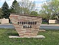
The sign for the Stratmoor Hills subdivision in Stratmoor.
-
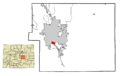
Location of the Stratmoor CDP in El Paso County, Colorado.
See also
 In Spanish: Stratmoor para niños
