
Streetsboro, Ohio facts for kids
Quick facts for kids
Streetsboro, Ohio
|
||
|---|---|---|

Saint Joan of Arc Church on Route 14 was built in 1987
|
||
|
||
| Motto(s):
Gateway to Progress
|
||
| Country | United States | |
| State | Ohio | |
| County | Portage | |
| Founded | 1822 | |
| Incorporated | 1968 | |
| Area | ||
| • Total | 24.33 sq mi (63.02 km2) | |
| • Land | 23.46 sq mi (60.75 km2) | |
| • Water | 0.88 sq mi (2.27 km2) | |
| Elevation | 1,129 ft (344 m) | |
| Population
(2020)
|
||
| • Total | 17,260 | |
| • Density | 735.85/sq mi (284.12/km2) | |
| Time zone | UTC-5 (EST) | |
| • Summer (DST) | UTC-4 (EDT) | |
| ZIP code |
44241
|
|
| Area code(s) | 330, 234 | |
| FIPS code | 39-75014 | |
| GNIS feature ID | 1086840 | |
Streetsboro is a city in Ohio, United States. It is located in Portage County, in the western part of the state. In 2020, about 17,260 people lived there. Streetsboro is also part of the larger Akron area. The city started from an older area called Streetsboro Township.
Contents
History of Streetsboro
Early Days and Native Americans
Long ago, before settlers came, Native American tribes like the Seneca lived in the area now known as Streetsboro. They used a path called the Old Portage Trail. This trail helped them travel between Lake Erie and the Ohio River.
How Streetsboro Was Founded
Streetsboro was founded by a man named Titus Street from Connecticut. He bought the land in 1798. This area was known as Streetsboro Township and covered about 15,279 acres. In 1822, Street's agents, Ralph Cowles and Lemuel Punderson, surveyed the land. They divided it into smaller lots of 100 acres each.
Roads and Growth
In 1825, a new road called a turnpike was planned. It would go from Cleveland to Wellsville, Ohio. Titus Street agreed to give land for the road to pass through his township. The turnpike was finished in 1827. Much of this old road is now part of Ohio State Route 14.
A big change happened in Streetsboro when the Ohio Turnpike opened in 1955. Exit 13 (now Exit 187) was the only exit in Portage County at first. Because of this new highway and the growing car industry, many people moved to Streetsboro. The city is close to Akron and Cleveland. It also has easy access to major highways like Interstate 80 (the Ohio Turnpike), Interstate 480, and State Routes 303, 43, and 14. These connections have helped Streetsboro grow a lot in the last 50 years. Many new businesses, factories, and homes have been built.
Becoming a City
In 1968, people in Streetsboro voted to combine the township and the village into one city. The new city covered about 25 square miles. Before 1970, Streetsboro was mostly a farming community. There was once a small amusement park called Shady Lake Park on Route 14. Today, that area is an apartment complex with the same name.
In the early 2000s, Streetsboro continued to grow steadily. It has become a major shopping area for Portage County. Many large stores have opened there.
Geography of Streetsboro
Streetsboro covers about 24.36 square miles in total. Most of this area is land, but about 0.90 square miles is covered by water.
Population of Streetsboro
| Historical population | |||
|---|---|---|---|
| Census | Pop. | %± | |
| 1900 | 672 | — | |
| 1910 | 674 | 0.3% | |
| 1920 | 715 | 6.1% | |
| 1930 | 709 | −0.8% | |
| 1940 | 894 | 26.1% | |
| 1950 | 1,107 | 23.8% | |
| 1960 | 5,767 | 421.0% | |
| 1970 | 7,966 | 38.1% | |
| 1980 | 9,055 | 13.7% | |
| 1990 | 9,932 | 9.7% | |
| 2000 | 12,311 | 24.0% | |
| 2010 | 16,028 | 30.2% | |
| 2020 | 17,260 | 7.7% | |
| 2021 (est.) | 17,640 | 10.1% | |
| Sources: | |||
In 2010, about 16,028 people lived in Streetsboro. There were 6,562 households and 4,316 families. The city had about 683 people per square mile.
Most people in Streetsboro were White (87.7%). About 7.9% were African American, and 2.2% were Asian. About 1.7% of the population was Hispanic or Latino.
In terms of age, the average age in Streetsboro was 37.9 years. About 22.3% of residents were under 18 years old. About 11.7% were 65 years or older.
Education in Streetsboro
Schools in the City
Most students in Streetsboro go to schools in the Streetsboro City School District. There are four schools in this district. A small part of the city is also served by the Kent City School District.
Younger students, from preschool to third grade, attend Streetsboro Elementary School. Henry Defer Intermediate School is for students in fourth and fifth grades. Students in sixth through eighth grades go to Streetsboro Middle School. Streetsboro High School is for students in grades 9 through 12.
Most of the schools and the district offices are on a large 116-acre campus. This campus also includes the Streetsboro City Park. The Pierce Streetsboro Library, which is part of the Portage County District Library, opened on this campus in 1988.
School Improvements
In 2013, voters approved a plan to spend $38.7 million to improve and expand the school buildings. This plan included building a new Streetsboro High School on State Route 14. It also involved expanding and renovating the old Campus Elementary to become the new Streetsboro Elementary School. Both of these projects were finished in December 2016, and classes started in the new buildings in January 2017.
Future plans include renovating the old high school building to become Streetsboro Middle School. This will allow sixth graders to move to the middle school from Henry Defer Intermediate School. The current middle school building will also be used for new purposes.
Media in Streetsboro
Radio Stations
- WSTB 88.9 FM: This radio station is run by Streetsboro High School. It plays alternative rock music from Monday to Saturday and oldies on Sunday.
Print Media
- Record-Courier: This is a daily newspaper that serves all of Portage County.
Notable People from Streetsboro
- Hester A. Benedict (1838-1921): A poet and writer.
- Matthew Hannan: A professional wrestler.
- Henry H. Wyatt: A soldier from the Civil War era and a state assemblyman in Wisconsin.
Images for kids
-
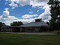
Saint Joan of Arc Church on Route 14 was built in 1987
-
The official logo of Streetsboro
See also
 In Spanish: Streetsboro (Ohio) para niños
