Sturgeon-Weir River facts for kids
Quick facts for kids Sturgeon-Weir River |
|
|---|---|

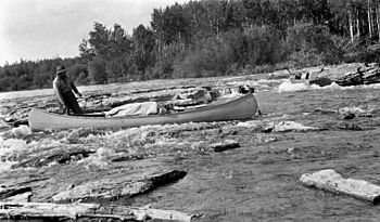
A canoe navigating the rapids on the Sturgeon-Weir River
|
|
|
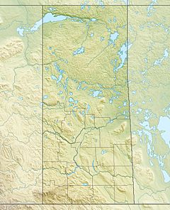
Location of the mouth of the Sturgeon-Weir River in Saskatchewan.
|
|
| Other name(s) | Riviere Maligne |
| Country | Canada |
| Province | Saskatchewan |
| Physical characteristics | |
| Main source | Corneille Lake 311 m (1,020 ft) 55°01′3″N 102°38′9″W / 55.01750°N 102.63583°W |
| River mouth | Namew Lake 266 m (873 ft) 54°16′23″N 101°49′01″W / 54.27306°N 101.81694°W |
| Length | 131 km (81 mi) |
| Basin features | |
| Tributaries |
|
The Sturgeon-Weir River is a river in east-central Saskatchewan, Canada. It flows for about 130 kilometers (81 miles) south-southeast. The river eventually joins the Saskatchewan River near Cumberland House, Saskatchewan.
This river was once a very important path for early Canadian explorers and traders. It was part of the main route for voyageurs (French-Canadian fur traders) traveling from eastern Canada. They used it to reach the far northern Mackenzie River basin. Today, the Sturgeon-Weir River is a popular spot for people who love to go canoeing in the wilderness.
Contents
What is the Sturgeon-Weir River Like?
The Sturgeon-Weir River begins at Corneille Lake. This lake is close to the community of Pelican Narrows. From there, the river flows mostly towards the southeast.
River's Journey and Surroundings
As it travels, the river crosses Saskatchewan Highway 106. It then reaches Amisk Lake. After Amisk Lake, it continues its journey southeast. It passes through a place called Sturgeon Landing before flowing into Namew Lake.
The river flows through a special natural area. This area is known as the Churchill River Uplands ecoregion. It is located at the southern edge of the Precambrian Shield. This is a very old and rocky part of Canada.
Plants and Animals of the River Area
The land around the Sturgeon-Weir River is covered by thick forests. These are mostly coniferous and boreal forests. They have many black spruce and jack pine trees. The ground is often covered with soft mosses and lichens.
The land here is not very hilly. Most hills are less than 25 meters (82 feet) high. But there are some steep, rocky areas. You can also see lowlands where the bedrock is exposed.
Wildlife You Might See
Many different animals live near the river. Some of the larger animals include:
Smaller animals like beaver, muskrat, snowshoe hare, and red-backed vole also make their homes here.
Birds of the River
The river area is also home to many bird species. You might spot:
Many waterfowl, such as ducks and geese, also live on the river and nearby lakes. People sometimes use this land for trapping, hunting, fishing, and tourism.
A Look Back: History of the River
The Sturgeon-Weir River has a long and important history. It was a key connection between two major river systems: the Saskatchewan River and the Churchill River.
Early Use and Exploration
People have used this river route for thousands of years. Archeologists have even found old pottery here. Some of it dates back to 1100 CE. This shows that people lived and traveled here a very long time ago.
The first European to explore the river might have been Isaac Batt. He was a fur trader for the Hudson's Bay Company. He explored the area in the winter of 1766–67.
In 1776, several important fur traders traveled up the river. These included Alexander Henry, Joseph Frobisher, Thomas Frobisher, and J. B. Cadotte. They started from Cumberland House. They built a fort at the river's exit from Amisk Lake. They called it Fort Beaver Lake.
This river route became the main way to connect the Saskatchewan River system to northern Canada. It linked important trading posts like Cumberland House to Frog Portage, Île à la Crosse, and eventually Lake Athabasca.
Why it was Called "Bad River"
The river was not always easy to travel. It has a steep slope, dropping about 1.2 meters (4 feet) for every mile. Because of this, the voyageurs called it the Rivière Maligne. This means "Bad River" in French.
One traveler in the early 1800s wrote about it. They said, "This river is most appropriately named by the Canadians." They thought it was "the most dangerous, cross-grained piece of navigation in the Indian country." The famous explorer Sir Alexander Mackenzie also described it as "an almost continual rapid."
Mapping the River
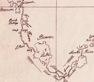
In 1779, Philip Turnor was the first to show the river on a map. He noted it as a "river leading northward and upon the back of the Churchill." Its path was first fully recorded on a map by Aaron Arrowsmith in 1802. However, it was not named on that map.
David Thompson, another famous explorer, measured its length. He named it "Sturgeon Weir River" on his 1814 map of the North-West Territory.
 | Misty Copeland |
 | Raven Wilkinson |
 | Debra Austin |
 | Aesha Ash |


