Goose River (Manitoba-Saskatchewan) facts for kids
Quick facts for kids Goose River |
|
|---|---|
Tracking Rapids on the Goose River
|
|
|
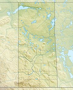
Location of the river mouth in Saskatchewan
|
|
| Other name(s) | Rat Creek, Small's River |
| Country | Canada |
| Provinces | |
| Physical characteristics | |
| Main source | Lake Athapapuskow Northern Region, Manitoba 291 m (955 ft) 54°33′26″N 101°27′39″W / 54.55722°N 101.46083°W |
| River mouth | Sturgeon-Weir River Division No. 18, Saskatchewan 267 m (876 ft) 54°19′00″N 101°49′01″W / 54.31667°N 101.81694°W |
| Length | 40.5 km (25.2 mi) |
| Basin features | |
| River system | Nelson River drainage basin |
The Goose River is a cool river in Canada. It flows through parts of Manitoba and Saskatchewan. This river is part of a huge area where water drains into Hudson Bay. It's about 19 kilometers (12 miles) southeast of a place called Bakers Narrows.
Contents
About the Goose River
The Goose River starts at Lake Athapapuskow in Manitoba. This is near a community called Cranberry Portage. The river then flows south into Goose Lake. After that, it enters Saskatchewan for its last 700 meters (about half a mile). Finally, it joins the Sturgeon-Weir River.
A Historic Travel Route
For a long time, the Goose River was a very important path. First Nations hunters used it to travel between the Saskatchewan River and the Grass River systems. This helped them hunt and move around the land.
Many early European explorers also used this river. Samuel Hearne explored it in 1774. The river first appeared on a map drawn by Philip Turnor in 1779. David Thompson traveled here in 1794. It was part of a major route from the middle of Canada to Hudson Bay.
In 1847, a missionary from Cumberland House met a chief named Kinnakahpoo on the river banks. The river was first officially surveyed in 1896 by J.B. Tyrell. In 1919, the Canadian government made the river easier to travel by canoe. They created a channel through some rapids. This was to encourage people to explore the area for valuable resources.
The River's Environment
The Goose River is quite remote and mostly untouched. It flows through a part of the Midwestern Canadian Shield forests. This area is known for its mixed forests. You can find trees like black spruce, white spruce, jack pine, and trembling aspen.
The riverbanks have steep, rocky ridges. There are also wet, boggy areas called muskeg.
Animals and Plants
The Goose River is home to many kinds of fish. You might find brown trout, tullibee, northern pike, rainbow trout, walleye, and yellow perch.
Many wild animals live near the river too. These include moose, black bear, lynx, wolf, and beaver. Bird watchers can spot ravens, common loons, spruce grouse, bald eagles, and hawk owls. Some people also hunt and trap animals in this area.
What's in a Name?
The Goose River has had a few different names over time.
In 1806, a map by Cha Chay Pay Way Ti called it "Nis Caw." This word means "Goose" in the Cree language.
In 1814, explorer David Thompson made a map. He named the river "Small's River." He might have named it after his wife, Charlotte Small.
Locally, people sometimes call it "Rat Creek." This name has been used since at least the 1920s.
The name "Goose River" became official in 1948. It probably got this name because the river flows through a place called "Goose Lake."
 | Ernest Everett Just |
 | Mary Jackson |
 | Emmett Chappelle |
 | Marie Maynard Daly |


