Grass River (Manitoba) facts for kids
Quick facts for kids Grass River |
|
|---|---|

Grass River
|
|
|
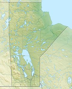
Location of the mouth of the Grass River in Manitoba
|
|
| Native name | Muskuskow' Sipi |
| Country | Canada |
| Province | Manitoba |
| Region | Northern Region |
| City | Cranberry Portage, Kelsey |
| Physical characteristics | |
| Main source | Cranberry Lakes 295 m (968 ft) 54°43′16″N 101°0′3″W / 54.72111°N 101.00083°W |
| River mouth | Nelson River 168 m (551 ft) 56°02′39″N 96°34′22″W / 56.04417°N 96.57278°W |
| Length | 599 km (372 mi) |
| Basin features | |
| River system | Hudson Bay drainage basin |
| Basin size | 15,400 km2 (5,900 sq mi) |
| Tributaries |
|
The Grass River is an important river in the northern part of Manitoba, Canada. It is part of the Hudson Bay drainage basin, meaning its waters eventually flow into Hudson Bay.
The river starts at the Cranberry Lakes, about 27 kilometres (17 mi) east of Cranberry Portage. It flows northeast for about 500 kilometres (310 mi) until it joins the Nelson River. For many years, the Grass River was a very important path for early European explorers. It was also a key route for the fur trade, helping people travel deep into Canada.
Contents
Where the Grass River Flows
The Grass River begins in Third Cranberry Lake. This is about 27 kilometres (17 mi) east of Cranberry Portage. From there, it flows north to Elbow Lake. Then, it makes a sharp turn south towards Iskwasum Lake.
After Iskwasum Lake, the river continues east to Reed Lake. This part of the river is located within Grass River Provincial Park. The river then enters Tramping Lake, passes by the Wekusko Falls, and flows into Wekusko Lake. It continues east to Setting Lake.
The Grass River then goes through Sasagiu Rapids Provincial Park and Pisew Falls Provincial Wayside Park. It enters Paint Lake and Paint Lake Provincial Park. The river keeps flowing northeast through several remote lakes. Finally, it meets the Nelson River near Kelsey, Manitoba. The river is 599 kilometres (372 mi) long. It collects water from an area of 15,400 square kilometres (5,900 sq mi).
Nature and Wildlife Along the River
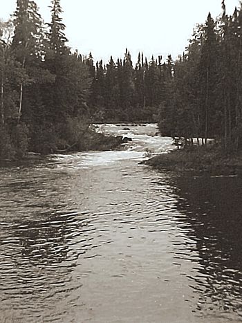
The Grass River flows through the Canadian Shield forests. These forests have a mix of trees like black spruce, white spruce, jack pine, and trembling aspen. Along its banks, you'll see rocky hills and wet, boggy areas called muskeg. The land is hilly with many rocks shaped by glaciers long ago.
Animals You Might See
Many different animals live around the Grass River. You might spot birds like ravens, common loons, spruce grouse, bald eagles, and hawk owls. The area around the Grass River is mostly untouched by humans. It is home to large animals such as moose, black bears, lynx, wolfs, and beavers. You can also see herds of woodland caribou migrating along the river.
Fish in the River
Many parts of the river are hard to reach. However, people do go there for trapping, hunting, and fishing. The Grass River is home to fish like burbot, lake whitefish, northern pike, suckers, walleye, and yellow perch.
History of the Grass River
People have lived along the Grass River for thousands of years. The Shield Archaic peoples lived here about 5,000 years ago. They migrated from what is now the Northwest Territories. Many rock paintings found along the river were made during this time.
Around 2,000 years ago, people in the region started using pottery. The Woodland Cree became the main culture in the area. In the 1700s, the river became an important route for Cree hunters. They traveled to York Factory at Hudson Bay to trade their furs.
Early European Explorers
The first Europeans known to travel the Grass River were Hudson's Bay Company fur traders, Joseph Smith and Isaac Batt. In 1763, they traveled from York Factory up the Grass River. They went to Cranberry Portage, then to Lake Athapapuskow, and down into the Saskatchewan River system. Joseph Smith died on the way back.
In 1774, explorer Samuel Hearne paddled up the Grass River. He was on his way to establish Cumberland House. In the summer of 1794, surveyor and explorer David Thompson traveled up the Grass River. He did this many times during his career mapping North America.
Several fur trading posts were built along the river. Important ones were Reed Lake House (1794) and Cranberry Lake (1804). In the early 1900s, there was a mining boom. This led to more exploration by prospectors and the start of several mining operations.
Mapping the River
The course of the river was first roughly shown on a map in 1760. This map was given to Moses Norton, who worked at Churchill Fort, by some Indigenous traders. The name "Grass River" first appeared on Samuel Hearne's map in 1776.
In 1876, geologist Robert Bell surveyed the lower parts of the river. But it wasn't until 1896 that explorer Joseph Tyrell completed the first full survey of the river. Tyrell wrote that the Cree name for the river was Muskuskow' Sipi, which means "Grassy River."
Canoeing on the Grass River
The Grass River is a popular place for wilderness canoe trips. People enjoy it because it is very natural and untouched. It also has Indigenous rock paintings, beautiful waterfalls, and good sport fishing.
A trip down the entire river can take up to three weeks. However, most canoeists travel shorter sections. A common route is from Cranberry Portage to Split Lake. The river's difficulty for canoeing is considered intermediate. This means it has moderate portaging (carrying canoes around rapids) and more advanced lake travel.
 | Claudette Colvin |
 | Myrlie Evers-Williams |
 | Alberta Odell Jones |


