Sugar Grove Petroglyphs facts for kids
Quick facts for kids |
|
|
Sugar Grove Petroglyph Site (36GR5)
|
|

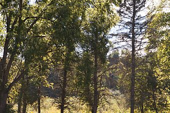
Heavily wooded and on private land, this is a largely obscured view of the area of the site
|
|
| Location | Off Pennsylvania Route 88, 0.7 miles (1.1 km) northwest of its bridge over Whiteley Creek in Monongahela Township |
|---|---|
| Nearest city | Masontown, Pennsylvania |
| Area | 0.1 acres (0.040 ha) |
| NRHP reference No. | 86000476 |
| Added to NRHP | March 20, 1986 |
The Sugar Grove Petroglyphs are special rock carvings found in southwestern Pennsylvania. These carvings, called petroglyphs, are located on a large sandstone rock in Monongahela Township. People have known about these ancient artworks since at least the 1930s. Because they are so important for understanding history, the Sugar Grove Petroglyphs are now a protected historic site.
Contents
Who Made the Sugar Grove Petroglyphs?
It's clear that Native American people created the Sugar Grove Petroglyphs. However, archaeologists aren't completely sure which specific group made them. Some experts think they were made by the Monongahela or Fort Ancient people. Both of these groups lived in the Ohio River valley a long time ago.
One expert, James L. Swauger, studied the carvings in 1974. He thought the carvings might be linked to the Monongahela culture and the ancestors of the Shawnee people. He believed some carvings looked like symbols from the Ojibwe religion. Even though the Ojibwe never lived in this part of Pennsylvania, Swauger thought the Shawnee's ancestors might have shared similar beliefs.
What Is the Rock Like?
The petroglyphs are carved into a flat part of a large Dunkard-series sandstone rock. On one side, the rock rises about 4 feet (1.2 meters) above the ground. The other sides are mostly level with the forest floor around it.
The carvings are found in a square area on the stone, about 23 feet (7 meters) on each side. Most of the carvings are on the eastern side and in the middle of this area.
What Do the Carvings Show?
There are 48 different carvings on the sandstone rock. Most of them are ancient Native American art. However, a few carvings were added later by people who visited the site after white settlers arrived in Pennsylvania.
James Swauger divided the designs into six main groups:
| Category | Number of carvings |
|---|---|
| Abstract designs | 23 |
| Birds and footprints | 10 |
| Complete and partial human figures | 8 |
| Animals and footprints | 4 |
| Arrows | 2 |
| Nut-cracking holes | 1 |
It can be hard to tell exactly what some designs are because of erosion. Erosion is when wind and water wear away the rock over time. Some carvings, especially those close together, have worn down. This makes them difficult to identify clearly. For example, some carvings thought to be bird tracks might have been abstract designs or arrowheads originally.
Many abstract designs might have started as clear pictures. But they could have changed due to vandalism, later Native American carvings, or erosion. The most unique carving on the rock is a large, almost round animal that looks like it's swallowing its tail. It's about 5 feet (1.5 meters) across. Because of its unusual shape and size, it's considered the most important carving at the site.
Some people claimed the site was damaged by quarrying (removing stone) around 1950. However, surveys in the 1960s and 1982 only found small chips of stone missing. These chips were likely caused by vandals trying to remove individual carvings. The site has not changed much since the 1960s.
Why Are They Important?
Local people have always called these carvings the "Picture Rocks." They were first studied by experts under this name. This caused some confusion later when the site was also called "Sugar Grove Petroglyphs." The carvings first appeared in scholarly books around 1931. More detailed studies in 1934 and 1950 led to drawings of the designs and official recognition as an important archaeological site.
The Carnegie Museum of Natural History even made plaster casts of the designs. This was done to help preserve them and allow people to study them without damaging the original rock.
Sugar Grove is considered one of the most important petroglyph sites in western Pennsylvania. Even though it's smaller than some others, its location has protected it. Many other waterside petroglyphs have been covered by water when dams were built. Also, Sugar Grove has suffered less damage from vandals compared to other sites on dry land.
In 1986, the Sugar Grove Petroglyphs were added to the National Register of Historic Places. This list recognizes places that are important to the history of the United States. It is one of four petroglyph sites in Pennsylvania to receive this special honor. The others are the Indian God Rock, the Francis Farm Petroglyphs, and the Big and Little Indian Rock Petroglyphs.


