Sugar Loaf Mountain (Alaska) facts for kids
Quick facts for kids Sugar Loaf Mountain |
|
|---|---|
 |
|
| Highest point | |
| Elevation | 4,784 ft (1,458 m) |
| Prominence | 384 ft (117 m) |
| Isolation | 2.4 mi (3.9 km) |
| Parent peak | Mount Healy (5,716 ft) |
| Geography | |
| Location | Denali Borough Alaska, United States |
| Parent range | Alaska Range |
| Topo map | USGS Healy D-4 |
| Climbing | |
| Easiest route | Trail, scrambling |
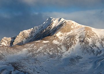
Sugar Loaf Mountain, also called Sugar Mountain, is a cool peak in the Alaska Range. It stands tall at 4,784 feet (about 1,458 meters) above sea level. You can find it near Denali National Park and Preserve in Alaska, United States.
This mountain is about 6 miles (10 km) northeast of the park's main office. It's also 6 miles (10 km) southeast of a town called Healy. The George Parks Highway and the Alaska Railroad run along the mountain's western side. They both pass through the beautiful Nenana River Gorge. Mount Healy, a taller mountain nearby, is about 5.2 miles (8.4 km) to the west. It's on the other side of the gorge. The name "Sugar Loaf" was given to this mountain in 1950 by the United States Geological Survey. It's a descriptive name, meaning it looks like a cone or a "sugar loaf."
Understanding Sugar Loaf Mountain's Climate
Sugar Loaf Mountain is in a subarctic climate zone. This means it has very long, cold, and snowy winters. The summers, however, are usually mild. Temperatures can drop below −20 °C (which is -4 °F). With the wind chill, it can feel even colder, sometimes below −30 °C (-22 °F).
The best time to visit or climb Sugar Loaf Mountain is from May through June. The weather during these months is usually the most pleasant. Rain and melting snow from the mountain flow into small streams. These streams then join the Nenana River. The Nenana River is part of a bigger water system called the Tanana River drainage basin.
 | Tommie Smith |
 | Simone Manuel |
 | Shani Davis |
 | Simone Biles |
 | Alice Coachman |


