
Sugarloaf Mountain (Florida) facts for kids
Quick facts for kids Sugarloaf Mountain |
|
|---|---|

Road leading to the summit of Sugarloaf Mountain
|
|
| Highest point | |
| Elevation | 312 ft (95 m) |
| Prominence | 245 ft (75 m) |
| Listing | Florida's Highest Points |
| Geography | |

Sugarloaf Mountain
Location in Florida
|
|
| Location | Lake County, Florida, United States |
| Parent range | Lake Wales Ridge |
| Topo map | USGS Astatula |
| Geology | |
| Age of rock | ~20,000,000 years |
| Mountain type | uplifted coastline |
| Climbing | |
| Easiest route | Hike, road |
Sugarloaf Mountain is a well-known hill in Florida, USA. It is the highest point on Florida's main peninsula, reaching 312 feet (about 95 meters) above sea level. This makes it the fifth-highest named spot in the entire state. The mountain is located in Lake County, close to the town of Clermont.
Contents
Where is Sugarloaf Mountain Located?
Sugarloaf Mountain sits along the western edge of Lake Apopka in Lake County, Florida. It is the northernmost part of the Lake Wales Ridge. This ridge is a chain of sand hills that stretches south into Highlands County.
How Tall is Sugarloaf Mountain?
Even though it's called a mountain, Sugarloaf is more like a ridge with rolling, dome-shaped peaks. It rises sharply from the flat land around it. Its highest point is about 312 feet (95 meters) above sea level. This makes it the most prominent peak in Florida. While it's very prominent, it's not the absolute highest point in Florida. That title belongs to Britton Hill in the Florida Panhandle, which is 345 feet (105 meters) tall.
Sugarloaf Mountain is even more noticeable than the highest hills in states like Louisiana or Delaware. These are also states with generally low elevations.
What is the History of Sugarloaf Mountain?
Before the 1900s, Sugarloaf Mountain was a wild area. It was covered with sandhill and flatwood pine forests. These were natural environments for the region.
How Did Farming Change the Mountain?
By the 1920s, people started cutting down trees on the mountain. This logging removed most of its natural hardwood trees. This changed the environment of the mountain forever. After the logging, new plants like scrub began to grow on the slopes. People also started planting grapes, mostly to the south of the mountain.
Grape farming slowed down by the 1940s because of plant diseases. Farmers then switched to growing citrus fruits like oranges. Citrus groves grew well on Sugarloaf Mountain's sides. This industry was very important for the local economy. However, in the 1980s, cold weather began to damage the citrus groves.
What Happened After Citrus Farming?
As the citrus industry declined, parts of the mountain were set aside for building homes. People saw value in the mountain's amazing views of the area. Other lands near the mountain, especially along Lake Apopka, were protected. The goal was to bring back the natural environments that had been lost. Today, only a few citrus farms and vineyards remain.
How Was Sugarloaf Mountain Formed?
The way Sugarloaf Mountain was formed is linked to Florida's sand ridges. It is especially connected to the Lake Wales Ridge. The mountain is made of old sand ridges and dunes. These formed in a marine (ocean) shoreline environment about 2 million years ago. This was during a time called the Pleistocene epoch.
Since then, the sands that make up the mountain have likely been pushed up. This is due to a process called isostatic rebound. It's like the Earth's crust bouncing back up. This happens when weight is removed from the land. In Florida, this weight is removed as the land erodes.
What Can You Do at Sugarloaf Mountain?
The state of Florida has created the Green Mountain Scenic Byway. This road mainly goes along the eastern side of the mountain. The Byway offers great views of the surrounding landscape. It also provides access to new nature preserves and historical places.
Biking and Golf at Sugarloaf
Biking has become very popular on the Byway and other roads on the mountain. This is because the mountain's terrain is much more challenging than the flat areas around it.
Sugarloaf Mountain also used to have a golf course. It was designed to use the mountain's unique landscape. The golf course was part of a planned housing development. However, it closed in 2012. This was due to low numbers of players and slow development after the 2008 housing bubble.
Images for kids
-
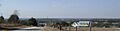
View of the western horizon from the summit of Sugarloaf Mountain
