Sugarloaf Peak facts for kids
Quick facts for kids Sugarloaf Peak |
|
|---|---|
| Highest point | |
| Elevation | 9,287 ft (2,831 m) NAVD 88 |
| Prominence | 591 ft (180 m) |
| Geography | |
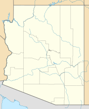
| Location | Coconino County, Arizona, U.S, |
| Topo map | USGS Sunset Crater West |
| Geology | |
| Mountain type | rhyolite dome |
| Volcanic field | San Francisco volcanic field |
Sugarloaf Peak is a special kind of mountain called a lava dome. It's found near the bigger San Francisco Peaks in Flagstaff, Arizona. This unique peak was formed a long, long time ago when a volcano erupted in a very interesting way.
Contents
What is Sugarloaf Peak?
Sugarloaf Peak is a type of volcano known as a lava dome. It's made from a kind of volcanic rock called rhyolite. Rhyolite is a thick, sticky lava that doesn't flow easily. Instead, it piles up around the volcanic vent, creating a dome shape. Imagine squeezing very thick toothpaste out of a tube – it just piles up instead of spreading out!
How Did Sugarloaf Peak Form?
Sugarloaf Peak formed from a "sideways eruption." This means the lava didn't just shoot straight up from the top of a volcano. Instead, it burst out from the side of a larger mountain. This kind of eruption happened in a similar way to the famous 1980 eruption of Mount St. Helens in Washington state. When Mount St. Helens erupted, a huge part of its side collapsed, and then the eruption blasted out sideways. Sugarloaf Peak's formation was a smaller, but similar, event.
What is Rhyolite?
Rhyolite is a type of igneous rock, which means it forms when molten rock (magma or lava) cools and hardens. It's usually light in color, like pink or gray. Rhyolite lava is very thick because it has a lot of silica, a common mineral found in rocks. This thickness is why it forms domes instead of wide, flat lava flows.
Where is Sugarloaf Peak Located?
Sugarloaf Peak is located in Coconino County, Arizona, very close to the city of Flagstaff, Arizona. It's part of a larger area called the San Francisco volcanic field. This field has many volcanoes, but most of them are now quiet and covered in forests.
The San Francisco Peaks
Sugarloaf Peak sits just below the much larger San Francisco Peaks. The San Francisco Peaks are the highest mountains in Arizona. They are also ancient volcanoes, but they are no longer active. These peaks are a popular spot for hiking, skiing, and enjoying nature.
Exploring the Area Around Sugarloaf Peak
The area around Sugarloaf Peak and the San Francisco Peaks is a beautiful place to visit. It's covered in pine forests and offers many outdoor activities.
Hiking and Nature
Even though Sugarloaf Peak itself might not be a famous hiking destination, the surrounding San Francisco volcanic field has many trails. You can explore old lava flows, cinder cones (another type of small volcano), and enjoy the cool mountain air. It's a great place to learn about geology and see different kinds of volcanic landscapes up close.
Wildlife in the Region
The forests around Sugarloaf Peak are home to various animals. You might see deer, elk, and many types of birds. It's important to respect their habitat and observe them from a distance.
Images for kids
 | James Van Der Zee |
 | Alma Thomas |
 | Ellis Wilson |
 | Margaret Taylor-Burroughs |


