Sultan River facts for kids
Quick facts for kids Sultan River |
|
|---|---|

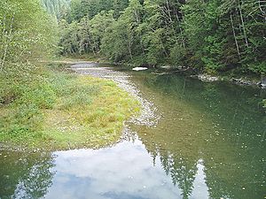
The Sultan River a few miles downstream of Culmback Dam near a USGS stream gauge and a diversion dam
|
|

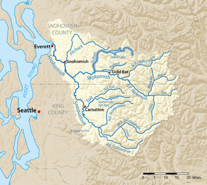
The Sultan River highlighted on a map of the Snohomish River watershed
|
|
|
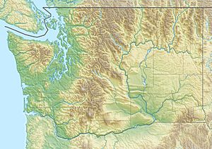
Location of the mouth of the Sultan in Washington
|
|
| Country | United States |
| State | Washington |
| County | Snohomish |
| Physical characteristics | |
| Main source | Cascade Range 47°56′53″N 121°28′4″W / 47.94806°N 121.46778°W |
| River mouth | Skykomish River Sultan 47°51′28″N 121°49′13″W / 47.85778°N 121.82028°W |
| Length | 30 mi (48 km) |
| Basin features | |
| Basin size | 80 sq mi (210 km2) |
The Sultan River is a river located in Snohomish County, in the state of Washington, United States. It flows into the Skykomish River near the town of Sultan, Washington. A large part of the river is held back by the Culmback Dam, which creates Spada Lake.
Both the Sultan River and the town of Sultan get their names from a local Native American chief. He was a leader of a Snohomish sub-tribe living on the Skykomish River in the 1870s. His name, Tsul-tad or Tseul-tud, was later changed by miners to "Sultan."
Long ago, during the Pleistocene Ice Age, huge glaciers covered the Sultan River area. These glaciers carved out the river's path, creating deep valleys. The upper part of the South Fork Sultan River flows through a valley shaped like a "U," which is typical of areas where glaciers have been. The smaller streams that feed the Sultan River meet in a wider area before the river flows through a narrow canyon.
Contents
River's Journey: Where Does the Sultan River Flow?
The Sultan River starts high up at a place called Crested Buttes. It flows first to the northwest, then turns southwest into Spada Lake. This lake, held by the Culmback Dam, is super important because it provides drinking water for the city of Everett.
The South Fork Sultan River joins the main river by flowing into a big arm of Spada Lake. After leaving the lake, the Sultan River flows west, then south. Finally, it meets the Skykomish River. The biggest streams that flow into the Sultan River are Elk Creek and Williamson Creek. Elk Creek joins just before the river enters Spada Lake. Williamson Creek comes from remote Copper Lake and enters Spada Lake a bit further down.
South Fork Sultan River
The South Fork Sultan River is formed when two smaller streams, the North Fork South Fork and the Middle Fork South Fork, come together. It then flows northwest and empties into the southern part of Spada Lake.
North Fork South Fork
This stream starts where its path separates from Salmon Creek. It flows west until it meets the Middle Fork South Fork, forming the South Fork Sultan River.
Middle Fork South Fork
The Middle Fork South Fork Sultan River begins on the eastern side of Mount Stickney. It flows north for about 2.5 miles (4.0 km) before joining the North Fork South Fork.
History of the Sultan River Area
People started looking for valuable minerals, like gold, in the Sultan River basin around 1870. Small-scale gold mining began as early as 1869 along the lower river. Even richer gold deposits were found a few years later.
In 1891, a very important discovery was made: the "45 vein," which was mined by the 45 Mine. Getting the mined materials out was hard because there weren't good roads. By 1896, the 45 Mine became the first successful mine in the Sultan basin. A rough wagon road, about 20-mile (32 km) long, was built from the mine to the railroad in Sultan. A trail was also built over Marble Pass to Silverton.
 | John T. Biggers |
 | Thomas Blackshear |
 | Mark Bradford |
 | Beverly Buchanan |


