
Suraua facts for kids
Quick facts for kids
Suraua
|
||
|---|---|---|

Surcasti
|
||
|
||

Suraua
Location in Switzerland

Suraua
Location in Canton of Graubünden
|
||
| Country | Switzerland | |
| Canton | Graubünden | |
| District | Surselva | |
| Area | ||
| • Total | 24.20 km2 (9.34 sq mi) | |
| Elevation | 932 m (3,058 ft) | |
| Population
(Dec 2012)
|
||
| • Total | 238 | |
| • Density | 9.835/km2 (25.47/sq mi) | |
| Postal code |
7110 Peiden
7114 Uors 7113 Camuns 7115 Surcasti 7116 Tersnaus |
|
| Localities | Camuns, Surcasti, Tersnaus, Uors-Peiden | |
| Surrounded by | Cumbel, Degen, Duvin, Sankt Martin, Vella, Vignogn | |

Suraua was a small town, also called a municipality, located in the Surselva district of the Graubünden area in Switzerland. It was created on January 1, 2002, when four smaller villages decided to join together. These villages were Camuns, Surcasti, Tersnaus, and Uors-Peiden.
However, Suraua itself later joined with several other towns. On January 1, 2013, Suraua and seven other municipalities became part of a new, larger municipality called Lumnezia. This means Suraua is no longer a separate town on its own.
Contents
History of Suraua and Its Villages
Suraua was formed when four villages decided to merge into one larger municipality. This happened on January 1, 2002. Let's look at when each of these villages was first mentioned in old records:
 Camuns was first written about in 1543.
 Surcasti was first mentioned in 1515. For a long time, until 1943, it was known by its German name, Obercastels.
 Tersnaus appears in records from 1362.
 Uors was first mentioned way back in 831. Peiden was first mentioned in 1345. These two villages, Uors and Peiden, joined together in 1963 to form Uors-Peiden, even before they became part of Suraua.
Understanding the Coat of Arms
The coat of arms for Suraua has a special meaning. It was chosen after a contest where children from the municipality submitted their own designs!
The design shows a blue wavy line on a green background. This represents a river flowing through green forests and fields, showing the area's natural beauty. In the middle, there's a ring and a four-pointed star. The ring stands for the four villages that merged to form Suraua. Each point of the star represents one of those original villages.
Geography and Landscape


Suraua covered an area of about 24.2 square kilometers (about 9.3 square miles). A large part of this land was covered by forests, making up 52% of the area. About 29.1% of the land was used for farming.
A small portion, 2%, had buildings or roads. The remaining 16.9% was made up of natural features like rivers, glaciers, or mountains. The former municipality included the villages of Camuns, Surcasti, Tersnaus, and Uors-Peiden.
Population and People
In 2011, Suraua had a population of 247 people. Over the ten years before that, the number of people living there had decreased by about 15%.
Most people in Suraua speak Romansh, which is a special language spoken in parts of Switzerland. About 75.9% of the population spoke Romansh. The second most common language was German, spoken by 21% of the people.
In 2000, the population was almost evenly split between males and females. About 12.8% of the people were children aged 0-9, and 11.6% were teenagers aged 10-19.
Education and Jobs
Many adults in Suraua have a good education. About 54.5% of people aged 25 to 64 had completed either higher secondary education or gone on to university or a special college called a Fachhochschule.
In 2005, many people in Suraua worked in farming, which is part of the primary economic sector. There were 76 people working in this area. A smaller number of people worked in manufacturing or construction (the secondary sector), and some worked in services like shops or tourism (the tertiary sector).
Important Historical Building

One very important building in Suraua is the Church of S. Luregn/St. Lorenz. It is considered a special historical site in Switzerland.
The church's tower was built a very long time ago, in the 12th century. It was originally part of a castle belonging to a family called Überkastel. When that family no longer existed in the 15th century, the castle tower became the church tower. The church itself was rebuilt in a beautiful Gothic style in 1520. Later, in 1774, it was rebuilt again in a Baroque style, which is how it looks today. During one of its restorations, a valuable statue of Mary was found. This statue is now kept in a museum at Disentis Abbey.
Images for kids
-
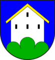
Camuns coat of arms
-
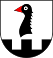
Surcasti coat of arms
-
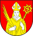
Tersnaus coat of arms
-
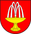
Uors-Peiden coat of arms


See also
 In Spanish: Suraua para niños
