
Swat District facts for kids
Quick facts for kids
Swat
سوات
|
|
|---|---|

The Swat River flows through the Swat District
|
|
| Nickname(s):
Switzerland of the East
|
|

|
|
| Country | |
| Province | |
| Capital | Saidu Sharif |
| Largest city | Mingora |
| Area | |
| • District | 5,337 km2 (2,061 sq mi) |
| Population | |
| • District | 2,309,570 |
| • Density | 432.75/km2 (1,120.81/sq mi) |
| • Urban | 695,900 |
| • Rural | 1,613,670 |
| Time zone | UTC+5 (PKT) |
| Area code(s) | Area code 0946 |
| Languages (1981) | 90.28% Pashto 8.67% Kohistani |
Swat District, also known as Swat (Pashto: سوات ولسوالۍ), is a beautiful area in the Khyber Pakhtunkhwa province of Pakistan. Many people call it the "Switzerland of the East" because of its amazing natural beauty.
This region is famous for its stunning landscapes, including the Swat River that flows through it. Swat was once a very important place for early Buddhist ideas, part of the ancient Gandhara kingdom. Today, you can still see many old ruins from that time.
For a long time, Swat was a self-governing area called the Yusafzai State of Swat until 1969. In recent history, the area faced some challenges that affected its tourism. However, peace was restored in mid-2009, and Swat is now welcoming visitors again.
The capital city of Swat is Saidu Sharif. However, the biggest city and main business hub is Mingora. According to the 2017 census, about 2.3 million people live in Swat. Most people living here are Yousafzai Pashtuns.
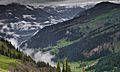
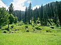
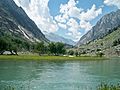
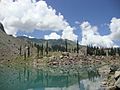
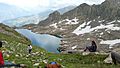
Swat is known for its cool and wet weather, which is different from most of Pakistan. It has lush green forests, beautiful mountain meadows, and snow-capped peaks. This makes Swat one of Pakistan's most popular places for tourists.
Contents
Exploring Swat's Geography
.jpg)


Swat is surrounded by other districts. To the west, you'll find Chitral, Upper Dir, and Lower Dir. To the north, it borders Gilgit-Baltistan and Kohistan. To the east and southeast, it's next to Buner and Shangla.
The Swat Valley itself is located in the northern part of Khyber Pakhtunkhwa. It is surrounded by very tall mountains.
Swat's Physical Features
Swat can be divided into two main types of land:
- Mountainous Ranges
- Plains
Mountainous Ranges of Swat
.jpg)
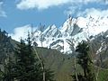
Swat is nestled among high mountain ranges. These mountains are part of the larger Hindukush range. Because of this, a large part of Swat is covered with tall mountains and hills. The very tops of these mountains are often covered in snow all year round.
The mountains don't run in a perfectly straight line. Some go west, others go east, but generally, they stretch from north to south.
Plains of Swat Valley
The Swat Valley stretches for about 91 miles, from Landakay to Gabral. Along the banks of the Swat River, from Landakay to Madyan, there are two narrow strips of flat land called plains. Beyond Madyan, in the area known as Kohistan-e-Swat, the plains become very small.
The width of the valley's plains changes from place to place. On average, they are about 5 miles wide. The widest part of the valley is between Barikot and Khwaza Khela. One of the best places to see a large part of the valley is from Gulibagh, which is on the main road leading to Madyan.
Swat's Economy and Jobs
About 38% of Swat's economy comes from Tourism. Another 31% comes from Agriculture. This means that both visitors and farming are very important for the people living in Swat.
Farming and Delicious Fruits
Gwalerai village, near Mingora, is special because it grows 18 different kinds of apples! The climate there in summer is just right for them. These apples are eaten in Pakistan and also sent to other countries. They are known as 'the apple of Swat'.
Swat is also very famous for growing peaches. Most of these peaches are grown in the flat valley bottoms. Swat produces about 80% of all the peaches in Pakistan! These peaches are sold in markets across the country under the name "Swat Peaches." You can find them from April all the way to September because farmers grow many different types that ripen at different times.
Images for kids
-

Geography of the Rigveda; the extent of the Swat and Cemetery H cultures are indicated.
-
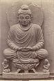
An 1869 photo of a Buddha statue seated on a lotus throne in Swat Valley.
-
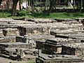
Buddhism heritage site in Swat Valley
-
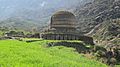
Amlukdara stupa
-
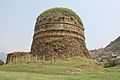
Shingardar Stupa
-
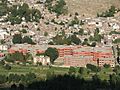
Main Building of Saidu sharif Hospital
-
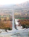
Autumn View of Plains of Swat
-
Sufid Mahal Marghazar Swat valley
-
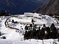
PTDC Motel at Malam Jabba Ski Resort
-
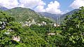
Miandam
-
Utror, Swat valley
-
Ghabral, Swat Valley
-
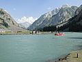
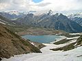
Mahodand Lake, Swat valley
-
On the way to shahi bagh Lake Swat valley
-
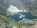
Kundol Lake, Swat valley
-
Spin Khwar Lake Swat valley
-
Khapiro Lake
-
Kundol Lake
-
Bashigram lake
-
Daral lake
-
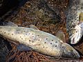
Famous Trout Fish of Swat valley
-
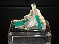
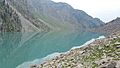
Emerald of Swat Valley Swat valley
-
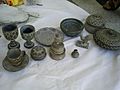
Stone art in Swat Valley
-
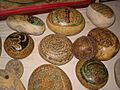
Stone art in Swat Valley
-
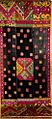
Swat Valley – Vintage Silk Embroidery – from the Wovensouls collection


