Taft, Texas facts for kids
Quick facts for kids
Taft, Texas
|
|
|---|---|

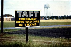
Sign at the entrance to Taft
|
|
| Nickname(s):
"The Friendliest Cotton Pickin' Town in Texas"
|
|
| Motto(s):
"The Friendliest Cotton Pickin' Town in Texas"
|
|

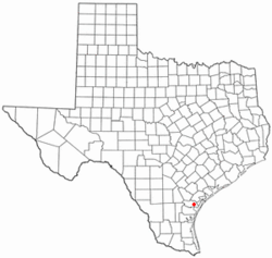
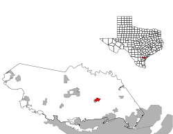
Location of Taft, Texas
|
|
 |
|
| Country | United States |
| State | Texas |
| County | San Patricio |
| Area | |
| • Total | 1.67 sq mi (4.32 km2) |
| • Land | 1.67 sq mi (4.32 km2) |
| • Water | 0.00 sq mi (0.00 km2) |
| Elevation | 49 ft (15 m) |
| Population
(2020)
|
|
| • Total | 2,801 |
| • Density | 1,677/sq mi (648.4/km2) |
| Time zone | UTC-6 (Central (CST)) |
| • Summer (DST) | UTC-5 (CDT) |
| ZIP code |
78390
|
| Area code(s) | 361 |
| FIPS code | 48-71684 |
| GNIS feature ID | 1348200 |
Taft is a city located in San Patricio County, Texas, in the United States. In 2020, the city had a population of 2,801 people. Taft is often known as "The Friendliest Cotton-Pickin' Town in Texas."
Contents
History of Taft
Taft is a city with a rich history, known for its cotton, gas, and oil resources. It was once the center of the huge Taft Ranch, which covered a million acres. This ranch was built and owned by Charles Phelps Taft, who was the half-brother of former U.S. President William Howard Taft. The nearby city of Sinton, Texas is named after Charles Phelps Taft's father-in-law, David Sinton.
The Blackland Museum in Taft shows what life was like for the city's first residents. It has everything from old farm equipment to personal items used long ago. Every year during Christmas, Santa Claus leads a parade through the city from a fire truck, bringing joy to everyone.
Hurricane Harvey's Impact
On August 25, 2017, a very strong storm called Hurricane Harvey hit the coast near Rockport, Texas. Rockport is about 30 miles north of Taft. The hurricane was a Category 4 storm, meaning it was very powerful. Taft felt the edges of the storm's eye, with winds reaching about 90 miles per hour. Hurricane Harvey was the first Category 4 hurricane to affect the city in over 20 years.
Education in Taft
The schools in Taft are part of the Taft Independent School District. Students in Taft attend different schools based on their age:
- Woodrow Petty Elementary serves students from Pre-Kindergarten to 5th grade.
- Taft Junior High School is for students in 6th to 8th grade.
- Taft High School is for students in 9th to 12th grade.
For higher education, Del Mar College is the designated community college for all of San Patricio County.
Geography and Climate
Taft is located at coordinates 27.978584 degrees North latitude and -97.394320 degrees West longitude. The United States Census Bureau reports that the city covers a total area of 1.5 square miles (3.9 square kilometers), and all of this area is land.
Taft's Climate
The weather in Taft is known for its hot and humid summers. Winters are generally mild to cool. According to the Köppen Climate Classification system, Taft has a humid subtropical climate. This type of climate is often shown as "Cfa" on climate maps.
Population History
The population of Taft has changed over the years, as recorded by the U.S. Decennial Census.
| Historical population | |||
|---|---|---|---|
| Census | Pop. | %± | |
| 1930 | 1,792 | — | |
| 1940 | 2,686 | 49.9% | |
| 1950 | 2,978 | 10.9% | |
| 1960 | 3,463 | 16.3% | |
| 1970 | 3,274 | −5.5% | |
| 1980 | 3,686 | 12.6% | |
| 1990 | 3,222 | −12.6% | |
| 2000 | 3,396 | 5.4% | |
| 2010 | 3,048 | −10.2% | |
| 2020 | 2,801 | −8.1% | |
| U.S. Decennial Census | |||
2020 Census Details
As of the 2020 United States census, there were 2,801 people living in Taft. These people made up 1,033 households, with 824 of those being families.
The racial makeup of Taft in 2020 was:
| Race | Number | Percentage |
|---|---|---|
| White (NH) | 550 | 19.64% |
| Black or African American (NH) | 41 | 1.46% |
| Native American or Alaska Native (NH) | 2 | 0.07% |
| Asian (NH) | 1 | 0.04% |
| Some Other Race (NH) | 4 | 0.14% |
| Mixed/Multi-Racial (NH) | 42 | 1.5% |
| Hispanic or Latino | 2,161 | 77.15% |
| Total | 2,801 |
See also

- In Spanish: Taft (Texas) para niños
 | Emma Amos |
 | Edward Mitchell Bannister |
 | Larry D. Alexander |
 | Ernie Barnes |

