Tarata, Peru facts for kids
Quick facts for kids
Tarata
San Benedicto de Tarata
|
||
|---|---|---|
|
||
| Nickname(s):
Fellowship city (Spanish: Ciudad de la confraternidad)
|
||
| Country | ||
| Region | Tacna | |
| Province | Tarata | |
| District | Tarata | |
| Time zone | UTC-5 (PET) | |
| Website | http://www.munitarata.gob.pe/ | |
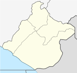
Tarata is a city located in the southern part of Peru, in the Tacna Region. It is an important city because it is the capital of both the Tarata District and the Tarata Province.
Contents
History of Tarata: A Journey Through Time
Ancient Times: The Pre-Inca Era
Did you know that people lived in Tarata a very long time ago? Around 9,000 years ago, in 7000 BC, there was an early settlement here. Archaeologist Rogger Ravines found proof of this in the Karu cave.
Not much is known about Tarata's earliest history. However, ancient rock carvings and cave paintings have been found in the Tarata province. These show us glimpses of how people lived back then.
Spanish Rule: The Colonial Era
In 1611, construction began on the San Benedicto Abad temple. This temple was built to help spread Christianity in the area. It also led to local people adopting Spanish customs.
The temple was officially opened on January 3, 1741. This date also marks the official founding of the city by the Spanish.
Becoming a Republic: The Modern Era
In 1824, Simón Bolivar, a famous leader, officially created the district of Tarata. Many years later, in 1874, President Manuel Pardo made Tarata a province.
This new province included several districts: Estike, Tarukachi, Tarata, Tikako, and Kandarave.
Chilean Administration: A Period of Change
After a battle called the Battle of Tacna, Peruvian and Bolivian forces had to leave the area. Tarata was then taken over by Chile. This began a time when Chile tried to make the area more Chilean.
On December 22, 1891, Tarata officially became a Chilean commune. It included six smaller areas. A special office for official records had been working there since 1885.
In 1911, Tarata became the main city of the Department of Tarata, which was part of the Chilean Province of Tacna. However, in 1921, Chile ended this department.
Finally, in 1925, Tarata was given back to Peru. This happened with the help of U.S. President Calvin Coolidge. He made sure the borders agreed upon earlier were followed.
Who Lives in Tarata? Demographics
According to a count done in 2007, the city of Tarata had 2,882 people living there. Most of these people, about 2,577, speak Spanish as their main language.
However, many people also speak Aymara, with 840 speakers. The largest group of people in Tarata are children between 10 and 14 years old.
Geography of Tarata: Land and Climate
Tarata's Unique Landscape
Tarata is located below the Titicaca plateau. This area has a very interesting geography. You can find volcanoes, dry deserts, and tall mountains here.
Rivers start in these mountains and flow across the high plains and plateaus. These rivers form the water system of the region. Even though the region is small, it has good potential for mining and agriculture. It also has different climates, which allows for various types of farming.
Tarata's Climate: What's the Weather Like?
The average temperature in Tarata throughout the year is about 8.6°C (47.5°F).
| Climate data for Tarata, elevation 3,100 m (10,200 ft), (1991–2020) | |||||||||||||
|---|---|---|---|---|---|---|---|---|---|---|---|---|---|
| Month | Jan | Feb | Mar | Apr | May | Jun | Jul | Aug | Sep | Oct | Nov | Dec | Year |
| Mean daily maximum °C (°F) | 19.8 (67.6) |
19.6 (67.3) |
20.2 (68.4) |
21.0 (69.8) |
20.8 (69.4) |
20.6 (69.1) |
20.3 (68.5) |
20.9 (69.6) |
21.1 (70.0) |
21.1 (70.0) |
20.9 (69.6) |
20.7 (69.3) |
20.6 (69.1) |
| Mean daily minimum °C (°F) | 6.4 (43.5) |
6.6 (43.9) |
5.5 (41.9) |
3.2 (37.8) |
1.0 (33.8) |
1.0 (33.8) |
1.7 (35.1) |
2.5 (36.5) |
3.4 (38.1) |
3.7 (38.7) |
4.0 (39.2) |
5.3 (41.5) |
3.7 (38.7) |
| Average precipitation mm (inches) | 69.1 (2.72) |
82.4 (3.24) |
36.2 (1.43) |
1.9 (0.07) |
0.8 (0.03) |
0.5 (0.02) |
1.0 (0.04) |
1.0 (0.04) |
1.1 (0.04) |
0.4 (0.02) |
0.3 (0.01) |
12.4 (0.49) |
207.1 (8.15) |
| Source: National Meteorology and Hydrology Service of Peru | |||||||||||||
See also
 In Spanish: Tarata (Tacna) para niños


