Tarrytown, Georgia facts for kids
Quick facts for kids
Tarrytown, Georgia
|
|
|---|---|

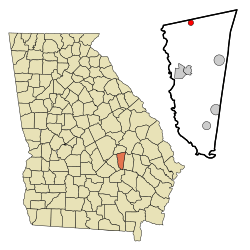
Location in Montgomery County and the state of Georgia
|
|
| Country | United States |
| State | Georgia |
| County | Montgomery |
| Government | |
| • Type | Mayor-council government |
| Area | |
| • Total | 0.86 sq mi (2.24 km2) |
| • Land | 0.86 sq mi (2.22 km2) |
| • Water | 0.01 sq mi (0.02 km2) |
| Elevation | 305 ft (93 m) |
| Population
(2020)
|
|
| • Total | 66 |
| • Density | 77.01/sq mi (29.72/km2) |
| Time zone | UTC-5 (Eastern (EST)) |
| • Summer (DST) | UTC-4 (EDT) |
| ZIP code |
30470
|
| Area code(s) | 912 |
| FIPS code | 13-75496 |
| GNIS feature ID | 0333191 |
Tarrytown is a small town located in Montgomery County, Georgia, in the United States. In 2020, about 66 people lived there. This number was a bit smaller than in 2010, when 87 people called Tarrytown home.
History of Tarrytown
Tarrytown has a short but interesting history. A post office opened in the town in 1902. This meant people could send and receive mail easily.
Later, in 1912, the Georgia General Assembly officially made Tarrytown a town. The General Assembly is like the state's main law-making group. This made Tarrytown an official place with its own local government.
Where is Tarrytown?
Tarrytown is in the northern part of Montgomery County. It is located at 32°19'9" North and 82°33'34" West. The border of Treutlen County is just north of the town.
Two main roads, Georgia State Routes 15 and 29, go through the center of Tarrytown. These roads lead northwest about 4.5 miles (7.2 km) to Soperton. They also go southeast about 9 miles (14 km) to Higgston.
Mount Vernon is the county seat of Montgomery County. It is about 10 miles (16 km) south of Tarrytown by local roads.
The United States Census Bureau says Tarrytown covers about 0.9 square miles (2.3 km²). Only a very small part of this area, about 0.008 square miles (0.021 km²), is water.
People of Tarrytown
The population of Tarrytown has changed over the years. Here is a quick look at how many people have lived there during different census counts:
| Historical population | |||
|---|---|---|---|
| Census | Pop. | %± | |
| 1910 | 236 | — | |
| 1920 | 273 | 15.7% | |
| 1930 | 295 | 8.1% | |
| 1940 | 298 | 1.0% | |
| 1950 | 250 | −16.1% | |
| 1960 | 191 | −23.6% | |
| 1970 | 188 | −1.6% | |
| 1980 | 145 | −22.9% | |
| 1990 | 130 | −10.3% | |
| 2000 | 100 | −23.1% | |
| 2010 | 87 | −13.0% | |
| 2020 | 66 | −24.1% | |
| U.S. Decennial Census | |||
A census is an official count of how many people live in a place. The last census in 2020 showed that 66 people lived in Tarrytown. This was a decrease from 100 people in the year 2000.
See also
 In Spanish: Tarrytown (Georgia) para niños
 | Bessie Coleman |
 | Spann Watson |
 | Jill E. Brown |
 | Sherman W. White |

