Temple Butte facts for kids
Quick facts for kids Temple Butte |
|
|---|---|

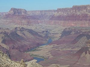
Temple Butte (left background) and Lava Butte. Temple Butte was near the site of a plane crash in 1956.
|
|
| Highest point | |
| Elevation | 5,308 ft (1,618 m) |
| Prominence | 859 ft (262 m) |
| Isolation | 1.77 mi (2.85 km) |
| Parent peak | Chuar Butte (6,500 ft) |
| Geography | |
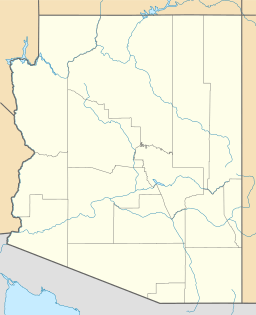
| Location | Palisades of the Desert, East Rim, Grand Canyon |
| Settlement | Grand Canyon Village, Arizona |
| Parent range | East Rim, 2-mi south of Little Colorado River with Colorado |
| Topo map | USGS Cape Solitude |
| Geology | |
| Mountain type | Toroweap Formation-(prominence), Coconino Sandstone, Hermit Formation & Supai Group |
| Climbing | |
| Easiest route | class 4 climbing |
Temple Butte is a mountain in the Grand Canyon, Arizona, USA. It is a tall hill or "prominence" that stands out from the land around it. This butte is on the west side of the Colorado River. The Little Colorado River joins the main Colorado River about 2 miles (3.2 km) upstream from Temple Butte.
Temple Butte is about 5,308 feet (1,618 meters) high. It is known as a historical site because some parts of a plane crash from 1956 were found here. At first, people thought smoke from Temple Butte was from a lightning strike. Later, they found out it was from a plane crash that happened in the air.
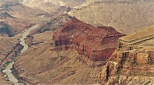
A closer look at Chuar and Temple Buttes.
Contents
Exploring Temple Butte
Hiking Trails Near Temple Butte
The Tanner Trail is a path that goes from Desert View, Arizona, down to the Colorado River. This trail follows the west side of Tanner Canyon. Along the way, hikers get many views looking north toward Temple Butte. The trail ends at a spot where you can see the top layers of the Redwall Limestone. This limestone forms a clear cliff below the East Rim. On top of this cliff, you can see the red rock layers of the Supai Group.
The Rocks of Temple Butte
What Rocks Make Up Temple Butte?
The top part of Temple Butte is made of a rock layer called the Toroweap Formation. Below it, you can see the tan or white Coconino Sandstone. This sandstone has "cross-bedding," which means it looks like old fossilized sand dunes. The Coconino Sandstone forms steep cliffs.
Below these layers are the Hermit Formation and the Supai Group. These are often called "redbeds" because of their reddish color. They form the lower, sloping parts of the butte. These rock layers are known as "slope-formers" because they create gentler slopes, while other layers are "cliff-formers" that make steep walls.
How the Land Changed Over Time
The east part of the Butte Fault is on the west side of Temple Butte. A "fault" is a crack in the Earth's crust where rocks have moved. The west part of this fault is called the East Kaibab Monocline. Both parts of the Butte Fault run from north to south. They are part of what caused the Kaibab Plateau to lift up over millions of years.
Visiting Temple Butte
How to Get There
Desert View is the closest place with a paved road where you can see Temple Butte. It is on the East Rim of the Grand Canyon. Desert View is about 20 miles (32 km) east of Grand Canyon Village. You can get there by taking the East Rim Road, which is Arizona State Route 64. Desert View is also 32 miles (51 km) west of U.S. 89, also by way of Arizona 64.
Best Places to See Temple Butte
You can see Temple Butte from the south at different viewpoints on the East Rim of the Grand Canyon, near Desert View. Places like Lipan Point, Desert View Point, and Hollenback Point (further south) offer views looking north into the Grand Canyon.
About 5 miles (8 km) north of Desert View Point, you can find Comanche Point. You can reach it by an unpaved road or by hiking. This point is about 5 miles (8 km) south-southeast of Temple Butte.
Another unpaved path goes north from Desert View for about 12 to 14 miles (19 to 23 km). It ends at Cape Solitude. This spot is right next to where the Little Colorado River canyon meets the Colorado River. Temple Butte is about 2.5 miles (4 km) west of Cape Solitude.
 | Selma Burke |
 | Pauline Powell Burns |
 | Frederick J. Brown |
 | Robert Blackburn |


