Tennyson, South Australia facts for kids
Quick facts for kids TennysonAdelaide, South Australia |
|||||||||||||||
|---|---|---|---|---|---|---|---|---|---|---|---|---|---|---|---|

Tennyson Dunes
|
|||||||||||||||
| Established | 5 January 1905 (town) 30 September 1976 (suburb) |
||||||||||||||
| Postcode(s) | 5022 | ||||||||||||||
| Area | 0.9 km2 (0.3 sq mi) | ||||||||||||||
| Time zone | ACST (UTC+9:30) | ||||||||||||||
| • Summer (DST) | ACST (UTC+10:30) | ||||||||||||||
| Location |
|
||||||||||||||
| LGA(s) | City of Charles Sturt | ||||||||||||||
| Region | Western Adelaide | ||||||||||||||
| County | Adelaide | ||||||||||||||
| State electorate(s) | Lee | ||||||||||||||
| Federal Division(s) | Hindmarsh | ||||||||||||||
|
|||||||||||||||
|
|||||||||||||||
| Footnotes | Adjoining suburbs | ||||||||||||||
Tennyson is a suburb in South Australia, a state in Australia. It's part of the Adelaide metropolitan area. Tennyson is about 11 kilometers north-west of the Adelaide city centre. It is also about 4.8 kilometers west of Woodville.
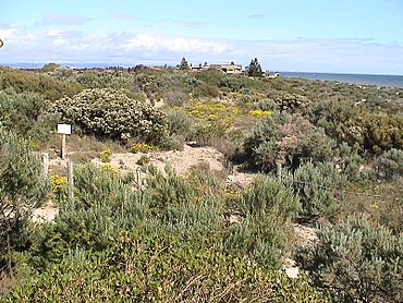
Tennyson is a narrow strip of land. It stretches from a sandy beach and sand dunes on the west side. On the east side, it reaches the artificial lake called West Lakes. This lake has a 2000-meter course for rowing. Tennyson's northern edge is near Estcourt Road. Its southern edge is Fort Street.
The suburb of Tennyson was officially created on September 30, 1976. This area included the older Town of Tennyson. In 2006, the northern border of the suburb was changed. This made the suburb's boundaries match the land plots better. The name Tennyson comes from the Town of Tennyson. This town was named after Hallam Tennyson, 2nd Baron Tennyson. He was the Governor of South Australia from 1899 to 1902. Later, he became the Governor-General of Australia from 1903 to 1904.
The Tennyson Post Office was open from 1962 to 1972.
Estcourt House is an old building in Tennyson. It used to be the home of Frederick Estcourt Bucknall. This house is now listed on the South Australian Heritage Register. It is located at the northern end of the suburb.
In August 2016, a count of people called the 2016 Australian census happened. It showed that 1,166 people lived in Tennyson.
Tennyson is part of several government areas. It is in the federal division of Hindmarsh. For state government, it's in the electoral district of Lee. Locally, it belongs to the City of Charles Sturt.
The Town of Tennyson: A Historical Look
The original Town of Tennyson was officially named on January 5, 1905. It was first surveyed in 1902. Then, it was surveyed again in 1904 to create a new layout. Land was offered for sale starting on February 16, 1905.
This town was originally Crown land. This means it was owned by the government. It was on the west side of Military Road. This land was taken back by the government in 1893. This was done to stop damage to the sandhills. Cows grazing there were causing sand to shift onto the road.
The Town of Tennyson was made bigger in 1940 and again in 1950. In 1982, some land was removed from it. The town still exists as an administrative area today. Since 1982, its borders have been Hallam Terrace to the north. Military Road is on the east side. Fort Street is to the south. The Tennyson Foreshore Reserve is on the west side.
 | Delilah Pierce |
 | Gordon Parks |
 | Augusta Savage |
 | Charles Ethan Porter |


