Teton River (Montana) facts for kids
Quick facts for kids Teton River |
|
|---|---|

The Teton River in Montana
|
|
| Country | Chouteau and Teton County, Montana |
| Physical characteristics | |
| Main source | 47°52′58″N 112°37′59″W / 47.88278°N 112.63306°W |
| River mouth | 2,562 feet (781 m) 47°55′55″N 110°30′32″W / 47.93194°N 110.50889°W |
| Basin features | |
| River system | Missouri River |
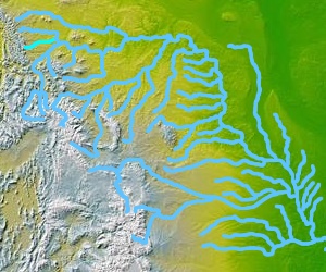
The Teton River (say "TEE-tuhn") is a cool river in northwestern Montana, a state in the Western United States. This river is about 150 miles (240 km) long. It flows into the Marias River, which is another important river in the area. The Teton River's water collects from an area called a watershed. This watershed is mostly found in Teton County and Chouteau County, Montana.
Where Does the Teton River Start and Go?
The River's Beginning
The Teton River begins high up in the Rocky Mountains. Its starting point is in the southern part of the Lewis Range. This spot is also on the continental divide, which is like a big ridge that separates where water flows either to the Pacific or Atlantic oceans. The river's source is inside the Lewis and Clark National Forest.
Journey Through Montana
From its mountain source, the Teton River first flows southeast. Then, it turns and heads east. It travels down from the Lewis mountains and crosses through Teton County. Along its way, it passes by the town of Choteau.
As it continues, two smaller streams join the Teton River. These are called Muddy Creek and Deep Creek. The river keeps flowing east, going near the town of Fort Benton. Finally, it meets and joins the Marias River. This meeting point is only about 3 miles (4.8 km) upstream from where the Marias River itself joins the mighty Missouri River.
 | Percy Lavon Julian |
 | Katherine Johnson |
 | George Washington Carver |
 | Annie Easley |

