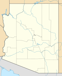
Texas Hill (Arizona) facts for kids
Quick facts for kids Texas Hill |
|
|---|---|
| Highest point | |
| Elevation | 784 ft (239 m) NAVD 88 |
| Prominence | 428 ft (130 m) |
| Geography | |
| Location | Yuma County, Arizona, U.S |
| Topo map | USGS Texas Hill |
Texas Hill is a noticeable hilltop and important place in the Gila River valley. You can find it in Yuma County, Arizona. This hill stands about 784 feet (239 meters) tall. It rises from the flat valley floor, which is around 330 feet (100 meters) high.
Texas Hill sticks out into the valley from the north side of the river. Its dark color makes it easy to spot from far away. This makes it a helpful landmark for travelers.
History of Texas Hill
Gold Rush Travelers
In 1849, many people headed west to California during the California Gold Rush. They hoped to find gold and get rich. A popular route they followed was the Southern Emigrant Trail. This trail went through the Gila River Valley.
Many of these gold seekers, called "49ers," came from places like Texas. They traveled through what was then New Mexico Territory. Texas Hill was along this important route. We don't know exactly how the hill got its name. But it was already called Texas Hill when it first appeared on maps.
Stagecoach Stops
Later, in 1859, the Butterfield Overland Mail company set up stagecoach stations. These stations were built to help travelers on long journeys. They offered places to get water and change horses. This was especially important in the hot, dry parts of the route.
One of these stations was called Texas Hill Station. It was located about 2 miles (3.2 kilometers) east of Texas Hill. These stations made travel safer and easier for people crossing the country.


