The Devil's Point facts for kids
Quick facts for kids The Devil's Point |
|
|---|---|
| Bod an Deamhain | |
 |
|
| Highest point | |
| Elevation | 1,004 m (3,294 ft) |
| Prominence | c. 89 m |
| Parent peak | Cairn Toul |
| Listing | Munro |
| Naming | |
| Language of name | Scottish Gaelic |
| Geography | |
| Location | Cairngorms, Scotland |
| OS grid | NN976951 |
| Topo map | OS Landranger 43 |
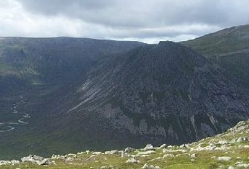
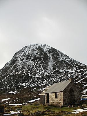
The Devil's Point (in Scottish Gaelic: Bod an Deamhain) is a famous mountain in Scotland. It is part of the Cairngorms mountain range. This mountain got its English name after a visit from Queen Victoria. It lies to the west of the Lairig Ghru pass.
Exploring The Devil's Point
The Devil's Point is a very noticeable mountain when you see it from the south. Even though it looks like its own peak, it is actually a smaller part of a bigger mountain called Cairn Toul. The very top of Cairn Toul is about 3 kilometers (1.9 miles) north of The Devil's Point.
How to Reach the Peak
The easiest way to climb The Devil's Point is to follow a path. This path goes up a valley called Coire Odhar. It starts from Corrour Bothy, which is a small shelter on the eastern side of the mountain.
To get to Corrour Bothy, you need to take a long walk. The most common way is to follow the Lairig Ghru. This is a well-known mountain pass. You would start from Linn of Dee, which is about 12 kilometers (7.5 miles) away.
Nearby Peaks
Many climbers like to climb The Devil's Point along with Cairn Toul. Another peak nearby is called Sgòr an Lochain Uaine. This mountain is north of Cairn Toul. It is sometimes called The Angel's Peak. This name is used to create a fun contrast with The Devil's Point.
 | Emma Amos |
 | Edward Mitchell Bannister |
 | Larry D. Alexander |
 | Ernie Barnes |


