Lairig Ghru facts for kids
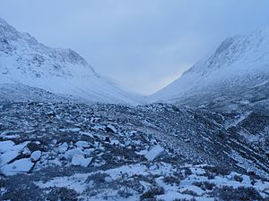
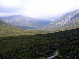
The Lairig Ghru is a famous mountain pass in the Cairngorms mountains of Scotland. It's like a natural pathway through the middle of these big mountains. Part of this route goes through the Mar Lodge Estate.
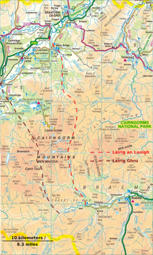
People can start their journey from different places. From the south, you can begin near Braemar or Blair Atholl. From the north, you can start from Glenmore or Aviemore. It's a long and exciting journey!
Contents
What Does "Lairig Ghru" Mean?
The name "Làirig Dhrù" (pronounced "Laarig Groo") means pass of Dhru or Druie. Experts think it comes from a word meaning "oozing" or "flowing." This makes sense because two streams seem to "ooze" out of the ground near the highest point of the pass.
Some people thought "Ghru" might mean "forbidding" or "sullen." This is because the pass can be very wild in bad weather. However, most experts agree that the name is linked to the water flowing from the valley floor.
Another idea is that "Lairig Ghru" might have originally been "Lairig Ruadh," meaning "Red Pass." This fits with the old name for the Cairngorms, "Am Monadh Ruadh," which means "The Red Mountains."
A Route Through History
The Lairig Ghru has been used for a very long time. It was a path for many different people, not just for moving cattle. People used it to travel between Deeside and Strathspey.
It was used regularly even before the 1700s. Back then, it was a path for traders and travellers. Later, it became known as a "Drove Road" because people used it to move cattle to markets. This happened until about 1873.
For many years, men from Rothiemurchus would clear rocks from the path every spring. This made it easier to travel. Today, cars use modern roads like the A9 or A939. The Lairig Ghru is now mostly used by walkers who love adventure.
The full walk from Aviemore to Braemar is about 43 kilometres (27 miles). Many walkers choose to start or finish at Linn of Dee to make the journey shorter.
Fun and Adventure in the Pass
People have been using the Lairig Ghru for fun and adventure for over a hundred years. In the early 1900s, it was a popular challenge for walkers. They wanted to add the "feat of doing it" to their list of achievements.
One early report from 1901 describes the snow conditions in the pass. A walker named C. G. Cash explored the Lairig Ghru in April. He found a lot of snow, so much that some rocks and cairns (stone piles) were completely covered. He was probably the first person to go up the pass that year! This shows how people were already exploring the Lairig Ghru for recreation.
Important Spots Along the Way
The Lairig Ghru has many interesting spots. Some of these are not even on regular maps! They are known through old stories and local traditions.
There isn't a clear start or end point for the Lairig Ghru. But generally, the pass is considered to be between Carn a' Mhaim and The Devil's Point in the south, and Carn Eilrig and Castle Hill in the north.
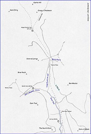
From the south, there are two main ways to reach the Lairig Ghru. These paths join up near Carn a' Mhaim and The Devil's Point. Soon after, the path splits again. One way leads to a footbridge over the River Dee towards Corrour Bothy.
Corrour Bothy
Corrour Bothy is a simple stone building used as a mountain refuge. It's a basic shelter for walkers, maintained by the Mountain Bothies Association. It has one room with a fireplace and a composting toilet outside. It's a great place to rest during a long walk.
Clach nan Taillear (Tailor's Stone)
This means "stone of the tailors." It's a large, ribbed stone next to the Lairig Ghru path. The stone has a sad story. It's named after some tailors who tried to dance at three different places in one winter day. They danced at two spots and were crossing the Lairig Ghru when a snowstorm hit. They tried to find shelter behind this stone but sadly didn't make it. The stone now serves as their memorial.
River Dee
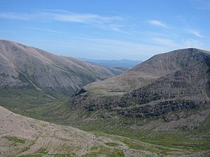
All the rain that falls on the mountains around the southern part of the Lairig Ghru flows into the River Dee. The official source of the River Dee is high up on Braeriach, at a place called the Wells of Dee. However, the River Dee (as named on maps) starts where two streams, Allt a' Gharbh choirie and Allt na Lairig Ghru, meet. From this point, the Lairig Ghru path continues north into a hanging valley.
The Duke's Path
This path is only shown on very detailed maps. It's a made path on the western side of the Lairig Ghru. It follows a stream and leads towards the mountains Braeriach and Sron na Lairige. This path was built by the Duke of Fife in the late 1800s. He owned the Mar Estate at the time. It was built for hunting but hasn't been used much since then, so it's hard to follow today.
Pools of Dee
As you walk around the highest part of the Lairig Ghru, you'll see a series of pools. Many people mistakenly think these are the source of the River Dee. But they are not! Their old name was Lochan Dubh na Lairige, meaning "black tarn of the Lairig." It's said that at least one of these pools has trout, even though no streams seem to flow in or out of them.
A little south of the largest pool, a stream called Allt na Lairig Ghru flows south. It joins another stream to form the real River Dee.
March Burn
The March Burn is a stream on the eastern side of the summit. It flows down the mountain slope and then disappears under rocks before reaching the valley floor. The word "March" here doesn't mean the month of the year. It refers to an old meaning of the word: "boundary." The summit of the Lairig Ghru marks the boundary between Deeside (in Aberdeenshire) and Strathspey (in Inverness-shire). Its old name was Allt na Criche, meaning "the burn of the boundary."
The Summit
The highest point of the Lairig Ghru is about 835 metres (2,733 feet) high. It's a significant point on the journey through the pass.
Angus Sinclair Memorial Hut
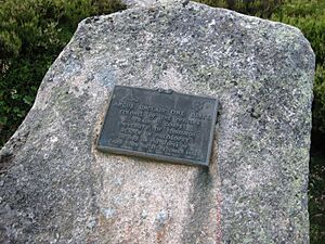
A small bothy (shelter) was built here in 1957. It was a memorial to Dr William Angus Sinclair, who sadly died on Cairn Gorm in 1954. This shelter was located near where several paths met, including the one from the Chalamain Gap. Like many other easily reachable mountain shelters in Scotland, it was taken down around 1991.
Chalamain Gap
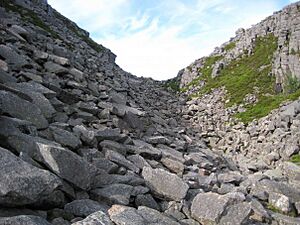
This is a ravine filled with large boulders. It's a route that connects the Lairig Ghru to Glen More. The name "Chalamain Gap" is quite new. Older books didn't name it but described it as a "dry den" or ravine. These types of ravines are thought to have been formed by ancient glaciers or side streams. Its older Gaelic names include Eag Coire a' Chomhlaich and Eag Coire na Comhdhalack, which means "The Ravine of the Corrie of the Assembly."
See also
- Places, place names, and structures on Mar Lodge Estate
 | Kyle Baker |
 | Joseph Yoakum |
 | Laura Wheeler Waring |
 | Henry Ossawa Tanner |


