Theba, Arizona facts for kids
Quick facts for kids
Theba, Arizona
|
|
|---|---|

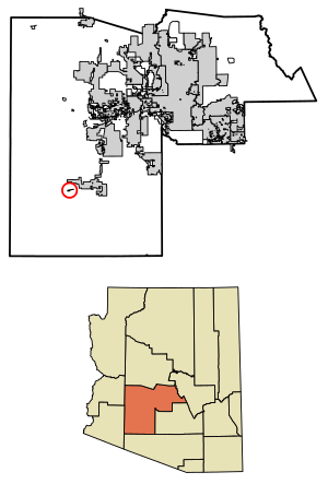
Location in Maricopa County, Arizona
|
|
| Country | United States |
| State | Arizona |
| County | Maricopa |
| Area | |
| • Total | 0.62 sq mi (1.61 km2) |
| • Land | 0.62 sq mi (1.61 km2) |
| • Water | 0.00 sq mi (0.00 km2) |
| Elevation | 728 ft (222 m) |
| Population
(2020)
|
|
| • Total | 111 |
| • Density | 178.46/sq mi (68.94/km2) |
| Time zone | UTC-7 (Mountain (MST)) |
| ZIP code |
85337 (Gila Bend)
|
| FIPS code | 04-73490 |
| GNIS feature ID | 12385 |
Theba is a small community in Maricopa County, Arizona, United States. It is called a census-designated place (CDP) because the government counts its population for official records. Theba is located about 728 feet (222 meters) above sea level. You can find it along Interstate 8, and it has its own exit, Exit 106.
In 2020, about 111 people lived in Theba. This number was a bit lower than in 2010, when 158 people lived there. Near Theba is the Rowley Mine, a private mine known for a special mineral called wulfenite. This mineral is usually orange, yellow, or red. A very large farm called Paloma Ranch used to be near Theba. Because of this, maps often show the area as Paloma.
Theba's Past
The area around Theba is part of the Sonoran Desert. This desert is known for its unique plants and animals. For many years, up until the 1960s, Theba was a farming area. Farmers grew crops like melons. In the 1970s, they also grew jojoba and guar. Jojoba is a plant whose seeds are used to make oil. Guar is a plant used in the oil industry.
A long time ago, the Southern Pacific Company had a train station in Theba. This company built many railroads across the western United States. The station was served by Wells Fargo, a company that delivered goods and money. In 1960, about 200 people were thought to live in Theba.
Theba is also close to the Painted Rock Petroglyph Site. This site has ancient petroglyphs, which are drawings carved into rocks by early people. These carvings are very old and tell us about the past. The site was added to the National Register of Historic Places in 1977. This means it is an important historical place in the United States.
Who Lives in Theba?
| Historical population | |||
|---|---|---|---|
| Census | Pop. | %± | |
| 2010 | 158 | — | |
| 2020 | 111 | −29.7% | |
| U.S. Decennial Census | |||
In 2010, there were 158 people living in Theba. The area had about 254 people for every square mile. This is called the population density. Most people living in Theba were from different racial backgrounds. About 96% of the people were Hispanic or Latino.
Learning in Theba
The schools in the Theba and Paloma area are part of the Paloma Elementary School District.
Theba Elementary School was in the news in 1977. At that time, the school leaders decided not to sign a federal agreement. This agreement said they would not treat women unfairly. Theba Elementary was one of the few schools in the country that did not sign. Because they didn't sign, they could not get money from the federal government. The school leaders said they had never received federal money anyway, so it didn't change much for them.
See also
 In Spanish: Theba (Arizona) para niños
 | John T. Biggers |
 | Thomas Blackshear |
 | Mark Bradford |
 | Beverly Buchanan |


