Thomas Glacier facts for kids
Quick facts for kids Thomas Glacier |
|
|---|---|

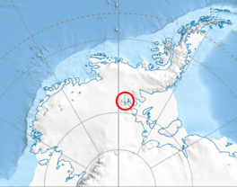
This map shows where the Sentinel Range is in Western Antarctica.
|
|
| Location | Vinson Massif Sentinel Range |
| Coordinates | 78°40′S 84°0′W / 78.667°S 84.000°W |
| Length | 17 nmi (31 km; 20 mi) |
| Thickness | unknown |
| Status | unknown |
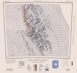
Thomas Glacier (78°40′S 84°0′W / 78.667°S 84.000°W) is a large river of ice found in Antarctica. It has a unique Z-shape. This glacier flows from the southeast side of the Vinson Massif. It travels for about 17 nautical miles (31 kilometers) through the southern part of the Sentinel Range. The glacier leaves the range between two areas called Doyran Heights and Petvar Heights. It passes south of Johnson Spur.
Discovery and Naming
The Thomas Glacier was first seen by a U.S. Navy team called Squadron VX-6. They took photos of the area on December 14 and 15, 1959. Later, the United States Geological Survey (USGS) used these photos to map the glacier. The Advisory Committee on Antarctic Names (US-ACAN) gave the glacier its name. They named it after R. Admiral Charles W. Thomas. He was a U.S. Coast Guard officer who went on many trips to Antarctica in the 1950s.
Where is Thomas Glacier?
Thomas Glacier is located in the Ellsworth Mountains in Antarctica. It is part of the Sentinel Range, which includes the Vinson Massif. The Vinson Massif is the highest mountain in Antarctica. The glacier helps drain ice from this very cold and icy region.
Glaciers That Join Thomas Glacier
Several smaller glaciers flow into Thomas Glacier. These are like smaller rivers joining a bigger one. They add more ice to the main glacier as it moves.
 | Laphonza Butler |
 | Daisy Bates |
 | Elizabeth Piper Ensley |


