
Thompson Creek (Chestatee River tributary) facts for kids
Thompson Creek is a small stream located in Georgia, USA. It flows into the Chestatee River. This creek is about 1.86 miles (3 kilometers) long.
Thompson Creek's Journey
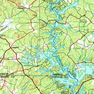
Thompson Creek starts in eastern Dawson County. Its source is west of U.S. Route 19 and State Route 400. It is also north of State Route 53. This area is southeast of Dawsonville.
The creek first flows southeast for a short distance. Then, it crosses U.S. Route 19 and State Route 400. After crossing, it turns south and runs alongside the highway.
Thompson Creek then turns east. It forms a part of Lake Lanier, which is like a big arm of the lake. This part is the westernmost arm of Lake Lanier. It is just east of State Route 400.
Another small, unnamed stream joins this arm from the south. Finally, Thompson Creek meets the Chestatee River. This meeting point is under Lake Lanier. It is where the Chestatee and Thompson Lake Lanier arms connect.
What is a Watershed?
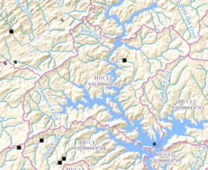
A watershed is an area of land. All the water in that area drains into a specific river, lake, or ocean. The land around Thompson Creek and its connected waters forms a special watershed. The United States Geological Survey calls this area the Thompson Creek-Chestatee River sub-watershed.
This watershed covers about 23 square miles. It is located southeast of Dawsonville. The area also includes a large southern part of the Chestatee River arm of Lake Lanier. This part is on the border of Dawson County and Hall County.
The watershed reaches a point just north of State Route 53 and Keith Bridge. It also goes into Forsyth County at its southern end. The Chestatee River enters this watershed just south of the Yellow Creek watershed. It collects water from an unnamed stream from the east. It also gets water from Toto Creek and two other unnamed streams from the west.
