
Yellow Creek (Chestatee River tributary) facts for kids
Yellow Creek is a stream in Georgia. It flows into the Chestatee River. This creek is about 5.66 miles (9.11 kilometers) long.
Where Yellow Creek Starts and Flows
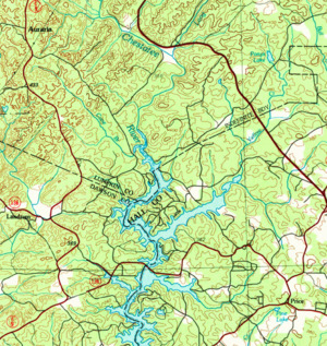

Yellow Creek begins in the southern part of Lumpkin County. This is a little less than 2 miles east of where three main roads meet: U.S. Route 19, State Route 60, and State Route 115. It starts southeast of the town of Dahlonega.
The creek flows south for a short distance. It then crosses into Hall County and helps form a small body of water called Pony's Lake. After that, it goes back into Lumpkin County. Here, it joins with another small stream that has been flowing next to it.
Yellow Creek then flows back into Hall County. It crosses State Route 60 and turns toward the southwest. Another small stream joins it from the south. Finally, Yellow Creek flows into Lake Lanier. It forms a part of Lake Lanier known as the Yellow Creek arm. This happens where it meets Little Yellow Creek, west of Murrayville.
This arm of Lake Lanier also gets water from one more unnamed stream coming from the north. Yellow Creek then meets the Chestatee River. Both of these rivers are now under the waters of Lake Lanier where they join.
Understanding the Yellow Creek Area
The area that Yellow Creek and its nearby waters drain is called a watershed. The United States Geological Survey (USGS) has given this specific watershed a special code: HUC 031300010701. It is known as the Yellow Creek-Chestatee River sub-watershed.
This area covers about 27 square miles. It is located south of Dahlonega and west of Murrayville. This watershed also includes the northern part of the Chestatee River arm of Lake Lanier in Lumpkin County. This part of the lake is west of the Yellow Creek arm. It is where the Chestatee River flows into Lake Lanier.
The Chestatee River enters this watershed just south of where it meets Long Branch. It then picks up two more unnamed streams and Cane Branch from the west. These waters then form the Chestatee arm of Lake Lanier, which is the most northwestern arm of the lake. A small part of this watershed, west of the Chestatee arm, is in Dawson County.
