
Lumpkin County, Georgia facts for kids
Quick facts for kids
Lumpkin County
|
||
|---|---|---|

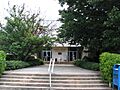
Lumpkin County Courthouse in Dahlonega
|
||
|
||

Location within the U.S. state of Georgia
|
||
 Georgia's location within the U.S. |
||
| Country | ||
| State | ||
| Founded | December 3, 1832 | |
| Named for | Wilson Lumpkin | |
| Seat | Dahlonega | |
| Largest city | Dahlonega | |
| Area | ||
| • Total | 284 sq mi (740 km2) | |
| • Land | 283 sq mi (730 km2) | |
| • Water | 1.3 sq mi (3 km2) 0.4%% | |
| Population
(2020)
|
||
| • Total | 33,488 | |
| • Density | 106/sq mi (41/km2) | |
| Time zone | UTC−5 (Eastern) | |
| • Summer (DST) | UTC−4 (EDT) | |
| Congressional district | 9th | |

Lumpkin County is a county in the Northeast part of the U.S. state of Georgia. In 2020, about 33,488 people lived here. The main town and county seat is Dahlonega. Lumpkin County is also part of the larger Atlanta-Sandy Springs-Roswell, Georgia metropolitan area.
Contents
A Look at Lumpkin County's Past
This area was first home to the Cherokee people. They lived in parts of what is now Georgia, as well as southeastern Tennessee and western North Carolina.
Lumpkin County was officially created on December 3, 1832. It was named after Wilson Lumpkin, who was the Governor of Georgia at that time. His daughter, Martha Wilson Lumpkin Compton, later inspired the name of Marthasville, which became the city of Atlanta.
The Gold Rush Era
In the 1830s, something exciting happened: gold was found near a place called Auraria in the county. This discovery led to a big rush of miners and new towns. The U.S. government even built a special mint in Dahlonega to make gold coins.
This mint worked for 23 years until the American Civil War began. Later, gold from Lumpkin County was used to cover the dome of the state capitol building in Atlanta, making it shine!
Modern Times in Lumpkin County
Today, farming and agritourism (tourism related to farms) are very important businesses here. Lumpkin County is also famous for its many vineyards and five licensed wineries. Because of this, it's known as "the heart of Georgia wine country." Many tourists visit to enjoy the wine.
In 2015, a state senator named Steve Gooch helped pass a resolution that officially called Lumpkin County the "Wine Tasting Room Capital of Georgia."
The historic Dahlonega Square is another popular spot. It has fun gift shops, tasty restaurants, art galleries, and more wine tasting rooms.
Lumpkin County is also home to Camp Frank D. Merrill, a special training base for the U.S. Army Rangers. This camp is located in the northern part of the county, within the Chattahoochee National Forest.
Several groups that support veterans are active in Lumpkin County. These include the Heyward Fields American Legion Post 239 and the Lumpkin and White County Veterans of Foreign Wars Post 5533. There's also a special committee that helps veterans and manages the Lumpkin County Veterans Memorial. This group puts up memorial crosses along major roads in Dahlonega twice a year to honor veterans who have passed away.
Exploring Lumpkin County's Nature
Lumpkin County covers about 284 square miles. Most of this is land, with a small part (about 0.4%) being water.
The county is located in the beautiful Blue Ridge Mountains. Blood Mountain, which Lumpkin County shares with Union County, is the highest point in the county. At 4,458 feet, it's the fifth-highest peak in Georgia and the highest point on Georgia's part of the Appalachian Trail.
The western part of Lumpkin County is in the Etowah River area, while the eastern part is in the Upper Chattahoochee River area.
Main Roads for Travel
 U.S. Route 19
U.S. Route 19 Business U.S. Route 129
 State Route 9
 State Route 11
 State Route 52
- 20px State Route 60
- 20px State Route 60 Business
- 20px State Route 115
- 20px State Route 400
Neighboring Counties
Lumpkin County shares borders with these other counties:
- Union County – to the north
- White County – to the east
- Hall County – to the southeast
- Dawson County – to the west
- Fannin County – to the northwest
Protected Natural Areas
Part of the Chattahoochee National Forest is located in Lumpkin County, offering beautiful natural spaces.
Towns and Communities
City
Ghost Town
- Auraria (a town that no longer exists)
Population and People
| Historical population | |||
|---|---|---|---|
| Census | Pop. | %± | |
| 1840 | 5,671 | — | |
| 1850 | 8,955 | 57.9% | |
| 1860 | 4,626 | −48.3% | |
| 1870 | 5,161 | 11.6% | |
| 1880 | 6,526 | 26.4% | |
| 1890 | 6,867 | 5.2% | |
| 1900 | 7,433 | 8.2% | |
| 1910 | 5,444 | −26.8% | |
| 1920 | 5,240 | −3.7% | |
| 1930 | 4,927 | −6.0% | |
| 1940 | 6,223 | 26.3% | |
| 1950 | 6,574 | 5.6% | |
| 1960 | 7,241 | 10.1% | |
| 1970 | 8,728 | 20.5% | |
| 1980 | 10,762 | 23.3% | |
| 1990 | 14,573 | 35.4% | |
| 2000 | 21,016 | 44.2% | |
| 2010 | 29,966 | 42.6% | |
| 2020 | 33,488 | 11.8% | |
| 2023 (est.) | 35,258 | 17.7% | |
| U.S. Decennial Census 1790-1880 1890-1910 1920-1930 1930-1940 1940-1950 1960-1980 1980-2000 2010 |
|||
| Group | Number of People | Percentage |
|---|---|---|
| White (not Hispanic) | 29,241 | 87.32% |
| Black or African American (not Hispanic) | 412 | 1.23% |
| Native American | 151 | 0.45% |
| Asian | 257 | 0.77% |
| Pacific Islander | 21 | 0.06% |
| Other/Mixed | 1,616 | 4.83% |
| Hispanic or Latino | 1,790 | 5.35% |
In 2020, there were 33,488 people living in Lumpkin County. There were 11,570 households and 7,800 families.
Schools and Learning
The Lumpkin County School System is in charge of the public schools. The county has one high school (Lumpkin County High School), one middle school (Lumpkin County Middle School), and three elementary schools (Long Branch, Blackburn, and Cottrell). The University of North Georgia also has a campus in Lumpkin County, offering higher education.
Images for kids
-
The Lumpkin County Courthouse in Dahlonega
See also
 In Spanish: Condado de Lumpkin para niños
