Thorpe Fell Top facts for kids
Quick facts for kids Thorpe Fell Top |
|
|---|---|

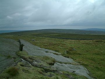
Thorpe Fell Top from the summit of Cracoe Fell.
|
|
| Highest point | |
| Elevation | 506 m (1,660 ft) |
| Prominence | c. 308 m |
| Parent peak | Whernside |
| Listing | Marilyn |
| Geography | |
| OS grid | SE008596 |
| Topo map | OS Landranger 104 |
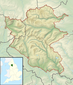
Thorpe Fell Top is a hill in the beautiful Yorkshire Dales in England. It's the highest point of Burnsall and Thorpe Fell. This area forms a large piece of land between two valleys, Wharfedale and Skipton. It's a great place for outdoor adventures!
Contents
Exploring Thorpe Fell Top
What is Thorpe Fell Top?
Thorpe Fell Top is a high point on a moor where grouse birds live. At the very top, you'll find a special marker called a trig point. This trig point is used by mapmakers to help them create accurate maps.
How High Is It?
The top of Thorpe Fell is 506 metres (about 1,660 feet) above sea level. It's listed as a "Marilyn." A Marilyn is a hill in the British Isles that is at least 150 metres (about 492 feet) higher than the land around it.
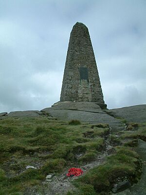
However, some recent measurements suggest that a nearby hill, Cracoe Fell, might be even taller. Cracoe Fell is about 1.7 kilometres (1.1 miles) away. The base of the war memorial on Cracoe Fell might be as high as 510 metres. This means Cracoe Fell could be slightly higher than Thorpe Fell Top.
How to Visit Thorpe Fell Top
It's fairly easy to visit Thorpe Fell Top. You can start your walk from the villages of Thorpe or Burnsall. There are paths and tracks marked on maps that lead right to the top.
You can also reach the top of Cracoe Fell from Thorpe Fell Top. Or, you can walk to Cracoe Fell along a path called Fell Lane, starting from the village of Cracoe.
 | Janet Taylor Pickett |
 | Synthia Saint James |
 | Howardena Pindell |
 | Faith Ringgold |


