
Tokushima (city) facts for kids
Quick facts for kids
Tokushima
徳島市
|
|||
|---|---|---|---|

Left to right from top: Yoshinogawa Bridge, Awa Odori in August, Tokushima Station, Mount Bizan, Senshukaku Garden at Tokushima Castle, Awa Jūrōbei House, Aibahama Park
|
|||
|
|||
 |
|||
| Country | |||
| Region | Shikoku | ||
| Prefecture | |||
| City Status | October 1, 1889 | ||
| Area | |||
| • Total | 191.52 km2 (73.95 sq mi) | ||
| Population
(September 1, 2024)
|
|||
| • Total | 245,264 | ||
| • Density | 1,280/km2 (3,300/sq mi) | ||
| Time zone | UTC+9 (JST) | ||
| Symbols | |||
| • Tree | Elaeocarpus sylvestris | ||
| • Flower | Prunus serrulata | ||
| Phone number | 088-621-5111 | ||
| Address | 2-5 Saiwaichō, Tokushima-shi, Tokushima-ken 770-8571 | ||


Tokushima (徳島市, Tokushima-shi, Japanese: [tokɯ̥ꜜɕima]) is the main city of Tokushima Prefecture. It is located on Shikoku island in Japan. As of September 1, 2024, about 245,264 people live here. The city covers an area of 191.52 square kilometers. This means there are about 1,280 people per square kilometer.
Contents
Geography of Tokushima
Tokushima city is in the northeast part of Tokushima Prefecture. It sits near where the Yoshino River meets the sea. The city looks like a traditional Japanese castle town. This means it grew up around a castle.
Most of Tokushima is flat land. This flat area is called the Tokushima plain. But right in the middle of the city, there is a mountain called Mt. Bizan. It makes the city look very beautiful. The southern part of Tokushima has more mountains and forests.
Mountains in Tokushima
Tokushima has several mountains. Some are small, and one is quite tall.
| Name | Height | Notes |
|---|---|---|
| Bizan (眉山) |
277 m | |
| Shiroyama (城山) |
62 m | |
| Nakatsu Mineyama (中津峰山) |
773 m | This is the tallest mountain in Tokushima City. |
| Nishi Ryuo-san (西竜王山) |
495 m | |
| Higashi Ryuo-san (東龍王山) |
408m | |
| Kinobeyama (気延山) |
212 m | |
| Bentenyama (弁天山) |
6.1 m | This mountain is said to be the smallest natural mountain in Japan. |
Rivers flowing through Tokushima
Many rivers flow through Tokushima. They are important for the city's geography.
- Akui River
- Imagire River
- Shinmachi River
- Suketō River
- Yoshino River
Cities and towns near Tokushima
Tokushima city is surrounded by other towns and cities in Tokushima Prefecture.
- Aizumi
- Ishii
- Kamiyama
- Katsuura
- Kitajima
- Komatsushima
- Matsushige
- Sanagōchi
Population of Tokushima
The number of people living in Tokushima has been increasing for the last 100 years. This information comes from Japanese census data.
| Historical population | ||
|---|---|---|
| Year | Pop. | ±% |
| 1920 | 140,534 | — |
| 1930 | 158,688 | +12.9% |
| 1940 | 164,572 | +3.7% |
| 1950 | 177,363 | +7.8% |
| 1960 | 203,326 | +14.6% |
| 1970 | 223,451 | +9.9% |
| 1980 | 249,343 | +11.6% |
| 1990 | 263,356 | +5.6% |
| 2000 | 268,218 | +1.8% |
| 2010 | 264,764 | −1.3% |
Climate in Tokushima
Tokushima has a humid subtropical climate. This means it has hot summers and cool winters. There is a lot of rain, especially in the summer. Winters are usually drier.
| Climate data for Tokushima (1991−2020 normals, extremes 1891−present) | |||||||||||||
|---|---|---|---|---|---|---|---|---|---|---|---|---|---|
| Month | Jan | Feb | Mar | Apr | May | Jun | Jul | Aug | Sep | Oct | Nov | Dec | Year |
| Record high °C (°F) | 22.5 (72.5) |
23.2 (73.8) |
26.4 (79.5) |
30.1 (86.2) |
32.9 (91.2) |
35.7 (96.3) |
38.4 (101.1) |
38.2 (100.8) |
36.2 (97.2) |
33.4 (92.1) |
27.1 (80.8) |
26.7 (80.1) |
38.4 (101.1) |
| Mean daily maximum °C (°F) | 10.0 (50.0) |
10.8 (51.4) |
14.3 (57.7) |
19.6 (67.3) |
24.0 (75.2) |
26.8 (80.2) |
30.6 (87.1) |
32.3 (90.1) |
28.5 (83.3) |
23.1 (73.6) |
17.7 (63.9) |
12.5 (54.5) |
20.9 (69.6) |
| Daily mean °C (°F) | 6.3 (43.3) |
6.8 (44.2) |
9.9 (49.8) |
15.0 (59.0) |
19.6 (67.3) |
23.0 (73.4) |
26.8 (80.2) |
28.1 (82.6) |
24.8 (76.6) |
19.3 (66.7) |
13.8 (56.8) |
8.7 (47.7) |
16.8 (62.2) |
| Mean daily minimum °C (°F) | 2.9 (37.2) |
3.1 (37.6) |
5.8 (42.4) |
10.6 (51.1) |
15.6 (60.1) |
19.8 (67.6) |
23.9 (75.0) |
24.9 (76.8) |
21.6 (70.9) |
15.9 (60.6) |
10.1 (50.2) |
5.2 (41.4) |
13.3 (55.9) |
| Record low °C (°F) | −5.4 (22.3) |
−6.0 (21.2) |
−3.6 (25.5) |
−0.7 (30.7) |
4.6 (40.3) |
9.7 (49.5) |
15.3 (59.5) |
16.6 (61.9) |
11.9 (53.4) |
4.5 (40.1) |
−1.3 (29.7) |
−4.3 (24.3) |
−6.0 (21.2) |
| Average precipitation mm (inches) | 41.9 (1.65) |
53.0 (2.09) |
87.8 (3.46) |
104.3 (4.11) |
146.6 (5.77) |
192.6 (7.58) |
177.0 (6.97) |
193.0 (7.60) |
271.2 (10.68) |
199.5 (7.85) |
89.2 (3.51) |
63.9 (2.52) |
1,619.9 (63.78) |
| Average snowfall cm (inches) | 1 (0.4) |
1 (0.4) |
0 (0) |
0 (0) |
0 (0) |
0 (0) |
0 (0) |
0 (0) |
0 (0) |
0 (0) |
0 (0) |
0 (0) |
2 (0.8) |
| Average precipitation days (≥ 0.5 mm) | 6.5 | 7.1 | 10.3 | 10.1 | 9.7 | 13.2 | 11.2 | 9.0 | 11.4 | 9.4 | 7.7 | 6.5 | 112.2 |
| Average relative humidity (%) | 61 | 61 | 61 | 62 | 67 | 75 | 77 | 73 | 72 | 69 | 66 | 63 | 67 |
| Mean monthly sunshine hours | 160.3 | 152.5 | 179.8 | 197.9 | 205.7 | 151.9 | 192.0 | 230.6 | 162.0 | 163.6 | 150.4 | 160.1 | 2,106.8 |
| Source: Japan Meteorological Agency | |||||||||||||
History of Tokushima
The area of Tokushima was once part of an old province called Awa Province. Tokushima city grew up around Tokushima Castle. This castle was home to the Hachisuka clan, who were powerful rulers called daimyo. They governed the Tokushima Domain during the Edo Period under the Tokugawa shogunate.
The city became rich because of its strong indigo dye industry. Indigo dye was used to color fabrics blue. Tokushima officially became a city on October 1, 1889. This happened when Japan created its modern system of towns and cities. At that time, Tokushima was the 10th largest city in Japan.
Tokushima during World War II
During World War II, Tokushima was a target for bombing. This was because it was an important center for farming in the region. On July 3, 1945, many planes dropped bombs on Tokushima. A large part of the city was destroyed. Many people were killed or hurt during this event. The city faced a very difficult time, but it was rebuilt quickly after the war.
Economy of Tokushima
Tokushima has been an important economic center in eastern Shikoku for a long time. During the Edo period, it was a major place for trading indigo and wood. It was one of the top business cities in Japan.
Tokushima has strong ties with the Kansai region, especially Osaka. These connections became even stronger after the Akashi Kaikyo Bridge opened. When the indigo industry became less important, the money saved by merchants helped new businesses grow. These included banks and financial companies. Later, modern industries like spinning, papermaking, medicine, food processing, and electricity also developed. Even though the city was heavily damaged in World War II, it was rebuilt quickly. Today, there are many industrial parks in Tokushima.
Farming and forestry are still very important to the local economy. The Tokushima Plain has rich farmland. Here, farmers grow rice, cauliflower, and carrots. These are some of the main products from the area.
Education in Tokushima
Tokushima has many schools and universities.
Universities and colleges in Tokushima
- Shikoku University
- Tokushima Bunri University
- University of Tokushima
Schools in Tokushima
The city government runs 30 public elementary schools and 18 public middle schools. The Tokushima Prefectural Department of Education runs nine public high schools. There are also private schools: one elementary, three middle, and five high schools. The prefecture also has a night school and four special education schools for students with disabilities.
Transportation in Tokushima
Getting around Tokushima and to other places is easy.
Airport near Tokushima
- Tokushima Airport is located in the nearby town of Matsushige.
Railway lines in Tokushima
![]() Shikoku Railway Company – Kōtoku Line
Shikoku Railway Company – Kōtoku Line
- Tokushima - Sako - Yoshinari
![]() Shikoku Railway Company – Mugi Line
Shikoku Railway Company – Mugi Line
- Tokushima - Awa-Tomida - Niken'ya - Bunkanomori - Jizōbashi
![]() Shikoku Railway Company – Tokushima Line
Shikoku Railway Company – Tokushima Line
- Sako - Kuramoto - Akui - Kō
Highways in Tokushima
Major roads connect Tokushima to other parts of Japan.
 Tokushima Expressway
 Tokushima-Nanbu Expressway
 National Route 11
 National Route 28
 National Route 55
 National Route 192
 National Route 195
 National Route 318
 National Route 438
 National Route 439
Sister cities of Tokushima
Tokushima has special friendships with cities in other countries. These are called sister cities.
 Saginaw, Michigan, United States, since December 1961
 Leiria, Portugal, since October 1969
 Dandong, Liaoning, China, since October 1991
Fun places to visit in Tokushima
Tokushima has many interesting places to see.
- Awa Kokubun-ji, the 15th temple on the Shikoku Pilgrimage
- Dainichi-ji, the 13th temple on the Shikoku Pilgrimage
- Ichinomiya Jinja, an important shrine of the old Awa Province
- Ido-ji, the 17th temple on the Shikoku Pilgrimage
- Jōraku-ji, the 14th temple on the Shikoku Pilgrimage
- Kan'on-ji, the 16th temple on the Shikoku Pilgrimage
- Shibunomaruyama Kofun, a National Historic Site
- Tokushima Archaeological Museum
- Tokushima Castle
- Tokushima Castle Museum
- Tokushima Domain Hachisuka clan cemetery, a National Historic Site
- Tokushima Prefectural Museum
Culture in Tokushima
Every August, Tokushima hosts a famous dance festival called the Awa Odori. This happens during the Obon Festival. Awa Odori means "Awa Dance," named after the old Awa Province. During the festival, people of all ages dance in special costumes. They dance to music played by strings and drums. The dancers often sing along too. It's a very lively and colorful event!
Sports in Tokushima
The city has a sports arena called Asty Tokushima. This arena hosted the official 2007 Asian Basketball Championship.
Gallery
-
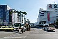
Tokushima Station Bus Terminal
-
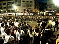
Awa Dancing Festival, a well-known Bon Festival
-
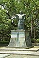
A statue of Hachisuka Iemasa


See also
 In Spanish: Tokushima (Tokushima) para niños
