Transportation in Memphis, Tennessee facts for kids
Memphis, Tennessee, is a very important city for travel and shipping in the middle of America. This is because it's right on the Mississippi River, and many train tracks and highways meet here. Four big bridges cross the Mississippi River at Memphis. Also, Memphis International Airport is one of the biggest airports in the world for moving cargo by air.
Getting around and shipping goods is easy thanks to two major highways, I-40 and I-55, which cross paths in Memphis. I-240 is another highway that helps traffic go around the city. A lot of train cargo also moves through Memphis because of two railroad crossings over the Mississippi River and where east-west and north-south train routes connect. Memphis is also the second busiest cargo port on the Mississippi River.
For getting around locally, the Memphis Area Transit Authority provides public transportation.
Contents
Highways in Memphis
Memphis has a great network of roads, including major interstates and U.S. highways, making it easy to travel in and out of the city.
Major Interstate Highways
The main highways in the Memphis area are Interstate 40 (I-40), its connecting highway I-240, and I-55. Both I-40 and I-55 cross the Mississippi River at Memphis, connecting to Arkansas.
I-22 links the southeast part of Memphis to Mississippi. I-269 is like a big circle road, or beltway, that goes around the city, partly in Mississippi. There are also plans for a future highway, I-69, to come through the Memphis area.
Important U.S. Highways
Memphis is served by seven main U.S. highways. This is more than any other city in the southeastern United States!
- U.S. Route 51 (US 51) comes into Memphis from the south. It's known as Elvis Presley Boulevard for a while.
- US 61 enters the city from the south as Third Street. It then heads west and crosses the Memphis & Arkansas Bridge.
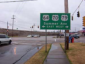
- US 64 comes in with Interstate 55 (I-55) on the Memphis & Arkansas Bridge. It then travels east out of the city.
- US 70 and US 79 travel together through the entire city. They come from the Memphis & Arkansas Bridge and head northeast, running next to I-40.
- US 72 goes through Memphis on Poplar Avenue, which is one of the city's main roads.
- US 78 starts in Memphis and heads southeast. It follows Lamar Avenue, which was once called Pigeon Roost Road.
Railroad Transportation
Memphis is a very busy place for train freight. This is because two train bridges cross the Mississippi River here. Also, train routes from the east and west meet with routes from the north and south in Memphis.
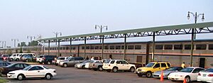
Memphis used to have two main train stations for passengers. One was Memphis Union Station, which was taken down in 1969. The other is Memphis Central Station, which was updated in 1999.
Passenger Train Service
Central Station is a stop for Amtrak's City of New Orleans train route. This train travels between Chicago and New Orleans.
- The southbound City of New Orleans train leaves Memphis around 6:50 AM every day. It goes to cities like Jackson, Mississippi, and ends in New Orleans.
- The northbound City of New Orleans train leaves Memphis around 10:40 PM every day. It goes to cities like Carbondale, Illinois, and ends in Chicago.
Train Freight Operations
Five very large train companies, called Class I railroads, operate in Memphis. These are Union Pacific (UP), Norfolk Southern (NS), Burlington Northern Santa Fe (BNSF), CSX Transportation (CSXT), and Canadian National (CN).
Memphis has ten train freight facilities. Some of these can load and unload large shipping containers. These facilities help move goods all over the country.
Public Transportation Options
Getting around Memphis without a car is possible thanks to several public transportation services.
Local Transit Services
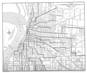
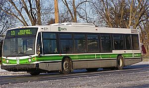
The Memphis Area Transit Authority (MATA) offers city bus service on a schedule. They also have a special service called paratransit for people with disabilities. In 2008, three express bus lines were added to help people get to Downtown Memphis from the outer parts of the city.
MATA also runs a historic trolley system in Downtown Memphis. It has 24 stops along three different lines. This trolley system is currently being expanded to cover a larger area.
There is also a monorail called the Memphis Suspension Railway. This monorail connects the city to Mud Island, which is a park and recreation area.
Intercity Bus Services
If you want to travel from Memphis to other cities by bus, you can use services like Flixbus, Greyhound Lines, and Jefferson Lines.
Airports in Memphis
Memphis is home to a major airport that plays a huge role in global shipping.
Memphis International Airport is Memphis's main airport for commercial flights. It used to handle more cargo than any other airport in the world until 2010. As of 2018, it is still the busiest cargo airport in the United States. This airport is the main international cargo hub for FedEx. It was also a passenger hub for Delta Air Lines after they merged with Northwest Airlines in 2008. Other airlines that fly passengers to Memphis include Allegiant Air, American Airlines, Frontier Airlines, Southwest Airlines, and United Airlines.
The Tennessee Air National Guard also has a unit, the 164th Airlift Wing, that operates at the airport.
Memphis also has several airports for general aviation (GA), which are for private planes and smaller aircraft. General DeWitt Spain Airport is the only GA airport within the city limits. Others are located nearby, like West Memphis Municipal Airport and Millington-Memphis Airport.
Memphis Mississippi River Port
The International Port of Memphis is a very important part of the city's transportation network. It is the second biggest cargo port on the Mississippi River. It's also the fourth biggest inland port in the United States.
The port stretches for about 15 miles (24 km) along the Mississippi River. It has 68 facilities right on the water, and 37 of these are terminals. Terminals are places where products are moved from the land to a ship, or from a ship to the land. The port is located 400 miles (644 km) downriver from St. Louis, Missouri and 600 miles (966 km) upriver from New Orleans.
Mississippi River Bridges
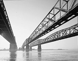
Four bridges cross the Mississippi River at Memphis, connecting Tennessee to Arkansas. They were built close together because the river is narrow at this point. The piers (the supports in the water) of the first three bridges had to be lined up perfectly for boats to pass safely.
Frisco Bridge
The Frisco Bridge opened on May 12, 1892. When it was built, it was the longest bridge in North America! It was first called the Great Bridge at Memphis. This steel railroad bridge was built between 1888 and 1892.
Harahan Bridge
The Harahan Bridge opened on July 14, 1916. It's a railroad bridge that originally had narrow, one-way wooden roads on the sides for cars. In 1928, sparks from a train caused one of these wooden roads to catch fire. Today, only trains use the Harahan Bridge. However, a new path for walking and biking was finished in the fall of 2016.
Memphis & Arkansas Bridge
The Memphis & Arkansas Bridge opened on December 17, 1949. This bridge carries Interstate 55 and also has a path for people to walk on. It was built between 1945 and 1949. It is the longest Warren truss-style bridge in the United States and is listed on the National Historic Register.
Hernando de Soto Bridge
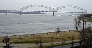
The Hernando de Soto Bridge opened on August 2, 1973. This bridge has cool steel arches and carries Interstate 40. In 1986, M-shaped lights were added to the bridge, making it a famous Memphis landmark.
The Guinness Book of World Records lists the de Soto bridge for its unique "M" shape. In May 2021, a crack was found in one of the bridge's supports. The bridge had to be closed for about three and a half months for repairs and fully reopened on August 3, 2021.
Memphis Bridges Overview
| Name | Nickname | Total length | Opening date |
|---|---|---|---|
| Frisco Bridge | 4,887 ft (1,490 m) | 12 May 1892 | |
| Harahan Bridge | 4,973 ft (1,516 m) | 14 July 1916 | |
| Memphis & Arkansas Bridge | "Old Bridge" | 5,222 ft (1,592 m) | 17 Dec. 1949 |
| Hernando de Soto Bridge | "New Bridge"; "Dolly Parton Bridge"; "M Bridge" | 19,535 ft (5,954 m) | 2 Aug. 1973 |
 | Ernest Everett Just |
 | Mary Jackson |
 | Emmett Chappelle |
 | Marie Maynard Daly |


