
Tremont, Maine facts for kids
Quick facts for kids
Tremont, Maine
|
||
|---|---|---|

Tremont Town Office
|
||
|
||

Tremont, Maine
Location in Maine

Tremont, Maine
Location in the United States
|
||
| Country | United States | |
| State | Maine | |
| County | Hancock | |
| Settled | 1762 | |
| Incorporated | June 3, 1848 | |
| Villages |
|
|
| Government | ||
| • Type | Board of Selectmen, Town Manager | |
| Area | ||
| • Total | 52.36 sq mi (135.61 km2) | |
| • Land | 16.83 sq mi (43.59 km2) | |
| • Water | 35.53 sq mi (92.02 km2) | |
| Elevation | 13 ft (4 m) | |
| Population
(2020)
|
||
| • Total | 1,544 | |
| • Density | 92/sq mi (35.4/km2) | |
| Time zone | UTC−5 (Eastern (EST)) | |
| • Summer (DST) | UTC−4 (EDT) | |
| ZIP Codes | ||
| Area code(s) | 207 | |
| FIPS code | 23-77345 | |
| GNIS feature ID | 0582767 | |

Tremont is a town in Maine, located in Hancock County. It's on the southwest side of Mount Desert Island, often called "the quiet side" by people who live there.
Tremont includes several small communities. These are Bass Harbor (also known as McKinley), Bernard, Gotts Island, Seal Cove, and West Tremont. A part of Acadia National Park is also within the town's borders. From Bass Harbor, you can catch ferries to Swan's Island and Frenchboro. In 2020, the town had a population of 1,544 people.
Contents
Tremont's History

Tremont was first settled in 1762. It officially became a town on June 3, 1848. At first, it was named Mansel. This name came from Isaac Young Ellis, who led a group of settlers to the Massachusetts Bay Colony in 1630. Just two months later, on August 8, the town's name was changed to Tremont. The name "Tremont" means "three mountains" in French.
By 1880, Tremont had grown to a population of 2,011 people. The town was busy with different industries. It had a sawmill for cutting wood and a shipyard for building boats. There was also a gristmill for grinding grain and a shingle mill for making roof tiles. People even made bricks at a brickyard. Fishing and fish curing (preserving fish) were the most important jobs. Today, many people visit Tremont, so tourism is a big part of the local economy.
Geography and Location
Tremont is a town with a mix of land and water. According to the United States Census Bureau, the town covers about 52.36 square miles (135.61 square kilometers). About 16.83 square miles (43.59 square kilometers) of this is land, and 35.53 square miles (92.02 square kilometers) is water.
The town is located on the southwest part of Mount Desert Island. It sits next to Blue Hill Bay and the Atlantic Ocean. Two main roads, Route 102 and Route 102A, pass through Tremont. The town shares its borders with Mount Desert to the north and Southwest Harbor to the east.
Population Changes
| Historical population | |||
|---|---|---|---|
| Census | Pop. | %± | |
| 1850 | 1,425 | — | |
| 1860 | 1,768 | 24.1% | |
| 1870 | 1,822 | 3.1% | |
| 1880 | 2,011 | 10.4% | |
| 1890 | 2,036 | 1.2% | |
| 1900 | 2,010 | −1.3% | |
| 1910 | 1,116 | −44.5% | |
| 1920 | 1,029 | −7.8% | |
| 1930 | 954 | −7.3% | |
| 1940 | 1,118 | 17.2% | |
| 1950 | 1,115 | −0.3% | |
| 1960 | 1,044 | −6.4% | |
| 1970 | 1,003 | −3.9% | |
| 1980 | 1,222 | 21.8% | |
| 1990 | 1,324 | 8.3% | |
| 2000 | 1,529 | 15.5% | |
| 2010 | 1,563 | 2.2% | |
| 2020 | 1,544 | −1.2% | |
| U.S. Decennial Census | |||
Tremont's Population in 2010
In 2010, there were 1,563 people living in Tremont. These people lived in 723 households, and 440 of these were families. The town had about 92.9 people per square mile (35.4 people per square kilometer) of land. There were also 1,260 housing units, like houses and apartments.
Most of the people in Tremont were White (97.3%). A small number were African American (0.6%), Native American (0.2%), or Asian (0.4%). Some people were from other races (0.1%) or from two or more races (1.4%). About 1.0% of the population was Hispanic or Latino.
About 24.1% of households had children under 18 living with them. Many households (45.4%) were married couples living together. The average household had 2.16 people, and the average family had 2.63 people. The median age in Tremont was 48.5 years. About 17.5% of residents were under 18, and 17% were 65 or older.
Education in Tremont
Tremont has one school called Tremont Consolidated School. It is located in Bass Harbor. This school teaches students from kindergarten up to eighth grade. After eighth grade, high school students from Tremont go to Mount Desert Island High School. This high school is located in the nearby town of Mount Desert.
Places to Visit
Tremont has several interesting places to explore:
- Acadia National Park: A beautiful national park with stunning nature.
- Bass Harbor Head Light: A famous lighthouse you can visit.
- Bass Harbor Memorial Library: A local library for the community.
- Ketterlinus Nature Preserve: A natural area to enjoy the outdoors.
- Seal Cove Auto Museum: A museum with a collection of old cars.
- Ship Island Group Preserve: Another natural area, possibly for hiking or wildlife viewing.
- Tremont Historical Society & Museum: A place to learn about the town's past.
Notable People from Tremont
Some well-known people have connections to Tremont:
- John F. Bickford: A hero from the Civil War who received the Medal of Honor.
- Muriel Davisson: A scientist who studied genetics.
- Elaine Guthrie Lorillard: A talented musician.
- Eleanor Mayo: A writer and also a politician.
- Ruth Moore: A famous author.
Images for kids
-
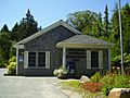
Bernard Post Office
-
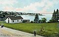
Bass Harbor (1908)
-
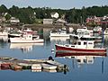
Bass Harbor (2008)
-
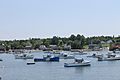
Boats docked at Tremont (2014)
-
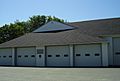
Tremont Volunteer Fire Department
-
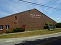
Tremont Community Center
-
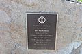
Sea Memorial in Tremont honors the memory of all who perished at sea.
-
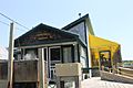
Thurston's Lobster Pound
-
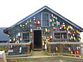
Colorful buoys at Thurston's


See also
 In Spanish: Tremont (Maine) para niños
