Trenton, Indiana facts for kids
Quick facts for kids
Trenton, Indiana
|
|
|---|---|

Trenton, Indiana
|
|

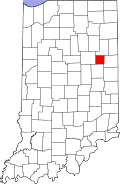
Blackford County's location in Indiana
|
|
| Country | United States |
| State | Indiana |
| County | Blackford |
| Township | Jackson |
| Established | 1847 |
| Elevation | 899 ft (274 m) |
| Time zone | UTC-5 (Eastern (EST)) |
| • Summer (DST) | UTC-4 (EDT) |
| ZIP code |
47348
|
| Area code(s) | 765 |
| FIPS code | 18-76436 |
| GNIS feature ID | 444871 |
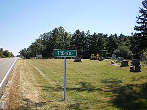
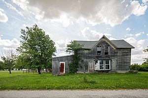
Trenton is a small, quiet community in Blackford County, Indiana. It's known as an unincorporated town, which means it doesn't have its own local government like a city or town. Most of its businesses closed many years ago. Even though some people call it a ghost town, many homes are still lived in and cared for today.
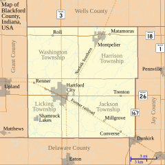
Trenton is located east of Hartford City on Indiana State Road 26. It was planned out in 1845, making it one of the older places in Blackford County. It even had its own Post Office from 1856 to 1907. Because there was another Trenton in Randolph County back then, Blackford County's post office used the name "Priam." That's why you might see "Priam" on older maps instead of Trenton.
Trenton was part of the exciting Indiana Gas Boom in the 1890s. During this time, natural gas was discovered, and many companies started up. Trenton had two of its own gas companies! But the Gas Boom slowly ended in the early 1900s. Many small towns like Trenton struggled after that. As cars and roads got better, people started driving to bigger cities to shop and work. This also helped lead to the decline of many small communities.
Contents
History of Trenton
Trenton is found in Jackson Township within Blackford County. In 1840, Jackson Township had only 154 people. This was partly because there were no train lines, and the land was often wet and hard to farm. Trenton was officially planned on January 20, 1845. It was laid out by Robert H. Laning, Ezekiel Laning, Basel Anderson, and William Cortright, who owned the land.
Railroads and the Gas Boom
When railroads were built in Blackford County in the late 1860s, Trenton was not on the main line. The closest train tracks were about four miles south of the town. However, in the 1880s, the community got a boost from the Indiana Gas Boom. Natural gas was found, and Trenton even had two gas companies of its own.
At its busiest, Trenton had about 25 homes. Besides its post office, it also had a tannery (where animal hides are made into leather), blacksmith shops, and mills for cutting wood and making tiles. There were also doctors, two churches, two general stores, and a drug store. The Trenton school was built in the 1870s, and its last building closed in 1964.
Decline of the Town
The Gas Boom slowly came to an end in the early 1900s. Many small communities that relied on the gas industry never fully recovered. At the same time, cars and roads got much better. This meant people could easily travel to larger cities for shopping and services. This change also played a part in the decline of smaller towns in the county.
Geography and Climate
Trenton is located in the Jackson Township part of Blackford County. It sits right on Indiana State Road 26. The community is about 60 miles (97 km) south of Fort Wayne and 80 miles (129 km) northeast of Indianapolis. Trenton is part of both East Central Indiana and Northern Indiana.
Land Features
Millions of years ago, two huge glaciers flattened the land in Northern Indiana, including what is now Jackson Township and Trenton. These glaciers also left behind rich farmland in Blackford County, which is why the area around Trenton is so good for farming.
Weather in Trenton
| Weather chart for Hartford City, Indiana (approximately 7 miles west of Trenton) | |||||||||||||||||||||||||||||||||||||||||||||||
|---|---|---|---|---|---|---|---|---|---|---|---|---|---|---|---|---|---|---|---|---|---|---|---|---|---|---|---|---|---|---|---|---|---|---|---|---|---|---|---|---|---|---|---|---|---|---|---|
| J | F | M | A | M | J | J | A | S | O | N | D | ||||||||||||||||||||||||||||||||||||
|
2
33
18
|
1.9
38
22
|
2.8
49
31
|
3.4
62
41
|
3.8
72
50
|
4.3
81
60
|
4.3
84
63
|
4.1
82
62
|
2.9
76
54
|
2.5
65
43
|
3.4
50
34
|
2.7
38
23
|
||||||||||||||||||||||||||||||||||||
| temperatures in °F precipitation totals in inches source: The Weather Channel |
|||||||||||||||||||||||||||||||||||||||||||||||
|
Metric conversion
|
|||||||||||||||||||||||||||||||||||||||||||||||
Trenton has a typical Midwestern climate. This means it has four clear seasons. Winters are cold with some snow, and summers are warm and humid. In nearby Hartford City, average temperatures range from 18°F (-8°C) in January to 84°F (29°C) in July. However, it can get much colder or hotter. The record low was -26°F (-32°C) in January 1994, and the record high was 103°F (39°C) in June 1988.
The amount of rain each month varies. It can be as little as 1.94 inches (4.9 cm) in February to as much as 4.33 inches (11.0 cm) in June. One of the biggest snowstorms in recent memory was the Great Blizzard of 1978. This huge storm happened on January 26–27, 1978, and a state of emergency was declared for Indiana.
Nearby Towns and Cities
Here are some other towns and cities close to Trenton:
- Dunkirk (about 7 miles southeast)
- Hartford City (about 7 miles west)
- Eaton (about 16 miles southwest)
- Portland (about 15 miles east)
- Upland (about 15 miles west)
 | Mary Eliza Mahoney |
 | Susie King Taylor |
 | Ida Gray |
 | Eliza Ann Grier |


