
Randolph County, Indiana facts for kids
Quick facts for kids
Randolph County
|
||
|---|---|---|

Randolph County Courthouse
|
||
|
||

Location within the U.S. state of Indiana
|
||
 Indiana's location within the U.S. |
||
| Country | ||
| State | ||
| Founded | 1818 | |
| Named for | Peyton Randolph | |
| Seat | Winchester | |
| Largest city | Winchester | |
| Area | ||
| • Total | 453.31 sq mi (1,174.1 km2) | |
| • Land | 452.38 sq mi (1,171.7 km2) | |
| • Water | 0.94 sq mi (2.4 km2) 0.21%% | |
| Population
(2020)
|
||
| • Total | 24,502 | |
| • Density | 54.0513/sq mi (20.8693/km2) | |
| Time zone | UTC−5 (Eastern) | |
| • Summer (DST) | UTC−4 (EDT) | |
| Congressional district | 6th | |
| Indiana county number 68 | ||
.jpg)
Randolph County is a county located in the middle of Indiana. It sits on Indiana's eastern border with Ohio. In 2020, about 24,502 people lived there. The main town and county seat is Winchester.
Contents
Exploring Randolph County's Past

Randolph County was officially created in January 1818. This was decided by the Indiana General Assembly, which is like the state's law-making group. The county started in August 1818.
Historians believe the county was named after Randolph County, Indiana Territory. This older county later became Randolph County, Illinois. It was named for Edmund Randolph, who was a Governor of Virginia. Another idea is that it was named after Randolph County, North Carolina. Many of the first people who settled here came from that area. That North Carolina county was named for Peyton Randolph. He was the first leader of the Continental Congress. This was an important group that helped form the United States.
Between 1820 and 1824, Randolph County was much bigger. It stretched all the way to the Michigan border. Because of this, the plans for the town of Fort Wayne were even recorded in Randolph County's office!
The county grew very quickly in the early 1800s. It became known as a place that liked new ideas. Many people moved here from states that did not allow slavery. A group called the Society of Friends, also known as Quakers, lived here. They strongly supported public education and ending slavery.
Early African American Settlements
Randolph County was home to three communities started by free African Americans. By 1845, about 500 people of color lived here. The most famous was the Greenville Settlement. It was in the southeast part of the county. This settlement was unique because it was partly in Indiana and partly in Darke County, Ohio.
The Greenville Settlement was home to the Union Literary Institute. This school was started in 1846 by Quakers and free African Americans. It was mainly for black students. But it also welcomed white students. This made it one of the first schools in the U.S. where different races learned together. Other mostly black settlements were Cabin Creek and Snow Hill.
Political Influence and Growth
Because many people from northern states settled here, the Republican Party was very strong in Randolph County. This lasted into the early 1900s. Between 1858 and 1931, the county produced many important leaders. These included two Governors, a Congressman, and a U.S. Senator.
After 1880, the county's population growth slowed down. In the early 1900s, Randolph County found a way to help its rural areas. They joined the "Country Life Movement." This movement focused on improving life in the countryside.
One big change was combining many small rural schools. This was led by Lee L. Driver, who was from the county. He became a national expert on combining rural schools. Randolph County became a great example of this idea. People from places like Canada and China came to study their methods.
Modern Efforts and Heritage
In recent years, towns like Winchester, Union City, and Farmland have worked to make Randolph County even better. They are focusing on saving old buildings and promoting local history. They also support the arts.
The county is part of the Ohio River National Freedom Corridor. This is because many people escaping slavery used routes through this area. They would cross the Ohio River and get help from local residents. Sometimes they traveled even further north into Canada. In 2016, a historical marker was placed at the Union Literary Institute. This honors its important role in educating black and mixed-race students. It also celebrates its part in the fight for freedom.
Randolph County's Natural Landscape
Randolph County covers about 453.31 square miles. Most of this area, about 452.38 square miles, is land. Only a small part, about 0.94 square miles, is water.
Two important rivers start in Randolph County. These are the White River and the Whitewater River.
Neighboring Counties
Randolph County shares its borders with several other counties:
- Jay County (to the north)
- Darke County, Ohio (to the east)
- Wayne County (to the south)
- Henry County (to the southwest)
- Delaware County (to the west)
Major Roads and Transportation
Several important roads run through Randolph County:
 U.S. Route 36
 U.S. Route 35
 U.S. Route 27
 Indiana State Road 1
 Indiana State Road 28
 Indiana State Road 32
 Indiana State Road 227
Cities and Towns in Randolph County
Incorporated Towns
These are towns with their own local government:
Unincorporated Communities
These are smaller communities without their own local government:

Townships in Randolph County
Townships are smaller divisions of the county.
- Franklin
- Green
- Greensfork
- Jackson
- Monroe
- Stoney Creek
- Union
- Ward
- Washington
- Wayne
- White River
Nettle Creek (Losantville) and West River (Modoc) Townships were combined to create Union Township.
Fun Things to Do in Randolph County
- McVey Memorial Forest: This forest is located about 6 miles north of Farmland on State Road 1. It's a great place to explore nature.
- Farmers Market: During the summer, you can visit the farmers market. It's held on the Courthouse Square in Winchester.
Local Festivals and Events
Randolph County hosts several exciting events throughout the year:
- Mom, Baseball and Apple Pie Festival: This festival takes place every August in Winchester.
- Labor Day Marathon Softball Tournament: Held at Winchester City Park, this tournament brings teams from all over the U.S. It's a big celebration for the last holiday of summer. Winchester's population almost doubles for this weekend!
- Mardi Gras: This event is held every October in Winchester.
- State Line Heritage Days: This festival takes place annually in the fall in Union City.
- A Community Christmas: Enjoy a drive-through light show at Harter Park in Union City. It runs between Thanksgiving and New Year's.
Airports
- Randolph County Airport: This airport was expanded in 2010 and 2011.
Weather and Climate in Randolph County
| Weather chart for Winchester, Indiana | |||||||||||||||||||||||||||||||||||||||||||||||
|---|---|---|---|---|---|---|---|---|---|---|---|---|---|---|---|---|---|---|---|---|---|---|---|---|---|---|---|---|---|---|---|---|---|---|---|---|---|---|---|---|---|---|---|---|---|---|---|
| J | F | M | A | M | J | J | A | S | O | N | D | ||||||||||||||||||||||||||||||||||||
|
1.9
32
16
|
1.6
36
19
|
2.9
47
29
|
3.6
60
40
|
4.1
70
51
|
4.3
80
60
|
4.3
83
63
|
3.6
81
61
|
2.8
75
54
|
2.6
63
42
|
3.2
49
33
|
2.8
37
22
|
||||||||||||||||||||||||||||||||||||
| temperatures in °F precipitation totals in inches source: The Weather Channel |
|||||||||||||||||||||||||||||||||||||||||||||||
|
Metric conversion
|
|||||||||||||||||||||||||||||||||||||||||||||||
In Winchester, the average temperatures change throughout the year. In January, the low is usually around 16°F. In July, the high can reach about 83°F. The coldest temperature ever recorded was -26°F in January 1994. The hottest was 102°F in September 1953.
The amount of rain and snow also varies. February usually has the least precipitation, about 1.63 inches. June tends to have the most, around 4.34 inches.
Education in Randolph County
Public schools in Randolph County are managed by several different school groups. These include Union School Corporation, Randolph Southern School Corporation, Randolph Eastern School Corporation, Randolph Central School Corporation, and Monroe Central School Corporation.
High Schools
- Union High School (Modoc)
- Randolph Southern High School
- Union City High School (Randolph Eastern)
- Winchester Community High School (Randolph Central)
- Monroe Central High School
Junior High/Middle Schools
- Union Jr. High School
- Randolph Southern Jr. High School
- West Side Middle School (Randolph Eastern)
- Lee L. Driver Middle School (Randolph Central)
- Monroe Central Jr. High School
Elementary Schools
- Union Elementary School
- Randolph Southern Elementary School
- North Side Elementary School (Randolph Eastern)
- Deerfield Elementary School (Randolph Central)
- O.R. Baker Elementary School (Randolph Central)
- Willard Elementary School (Randolph Central)
- Monroe Central Elementary School
Famous People from Randolph County
Many notable individuals have connections to Randolph County:
- Congressman Thomas M. Browne
- John R. Commons, a well-known economist
- Governor James P. Goodrich
- Governor Isaac P. Gray
- Wendell M. Stanley, a Nobel Prize winner in Chemistry
- Senator James E. Watson
- Robert Wise (1914–2005), a famous Hollywood director, was born in Winchester.
- Randy Hobbs, a great bass guitarist who played with Jimi Hendrix and the Johnny and Edgar Winters Bands.
Randolph County's Population Over Time
| Historical population | |||
|---|---|---|---|
| Census | Pop. | %± | |
| 1820 | 1,808 | — | |
| 1830 | 3,912 | 116.4% | |
| 1840 | 10,684 | 173.1% | |
| 1850 | 14,725 | 37.8% | |
| 1860 | 18,997 | 29.0% | |
| 1870 | 22,862 | 20.3% | |
| 1880 | 26,435 | 15.6% | |
| 1890 | 28,085 | 6.2% | |
| 1900 | 28,653 | 2.0% | |
| 1910 | 29,013 | 1.3% | |
| 1920 | 26,484 | −8.7% | |
| 1930 | 24,859 | −6.1% | |
| 1940 | 26,766 | 7.7% | |
| 1950 | 27,141 | 1.4% | |
| 1960 | 28,434 | 4.8% | |
| 1970 | 28,915 | 1.7% | |
| 1980 | 29,997 | 3.7% | |
| 1990 | 27,148 | −9.5% | |
| 2000 | 27,401 | 0.9% | |
| 2010 | 26,171 | −4.5% | |
| 2020 | 24,502 | −6.4% | |
| 2023 (est.) | 24,216 | −7.5% | |
| U.S. Decennial Census 1790-1960 1900-1990 1990-2000 2010 |
|||
In 2010, there were 26,171 people living in Randolph County. There were 10,451 households and 7,300 families. The population density was about 57.9 people per square mile. There were 11,743 homes, with about 26.0 homes per square mile.
Most of the people in the county were white (96.1%). A small number were black or African American (0.4%), American Indian (0.3%), or Asian (0.2%). About 1.8% were from other races, and 1.1% were from two or more races. People of Hispanic or Latino origin made up 3.0% of the population.
Many people had German (23.7%), Irish (13.9%), American (11.5%), or English (11.4%) backgrounds.
About 31.9% of households had children under 18 living with them. Most households (53.9%) were married couples. About 11.1% had a female head of household with no husband present. The average household had 2.47 people, and the average family had 2.93 people. The average age in the county was 40.8 years.
The average income for a household in the county was $47,697. For families, it was $45,543. Males earned about $37,528, while females earned $28,851. The income per person in the county was $19,552. About 10.3% of families and 13.2% of the total population lived below the poverty line. This included 20.3% of those under 18 and 8.7% of those aged 65 or older.
Images for kids
-
Randolph County Seal
-
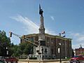
Randolph County Courthouse
See also
 In Spanish: Condado de Randolph (Indiana) para niños
