Tryal Rocks facts for kids
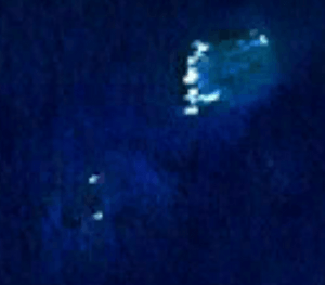
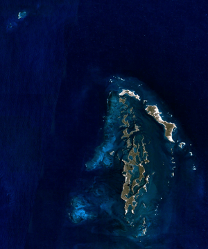
The Tryal Rocks, also known as Trial Rocks or Tryall Rocks, are a group of rocks hidden under the water. They are located in the Indian Ocean off the northwest coast of Australia. These rocks are about 14 kilometers (9 miles) northwest of the Montebello Islands.
The Tryal Rocks are famous because of a very old shipwreck. In 1622, a ship called the Tryall hit these rocks and sank. This was the first known shipwreck in Australian waters. For over 300 years, sailors searched for these dangerous rocks. They were finally found and mapped in 1969.
Contents
Where are the Tryal Rocks?
The Tryal Rocks are located at 20°16′S 115°23′E / 20.267°S 115.383°E. They are part of Western Australia. The rocks are about 14 kilometers (9 miles) northwest of the Montebello Islands. They are also about 105 kilometers (65 miles) away from the main coast of Australia.
The area around the rocks has two coral reefs close together. Sometimes, the sea breaks over these shallower areas, especially in bad weather.
History of the Tryal Rocks
The story of the Tryal Rocks is mostly about the ship that gave them their name.
The Shipwreck of the Tryall
The Tryall was an English ship. It was trying to sail from the Cape of Good Hope (in Africa) to Batavia (now Jakarta, Indonesia). The ship was using a new, faster route called the Brouwer Route. This route helped ships travel quicker by staying in strong winds called the Roaring Forties.
However, the captain of the Tryall, John Brookes, made a big mistake. He thought the ship was much further west than it actually was. He ended up about 1,000 kilometers (600 miles) too far east. When the ship turned north, it was sailing along the west coast of Australia.
Late at night on May 25, 1622, the Tryall hit the hidden rocks and sank. There were 139 people on board, but only 46 were saved, including Captain Brookes.
Captain Brookes' report about the shipwreck was very unclear. He did not even give the exact location of where the ship sank. Some people believe he did this on purpose to avoid being blamed for his mistake. Because of this, the Tryal Rocks were thought to be much further west than they really are. The Dutch, who also used these sea routes, put the reef on their maps. But they placed it incorrectly, about ten degrees of longitude too far west.
Searching for the Lost Rocks
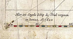
The Tryal Rocks first appeared on a map in 1627. This map was made by Hessel Gerritsz and was called Caert van't Landt van d'Eendracht. In the bottom corner, it showed where the English ship Tryall was wrecked.
For hundreds of years, many Dutch and English sailors looked for these rocks. In 1636, two Dutch ships were sent to search for them. Later, in 1700, William Dampier wanted to find the rocks, but he was too sick to continue his search.
Even though the rocks were on maps, some sailors started to doubt if they really existed. In 1705, a captain wrote in his journal that he had never heard of anyone actually seeing these rocks. He correctly guessed that if they did exist, they must be much further east.
In 1803, Matthew Flinders searched for the Tryal Rocks. He found nothing and thought they did not exist in the area he searched. Because of his findings, the British Admiralty (the British navy's command) even declared that the rocks did not exist at all.
However, in 1818, a British ship called the Greyhound found the true Tryal Rocks. The captain, Lieutenant Ritchie, did not know they were the famous Tryal Rocks. This new discovery was later called "Ritchie's Reef" or "the Greyhound's Shoal."
In 1820, Phillip Parker King thought the Tryal Rocks might be the Montebello Islands. He believed that strong ocean currents could have made old ship records wrong. This idea was repeated for many years.
Finally, in 1928, Commander Rupert Gould surveyed the area. He stated that Ritchie Reef was indeed the Tryal Rocks. The final proof came in 1969, when an exploration team found the actual wreck of the Tryall ship there. This discovery confirmed the location of the long-lost Tryal Rocks.
 | Shirley Ann Jackson |
 | Garett Morgan |
 | J. Ernest Wilkins Jr. |
 | Elijah McCoy |


