Tule Springs Hills facts for kids
Quick facts for kids Tule Springs Hills |
|
|---|---|
| Dimensions | |
| Length | 16 mi (26 km) NNW |
| Geography | |
| Country | United States |
| State | Nevada |
| District | Lincoln County |
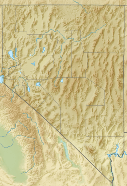
| Range coordinates | 37°4′50″N 114°10′44″W / 37.08056°N 114.17889°W |
| Topo map | USGS Tule Spring |
The Tule Springs Hills are a mountain range found in eastern Lincoln County, Nevada. These hills are an important part of the landscape in this area.
Contents
Exploring the Tule Springs Hills
The Tule Springs Hills are a range of mountains that stretch across the desert. They are known for their unique location among other natural features.
Where Are the Tule Springs Hills Located?
The Tule Springs Hills are in the eastern part of Lincoln County, Nevada. To their west, you'll find the Tule Desert.
Other mountain ranges surround these hills. The Mormon Mountains and East Mormon Mountains are to the southwest. The Clover Mountains are to the north. To the east, you can see the Beaver Dam Mountains which are in Utah.
How Big Are the Tule Springs Hills?
These hills are about 16 miles long. They stretch from Lime Mountain in the north to a peak above Toquop Gap in the south.
Lime Mountain is quite tall, reaching about 5,482 feet high. The peak above Toquop Gap is lower, at about 3,145 feet.
What is Toquop Gap?
Toquop Gap is a narrow pass that separates the Tule Springs Hills from the East Mormon Mountains. Through this gap, a stream called Toquop Wash flows. This wash helps drain water from the southern part of the Tule Desert.
 | John T. Biggers |
 | Thomas Blackshear |
 | Mark Bradford |
 | Beverly Buchanan |


