Turkville, Kansas facts for kids
Turkville is what people call a ghost town in Ellis County, Kansas, in the United States. A ghost town is a place where most or all people have left. It's located in a part of Kansas called Buckeye Township.
Quick facts for kids
Turkville, Kansas
|
|
|---|---|

|
|
| Country | United States |
| State | Kansas |
| County | Ellis |
| Township | Buckeye |
| Founded | 1876 |
| Elevation | 1,837 ft (560 m) |
| Population | |
| • Total | 0 |
| Time zone | UTC-6 (CST) |
| • Summer (DST) | UTC-5 (CDT) |
| ZIP code |
67663
|
| Area code | 785 |
| FIPS code | 20-71750 |
| GNIS ID | 484604 |
Contents
Turkville's Early Days
Settlers from Tennessee first came to Turkville in 1876. These early residents were Baptists. They built the very first Baptist church in all of Ellis County. Many of these settlers were part of the same big family. Their pastor, Reverend Allen King, led this group.
Turkville had its own post office starting in 1875. This post office helped people send and receive mail. It stayed open for many years but closed down in 1918. In 1910, about 40 people lived in Turkville.
Where is Turkville Located?
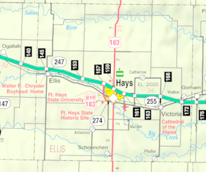
Turkville is located at 39°06′12″N 99°14′44″W / 39.10333°N 99.24556°W. It sits at an elevation of 1,837 feet (561 meters) above sea level. This means it's quite high up! The town is on the north side of the Saline River. This area is part of the Smoky Hills region, which is within the larger Great Plains.
Turkville is about 3 miles (4.8 km) east of U.S. Route 183. It is also roughly 16 miles (26 km) north-northeast of Hays. Hays is the main town and county seat of Ellis County.
Schools in Turkville
Turkville had its own elementary school for younger students. However, this school closed its doors in 1967.
Getting Around Turkville
The main road that runs through Turkville is called Saline River Road. This road goes from east to west. It is an unpaved county road.
 | Dorothy Vaughan |
 | Charles Henry Turner |
 | Hildrus Poindexter |
 | Henry Cecil McBay |


