Twin Peaks (Santa Clara County, California) facts for kids
Quick facts for kids Twin Peaks |
|
|---|---|

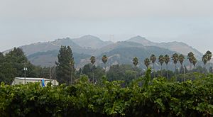
View of Twin Peaks along Watsonville Road.
|
|
| Highest point | |
| Elevation | 1,486 ft (453 m) NAVD 88 |
| Geography | |
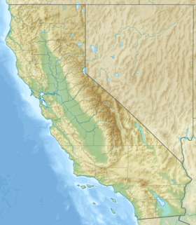
| Location | Santa Clara County, California, U.S. |
| Parent range | Santa Cruz Mountains |
| Topo map | USGS Mount Madonna |
Twin Peaks are two tall hills, or 'peaks,' located in Santa Clara County, California. They are found at the eastern edge of the Santa Cruz Mountains. These peaks are a noticeable part of the landscape in the area.
The Twin Peaks sit between two important places. To their west is the Uvas Reservoir, a large lake that holds water. To their east is Paradise Valley in the city of Morgan Hill.
A small stream called Sycamore Creek starts its journey near these peaks. Its "headwaters" or beginning flows from the eastern hillsides of Twin Peaks.
Exploring Twin Peaks
The Twin Peaks are part of the Uvas Reservoir County Park. This park is a great place for outdoor activities. However, there are no official trails that go directly to the top of the Twin Peaks from the park side. This means you cannot easily hike to the very top of these specific hills.
Location and Geography
Twin Peaks are considered "prominent" because they stand out from the land around them. They are part of the "foothills," which are smaller hills found at the base of larger mountains. In this case, they are at the foot of the Santa Cruz Mountains.
The Santa Cruz Mountains are a mountain range in California. They stretch along the coast and are known for their beautiful scenery. Twin Peaks are a small but important part of this larger mountain system.
Facts About Twin Peaks
- Location: Twin Peaks are located in Santa Clara County, California, USA.
- Elevation: The peaks reach an elevation of 1,486 feet (about 453 meters) above sea level.
- Nearby Features: They are close to Uvas Reservoir and the city of Morgan Hill.
- Water Source: Sycamore Creek begins its flow from the hills near Twin Peaks.
 | Lonnie Johnson |
 | Granville Woods |
 | Lewis Howard Latimer |
 | James West |


