
Unstrut-Hainich-Kreis facts for kids
Quick facts for kids
Unstrut-Hainich-Kreis
|
|||
|---|---|---|---|
|
|||
| Country | |||
| State | Thuringia | ||
| Capital | Mühlhausen | ||
| Area | |||
| • Total | 931.70 km2 (359.73 sq mi) | ||
| Time zone | UTC+1 (CET) | ||
| • Summer (DST) | UTC+2 (CEST) | ||
| Vehicle registration | UH, LSZ, MHL | ||
| Website | www.landkreis-unstrut-hainich.de | ||


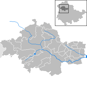
The Unstrut-Hainich-Kreis is a special area in Thuringia, Germany. It's like a county or a region. This area is in the northern part of Thuringia.
It has several neighbors around it. Clockwise from the north, these are the districts of Eichsfeld, Kyffhäuserkreis, Sömmerda, Gotha, Wartburgkreis, and the Werra-Meißner district in Hesse.
Contents
History of Unstrut-Hainich-Kreis
The Unstrut-Hainich-Kreis was formed not too long ago. It was officially created on July 1, 1994.
This new district came about by joining two older districts together. These were the districts of Mühlhausen and Bad Langensalza.
Partnerships with Other Regions
The Unstrut-Hainich-Kreis has special friendships with other areas. These are called partnerships.
One partnership is with the Wetteraukreis in Hesse. This friendship started in 1990, around the time Germany became one country again.
The district also has partnerships with two areas in Lithuania. These are the Lithuanian districts of Ukmerge and Raseiniai.
Geography and Nature of the District
The name of the district, Unstrut-Hainich-Kreis, comes from two important natural features. It is named after a river and a chain of hills.
The first part of the name, "Unstrut," comes from the Unstrut river. This river flows through the area.
The second part, "Hainich," refers to a group of hills. These hills are known as the Hainich.
Hainich National Park
The Hainich hills are very special. In 1997, the Hainich became the 13th national park in Germany.
National parks are protected areas. They help to keep nature safe and healthy for everyone.
Symbols: The Coat of Arms
The coat of arms for Unstrut-Hainich-Kreis tells a story. It shows symbols from different historical areas. These areas now make up the district.
- In the top left, you can see an eagle. This eagle is a symbol of the city of Mühlhausen.
- In the top right, there is a lion. This lion represents the dukes of Thuringia, who were important rulers in the past.
- The bottom left shows the Wheel of Mainz. This symbol comes from the historical territory of Mainz.
- Finally, in the bottom right, there is a deer antler. This antler is the symbol of the Principality of Schwarzburg-Sondershausen.
Towns and Communities
The Unstrut-Hainich-Kreis is made up of many towns and smaller communities. Some of these places manage themselves. Others work together in groups.
Main Towns and Independent Communities
These towns and communities manage their own affairs. They are not part of a larger administrative group.
- Bad Langensalza
- Mühlhausen
- Nottertal-Heilinger Höhen
- Großvargula
- Herbsleben
- Kammerforst
- Körner
- Marolterode
- Oppershausen
- Rodeberg
- Schönstedt
- Südeichsfeld
- Unstrut-Hainich
- Unstruttal
- Vogtei
Communities Working Together
Some communities in the district form groups called Verwaltungsgemeinschaften. This means they share some administrative tasks.
- 1. Bad Tennstedt
- Bad Tennstedt (This is the main town for this group and also a town itself)
- Ballhausen
- Blankenburg
- Bruchstedt
- Haussömmern
- Hornsömmern
- Kirchheilingen
- Kutzleben
- Mittelsömmern
- Sundhausen
- Tottleben
- Urleben
See also
 In Spanish: Unstrut-Hainich-Kreis para niños
