Upham, Hampshire facts for kids
Quick facts for kids Upham |
|
|---|---|
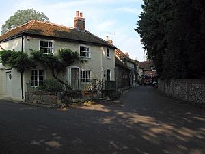
 Southeastern corner of Upham triangle |
|
| Population | 616 663 (2011 Census) |
| OS grid reference | SU531202 |
| Civil parish |
|
| District | |
| Shire county | |
| Region | |
| Country | England |
| Sovereign state | United Kingdom |
| Post town | Southampton |
| Postcode district | SO32 |
| Dialling code | 01489 |
| Police | Hampshire |
| Fire | Hampshire |
| Ambulance | South Central |
| EU Parliament | South East England |
| UK Parliament |
|
| Website | Upham Parish Council |
Upham is a charming small village in the south of England. It's part of Hampshire county. You can find it about 7 miles (11 km) south-east of the city of Winchester. Upham is also a "civil parish," which is a local area with its own council.
Contents
Exploring Upham Village
Upham is a friendly place with some key spots. It has a small post office where you can send letters. There's also a local primary school for younger kids.
The village is actually split into two main parts. One part is called Upham, and it's mostly around the church. The other part is called Lower Upham. This area is where you'll find the post office and the main road.
Upham has two traditional English pubs. These are places where people gather to eat and drink. They are called the Brushmakers Arms and the Alma Inn. You can also see a peaceful village pond.
Historic Buildings in Upham
One important building in Upham is a large country house called The Holt. It's a very old building, officially listed as a Grade II building. This means it's historically important. For a long time, it was the home of the Shendley-Leavett family.
A famous naval officer named Sir Robert Calder also lived at The Holt. He was a commander during the Napoleonic Wars. Sir Robert Calder passed away in 1815 and is buried in the local churchyard.
Not far from Upham, in a place called Little Woodcotte, people found some old remains in 1849. These were from a Late Roman period Villa. A villa was a large country house in ancient Roman times.
Getting Around Upham
Upham is connected by roads and paths. The B2177 road goes through Lower Upham. This road used to be a main route between Winchester and Portsmouth. There aren't many other big roads in the area.
Public Transport in Upham
If you need to travel, Upham has a regular bus service. You can catch a bus to nearby towns like Winchester, Twyford, Colden Common, Bishop's Waltham, and Fareham.
Walking and Ancient Paths
The area around Upham is great for walking. There are many old paths and trackways. Some of these include the Monarch's Way, the Pilgrims' Trail, and the King's Way. These paths have been used for a very long time.
In the southern part of Upham, the King's Way and the Pilgrims' Trail follow an ancient Roman road. This old road once connected Winchester to Portchester. It runs right between Upham and Lower Upham.
Upham's Natural Landscape
Upham sits on the edge of a special geological area. This area is called the Hampshire Basin. The northern part of Upham is on chalk rock. To the south, you'll find different types of clay and sand. These layers of rock and soil were formed millions of years ago.
 | Precious Adams |
 | Lauren Anderson |
 | Janet Collins |


