Upper Catesby facts for kids
Quick facts for kids Upper Catesby |
|
|---|---|
 Catesby House |
|
| OS grid reference | SP526593 |
| Civil parish |
|
| Unitary authority |
|
| Ceremonial county | |
| Region | |
| Country | England |
| Sovereign state | United Kingdom |
| Post town | Daventry |
| Postcode district | NN11 |
| Dialling code | 01327 |
| Police | Northamptonshire |
| Fire | Northamptonshire |
| Ambulance | East Midlands |
| EU Parliament | East Midlands |
| UK Parliament |
|
| Website | Catesby (Parish Meeting) |
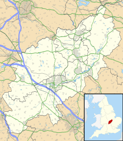
Upper Catesby is a small village, also known as a hamlet, located in the area called civil parish of Catesby, Northamptonshire. It is about 3.5 miles (5.6 km) southwest of the town of Daventry. This hamlet sits high up, about 550 feet (168 meters) above sea level, on top of a slope that faces northwest. The number of people living in Upper Catesby is counted as part of the nearby civil parish of Hellidon.
Contents
Discovering Ancient History
Roman Finds Near Upper Catesby
In 1895, something exciting was found near Upper Catesby! Workers were digging a deep hole for the Catesby Tunnel when they discovered a Roman cinerary urn. This is a special pot used to hold the ashes of someone who had died. The urn was found about 575 yards (526 meters) south of Upper Catesby, giving us a peek into the area's ancient past.
The Story of Upper Catesby Village
What's in a Name?
The name 'Catesby' has an interesting meaning. It comes from old words that mean "farm" or "settlement of Katr/Kati." This tells us that the area was likely a farming community long ago.
A Village That Shrank
In 1389, Upper Catesby was known as Overcatsby. It is what we call a "shrunken village." This means it used to be much bigger than it is today. While the modern hamlet only has a few houses built in the 1800s and 1900s, you can still see signs of the old village. All around, there are bumps and dips in the ground. These "earthen features" show where old cottages and the main village street used to be.
Many of the fields around the former village still have clear marks called "ridge and furrow." These are long, wavy lines in the ground. They were made by medieval farmers who used an "open field system" to grow crops. In this system, large fields were divided into narrow strips, and everyone in the village worked together to farm them.
Exploring Catesby House
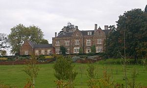
Catesby House is a large country house located about 400 yards (366 meters) west of Upper Catesby. It was built in 1863 and made even bigger in 1894. The house has some very old and special features inside. For example, it has "linenfold panelling" from the 1500s, which is wood carved to look like folded linen cloth. This panelling is believed to have come from Catesby Priory, an old religious building. The house also has panelling, door frames, and a staircase from the 1600s, which came from an even older Catesby House that was located in Lower Catesby.
The Catesby Tunnel
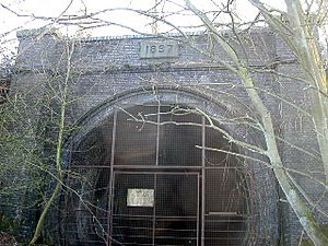
The Catesby Tunnel is a railway tunnel that is no longer used. It was once part of the Great Central Main Line, a major railway route. The tunnel passes about 250 yards (229 meters) west of Upper Catesby and about 100 yards (91 meters) east of Catesby House.
The northern entrance of the tunnel, called the "north portal," is about 400 yards (366 meters) northwest of the hamlet. The southern entrance, or "south portal," is about 0.6 miles (1 km) north of Charwelton. It sits just inside the southern edge of the Catesby parish area.


