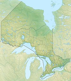
Upper Partridge Lake (Ontario) facts for kids
Quick facts for kids Upper Partridge Lake |
|
|---|---|
| Location | Tudor and Cashel, Hastings County |
| Coordinates | 44°56′47″N 77°29′11″W / 44.94639°N 77.48639°W |
| Primary inflows | Partridge Creek from unnamed lake |
| Primary outflows | Partridge Creek towards Grimsthorpe Lake |
| Basin countries | Canada |
| Max. length | 1.4 km (0.87 mi) |
| Max. width | 0.9 km (0.56 mi) |
| Surface elevation | 364 m (1,194 ft) |
Upper Partridge Lake is a freshwater lake located in Ontario, Canada. It is found in the Cashel part of the Tudor and Cashel township. This area is within Hastings County. The lake is part of the larger Lake Ontario drainage basin. This means all the water from Upper Partridge Lake eventually flows into Lake Ontario.
The lake is about 3.7 kilometres (2.3 mi) southwest of a small community called McCrae. You can find it just south of Weslemkoon Lake Road. This road leads directly to McCrae.
About Upper Partridge Lake
Upper Partridge Lake is a medium-sized body of water. It is known for its clear, fresh water. The lake is a natural part of the local environment. It plays a role in the water cycle of the region.
Lake Size and Location
The lake is approximately 1.4 kilometres (0.9 mi) long. It is also about 0.9 kilometres (0.6 mi) wide. The lake sits at an elevation of 364 metres (1,194 ft) above sea level. This elevation helps determine how water flows in and out of the lake.
Water Flow and Connections
The main stream that flows into Upper Partridge Lake is Partridge Creek. This creek brings water from an unnamed lake located to the north. Partridge Creek also flows out of Upper Partridge Lake. It carries water south towards another lake called Grimsthorpe Lake.
From Grimsthorpe Lake, the water continues its journey. It flows through the Skootamatta River and then the Moira River. Finally, all this water reaches the Bay of Quinte. The Bay of Quinte is a large bay on Lake Ontario. This shows how Upper Partridge Lake is connected to a much larger water system.
 | Charles R. Drew |
 | Benjamin Banneker |
 | Jane C. Wright |
 | Roger Arliner Young |


