Vale of Wardour facts for kids
Quick facts for kids Vale of Wardour |
|
|---|---|

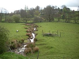
Stream flowing into the River Nadder near Wardour
|
|
| Floor elevation | 121.4 m (398 ft) |
| Geography | |
The Vale of Wardour is a beautiful valley in Wiltshire, England. It's mostly known for the River Nadder that flows through it. This area is full of interesting history and natural beauty.
Contents
Exploring the Vale of Wardour
What the Vale Looks Like
The Vale of Wardour is located east of Shaftesbury. It's not a huge area, but it has many different types of landscapes. The valley gets its name from the village of Wardour.
The main river here is the Nadder. It flows from the west side of the valley to the east. In the west, another river called the Sem joins the Nadder. The valley ends near Wilton, where the Nadder meets the Wylye. The biggest village you'll find in the Vale of Wardour is Tisbury.
Natural Areas Around the Vale
The Vale of Wardour is part of a larger natural area. This area is called the Blackmore Vale and Vale of Wardour. It's recognized by an organization called Natural England.
To the north of the vale, you'll find the Salisbury Plain and West Wiltshire Downs. To the south, there are the Dorset Downs and Cranborne Chase. The Vale of Wardour stretches west almost to a place called Barford St Martin. That's where the Nadder valley starts to get narrower.
Rocks and Land in the Vale
The ground and rocks in the Vale of Wardour are quite interesting. The River Nadder flows through a valley made of clay. This clay valley is surrounded by hills. These hills are made of different types of rock, including Purbeck, Portland, and Lower and Upper Greensand.
You can also find a type of clay called Gault here. It can be up to 27.5 meters (90 feet) thick! This Gault clay often contains small, round, rocky bits called phosphatic nodules.
Cool Places to See
The Vale of Wardour has some amazing historical and natural sights:
- Ancient Hillforts: You can visit old forts built on hills, like Castle Rings and Castle Ditches. These were used long ago for protection.
- Fovant Badges: These are giant pictures carved into the chalk hills by soldiers. They are memorials to military units.
- Old Wardour Castle: This is a fascinating old castle with a lot of history. It's a great place to explore and imagine life in the past.
- Philipps House: A grand country house with beautiful grounds.
 | Selma Burke |
 | Pauline Powell Burns |
 | Frederick J. Brown |
 | Robert Blackburn |

