
Van Buren, Missouri facts for kids
Quick facts for kids
Van Buren, Missouri
|
|
|---|---|

View across campground from US 60; courthouse square in the distance
|
|

Location of Van Buren, Missouri
|
|
| Country | United States |
| State | Missouri |
| County | Carter |
| Township | Carter |
| Area | |
| • Total | 2.00 sq mi (5.18 km2) |
| • Land | 2.00 sq mi (5.18 km2) |
| • Water | 0.00 sq mi (0.01 km2) |
| Elevation | 472 ft (144 m) |
| Population
(2020)
|
|
| • Total | 747 |
| • Density | 373.69/sq mi (144.28/km2) |
| Time zone | UTC-6 (Central (CST)) |
| • Summer (DST) | UTC-5 (CDT) |
| ZIP code |
63965
|
| Area code(s) | 573 |
| FIPS code | 29-75580 |
| GNIS feature ID | 0752687 |
Van Buren is a city in Carter County, Missouri, in the United States. It is the main city and the county seat of Carter County. A county seat is the city where the local government offices are located. Van Buren was founded in 1833. It was named after Martin Van Buren, who was the Vice President of the United States at that time. In 1859, Van Buren became part of the newly formed Carter County. It was then chosen to be the county seat for this new county. In 2020, about 747 people lived in Van Buren.
Contents
History of Van Buren
Early Beginnings (1833-1859)
In 1833, a group of people chose a spot for the main city of Ripley County. This spot was about half a mile west of where Van Buren is today. It was across the Current River. They named the new city Van Buren after the Vice President, Martin Van Buren. A courthouse was built there, and a small town grew around it. The town had a small store and a mill that used water power.
Van Buren was the county seat of Ripley County until 1847. Then, the county seat moved to a town called Doniphan. After this, Van Buren became much smaller. Only a few families stayed there.
On March 10, 1859, Van Buren became part of a new county called Carter County. On April 4 of that year, Van Buren was chosen to be the county seat for Carter County.
Moving and Growing (1867-1900s)
In 1867, the land for the current Van Buren was bought. This new spot was about half a mile east of the old one, across the river. Fifty acres of land were bought for $475. The first building on this new site was a log courthouse.
Newspapers started in Van Buren to share local news. The Vidette began in 1874 but only lasted a few months. In 1876, the Times started. It later joined with the Current Local in 1884. The Current Local is still the only local newspaper in Carter County today.
In 1893–1894, the first bridge was built over the Current River in Van Buren. It was a suspension bridge and cost $4,500. People had to pay a small fee to cross it. This made it easier for people and wagons to get across the river.
In 1901, the Carter County Bank opened in Van Buren. It was later known as the Carter County State Bank.
Modern Services Arrive (1907-1934)
In 1907, a company started a motorboat service. These boats carried passengers up and down the Current River. They traveled between Van Buren and Doniphan.
After 1907, phone service came to Van Buren. This connected the city to other places.
In 1909, a new steel bridge was built over the Current River. It cost about $9,000. A flood destroyed this bridge in 1915. It was rebuilt for $15,000. This bridge was used until 1926, when a new, larger bridge was finished. This new bridge cost $200,000. U.S. Highway 60 crossed this bridge.
In 1927, Van Buren got electricity for the first time. At first, a local plant made the electricity. By 1934, electricity came from larger power plants outside the city.
Geography of Van Buren
Van Buren is located in the northern part of Carter County. It sits where US Route 60 and Missouri Route 103 meet. The city is right next to the Current River. It is also very close to the Mark Twain National Forest.
The city covers an area of about 2 square miles (5.18 square kilometers). All of this area is land.
Population and People
The population of Van Buren has changed over the years. Here is how many people lived there during different census years:
| Historical population | |||
|---|---|---|---|
| Census | Pop. | %± | |
| 1930 | 345 | — | |
| 1940 | 458 | 32.8% | |
| 1950 | 708 | 54.6% | |
| 1960 | 575 | −18.8% | |
| 1970 | 714 | 24.2% | |
| 1980 | 850 | 19.0% | |
| 1990 | 893 | 5.1% | |
| 2000 | 845 | −5.4% | |
| 2010 | 819 | −3.1% | |
| 2020 | 747 | −8.8% | |
| U.S. Decennial Census | |||
2010 Census Information
In 2010, there were 819 people living in Van Buren. These people lived in 362 households. About 29% of households had children under 18 living with them. Many households (41.7%) were made up of single people. About 25% of households had someone living alone who was 65 years old or older.
The average age of people in the city was about 43 years old. About 24% of residents were under 18. Another 25% were 65 years or older. There were more females (55.7%) than males (44.3%) in the city.
Education in Van Buren
The Van Buren R-I School District runs the schools in the city. There is one elementary school, one middle school, and Van Buren High School.
Van Buren also has a public library. It is a branch of the Carter County Library.
Images for kids
-
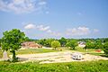
View across campground from US 60; courthouse square in the distance
-
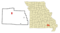
Location of Van Buren, Missouri
See also
In Spanish: Van Buren (Misuri) para niños
