
Van Duzen River facts for kids
Quick facts for kids Van Duzen River |
|
|---|---|
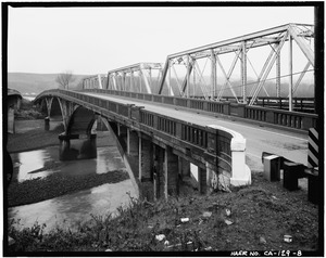
Van Duzen River Bridge at Highway 101
|
|

Map of the Eel River basin including the Van Duzen River
|
|
| Other name(s) | Van Duzen's Fork |
| Country | United States |
| State | California |
| Region | Trinity County, Humboldt County |
| Cities | Dinsmore, Bridgeville, Carlotta, Hydesville, Rohnerville |
| Physical characteristics | |
| Main source | Hettenshaw Valley About 1.5 miles (2.4 km) south of Ruth Reservoir, Trinity County 3,560 ft (1,090 m) 40°15′16″N 123°23′56″W / 40.25444°N 123.39889°W |
| River mouth | Eel River Humboldt County 33 ft (10 m) 40°32′54″N 124°09′40″W / 40.54833°N 124.16111°W |
| Length | 63 mi (101 km) |
| Basin features | |
| River system | Eel River |
| Basin size | 429 sq mi (1,110 km2) |
| Tributaries |
|
The Van Duzen River is a cool river located on the northern coast of California. It's a big branch of the Eel River. The Van Duzen River helps drain an area of about 429 square miles (1,110 km2), mostly in Humboldt County. A smaller part of the area it drains is in Trinity County.
This river flows for about 63 miles (101 km). It starts high up in the North Coast Range. Then it joins the Eel River, which is about 14 miles (23 km) away from the Pacific Ocean. When it starts, the river is over 5,000 feet (1,500 m) high. But by the time it meets the Eel River, it's only about 60 feet (18 m) above sea level.
Contents
Where Does the River Flow?
The Van Duzen River has two main branches near its beginning.
- The North Fork flows northwest. It passes by a small town called Dinsmore. After Dinsmore, it starts flowing west.
- The Little Van Duzen River also flows northwest. It joins the North Fork a few miles later.
After these two branches meet, the river generally flows west. It meets its biggest branch, Yager Creek, about 5 miles (8.0 km) before it reaches the Eel River.
Fun Things to Do and See
The Van Duzen River is a great place for outdoor activities.
- You can visit places like Grizzly Creek Redwoods State Park.
- People living along California State Route 36 use the river for water. This water is used for homes, farms, and businesses.
Home for Wildlife
The river is also a very important home for many animals. It provides a cool, fresh water home for fish. This is especially important for fish that need to travel upstream to lay their eggs. Some of these fish are rare or endangered species, which means they are very special and need protection.
Land Around the River
Most of the land around the Van Duzen River is covered in trees. This area is used for timber, which is wood for building.
- About 26% of the land is owned by large timber companies.
- Another 31% is privately owned. This land is used for growing timber or for ranches.
- Homes and other buildings make up about 26% of the land.
- Public land, which is open for everyone, makes up 17%. Most of this public land is near where the river starts, in the Six Rivers National Forest.
Protecting the River
The Van Duzen River is so special that it has been named a "National Wild and Scenic River" by the government. This means it is protected to keep its natural beauty and importance for wildlife.
Sometimes, things like building roads or certain ways of cutting down trees can cause problems. They can lead to more dirt and sand getting into the river. This extra dirt can fill up the river and its smaller streams. Also, digging for gravel, especially where the Van Duzen River meets the Eel River, can change how the river flows. It can also make it harder for fish to travel. People are working to make sure these activities don't harm the river.
Who is Van Duzen?
The river is named after a person named James Van Duzen. He was part of an exploring group led by Josiah Gregg. This group was the first to travel by land to Humboldt Bay way back in 1849.
