Vidal, California facts for kids
Quick facts for kids
Vidal, California
|
|
|---|---|
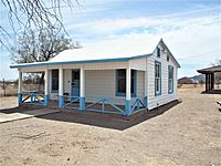
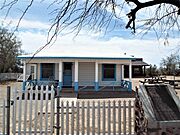
The Wyatt Earp and Josephine Sarah Marcus Cottage
|
|
| Country | United States |
| State | California |
| County | San Bernardino |
| Elevation | 627 ft (191 m) |
| Time zone | UTC-8 (Pacific (PST)) |
| • Summer (DST) | UTC-7 (PDT) |
| ZIP codes |
92280
|
| Area codes | 442/760 |
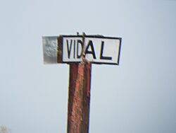
Vidal, California is a small, quiet community. It's not officially a city, but an unincorporated community. You can find it in the southeastern part of California. It's located in San Bernardino County right on U.S. Route 95.
Vidal is about 38 miles (61 km) north of Blythe, California. It's also about 55 miles (89 km) south of Needles, California. The community sits about 812 feet (247 meters) above sea level. Vidal is quite far from the county seat of San Bernardino, California.
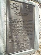
Did you know that the famous Old West lawman, Wyatt Earp, spent his last winters near Vidal? He was looking for gold and copper in the area. The nearby townsite of Earp is named after him.
The ZIP code for Vidal and nearby Vidal Junction is 92280. The local area codes 442 and 760 are used for phone numbers.
What's the Weather Like in Vidal?
Vidal has a desert climate. This means it can get very hot! In January, average temperatures are usually between 41°F (5°C) and 67°F (19°C). But in July, it gets much hotter. Temperatures often range from 78°F (26°C) to a high of 108°F (42°C).
The hottest temperature ever recorded in Vidal was in 1905. It reached an amazing 127°F (53°C)! The coldest temperature recorded was 9°F (-13°C) in 1911.
Vidal is located in the Sonoran Desert. This area doesn't get much rain. On average, Vidal Junction receives only about 5.17 inches (131 mm) of rain each year. July and January are usually the wettest months, but even then, they get less than an inch of rain.
Exploring Vidal's Old Buildings
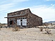
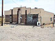
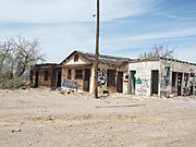
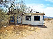
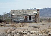
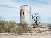
Vidal is sometimes called a "ghost town" because many of its buildings are now abandoned. Here are some pictures of the structures you can find there.
 | Lonnie Johnson |
 | Granville Woods |
 | Lewis Howard Latimer |
 | James West |


