Vining, Kansas facts for kids
Quick facts for kids
Vining, Kansas
|
|
|---|---|

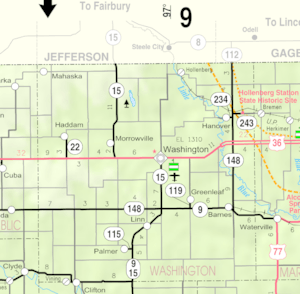
Location within Washington County and Kansas
|
|

|
|
| Country | United States |
| State | Kansas |
| Counties | Clay, Washington |
| Platted | 1877 (West Clifton) |
| Incorporated | 1885 |
| Area | |
| • Total | 0.21 sq mi (0.55 km2) |
| • Land | 0.21 sq mi (0.55 km2) |
| • Water | 0.00 sq mi (0.00 km2) |
| Elevation | 1,273 ft (388 m) |
| Population
(2020)
|
|
| • Total | 43 |
| • Density | 205/sq mi (78.2/km2) |
| Time zone | UTC-6 (CST) |
| • Summer (DST) | UTC-5 (CDT) |
| Area code | 785 |
| FIPS code | 20-73950 |
| GNIS ID | 2397147 |
Vining is a small city located in the state of Kansas, United States. It is unique because it sits across two counties: Clay County and Washington County. In 2020, a count showed that 43 people lived in Vining.
Contents
History of Vining
Vining was first planned out in 1877. At that time, it had a different name: West Clifton. In 1881, the city was renamed Vining. This new name honored E. P. Vining, who was an agent for the railroad.
Long ago, Vining was a very important place for shipping goods. This was because it was located right next to the Republican River. Also, two different railroad lines met there, making it easy to transport things.
The city's post office, where people sent and received mail, closed down in 1955.
Geography of Vining
Vining is a small city in terms of its size. According to the United States Census Bureau, which collects information about places in the U.S., the city covers about 0.22 square miles (0.57 km2) of land. There is no water area within the city limits. Vining is also located right next to another city called Clifton.
People and Population in Vining
| Historical population | |||
|---|---|---|---|
| Census | Pop. | %± | |
| 1890 | 241 | — | |
| 1900 | 245 | 1.7% | |
| 1910 | 191 | −22.0% | |
| 1920 | 183 | −4.2% | |
| 1930 | 198 | 8.2% | |
| 1940 | 188 | −5.1% | |
| 1950 | 168 | −10.6% | |
| 1960 | 128 | −23.8% | |
| 1970 | 84 | −34.4% | |
| 1980 | 85 | 1.2% | |
| 1990 | 55 | −35.3% | |
| 2000 | 58 | 5.5% | |
| 2010 | 45 | −22.4% | |
| 2020 | 43 | −4.4% | |
| U.S. Decennial Census | |||
Vining's Population in 2010
In 2010, a census count showed that 45 people lived in Vining. These people lived in 24 different households, and 13 of these were families.
The population density was about 204.5 inhabitants per square mile (79.0/km2). This means there were about 204 people per square mile. There were 27 housing units in total.
All of the people living in Vining at that time were identified as White.
Households and Families
Out of the 24 households, a quarter of them (25%) had children under 18 years old living there. About a third (33.3%) were married couples living together.
A small number of households (4.2%) had a female head of the house with no husband present. Another 16.7% had a male head of the house with no wife present. Almost half (45.8%) were not families.
Most households (41.7%) had only one person living in them. About 20.8% of households had someone living alone who was 65 years old or older. The average household had about 1.88 people, and the average family had about 2.54 people.
Age and Gender in Vining
The average age of people in Vining was 41.5 years old.
- 20% of the residents were under 18 years old.
- 6.6% were between 18 and 24 years old.
- 31% were between 25 and 44 years old.
- 28.9% were between 45 and 64 years old.
- 13.3% were 65 years old or older.
When looking at gender, 57.8% of the people in Vining were male, and 42.2% were female.
Education in Vining
Students in Vining attend public schools that are part of the Clifton-Clyde USD 224 school district. This district has three schools:
- Clifton-Clyde Senior High School, which is located in Clyde.
- Clifton-Clyde Middle School, which is located in Clifton.
- Clifton-Clyde Grade School, which is also located in Clifton.
See also
 In Spanish: Vining (Kansas) para niños
 | Frances Mary Albrier |
 | Whitney Young |
 | Muhammad Ali |

