Virginia State Route 193 facts for kids
Quick facts for kids
State Route 193 |
||||
|---|---|---|---|---|
| Georgetown Pike | ||||
 |
||||
| Route information | ||||
| Maintained by VDOT | ||||
| Length | 11.79 mi (18.97 km) | |||
| Tourist routes |
||||
| Major junctions | ||||
| West end | ||||
| East end | ||||
| Highway system | ||||
| Virginia Routes Primary • Secondary • History • Turnpikes
|
||||
|
Georgetown Pike
|
||||

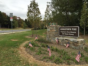
Georgetown Pike sign commemorating its standing as the first historic and scenic byway in Virginia
|
||||
| Location | From DC/VA boundary at Chain Bridge to the junction with Leesburg Pike at Seneca Rd., near McLean, Virginia | |||
| NRHP reference No. | 12000537 | |||
| Significant dates | ||||
| Added to NRHP | August 22, 2012 | |||
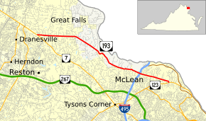
State Route 193 (SR 193) is an important road in the state of Virginia. It is also known as Georgetown Pike. This state highway is about 11.79 miles (18.97 km) long. It stretches from SR 7 in Dranesville to SR 123 in Langley.
SR 193 goes through areas like Great Falls and McLean. It also crosses Interstate 495 (I-495). In 1974, this road was named the first Virginia Byway. This means it is a special road known for its beautiful views.
Driving Along SR 193
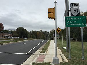
SR 193 starts in Dranesville at a crossing with SR 7, which is called Leesburg Pike. The road heads east and has two lanes. It goes through many nice neighborhoods in Great Falls.
After passing through the center of Great Falls village, the road turns southeast. It then follows the edge of Great Falls Park. The highway has many sharp turns as it goes down into the valley of Difficult Run. SR 193 continues with more curves, passing by homes and the Madeira School. It also crosses Bullneck Run and Scott Run.
Near McLean, the road gets wider to four lanes for a short time. This is around its interchange with I-495, also known as the Capital Beltway. After passing Langley High School, SR 193 ends at SR 123 (Dolley Madison Boulevard) in Langley.
The History of Georgetown Pike
The Georgetown Pike has a long and interesting history. When it was first built, it continued all the way to the Potomac River. It was added to the National Register of Historic Places in 1974. This means it is recognized as an important historical site.
The road was built between 1813 and 1827. It was made to be very strong, using layers of stone. This special way of building helped the road last through floods, wars, and many years of use. Workers used hand tools and horse-drawn equipment to clear the land and build the road. They also built stone walls, tunnels, and bridges where needed.
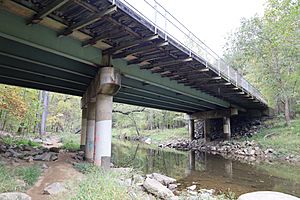
One important bridge was built over Difficult Run. It was a chain bridge, meaning it used strong chains for support. Even though this original bridge is no longer there, it was a big achievement for its time.
From 1940 to 1963, Georgetown Pike ended at Chain Bridge Road. In 1963, a new road called Dolley Madison Boulevard was built. This new road helped reduce traffic on the older roads. After this, Georgetown Pike was extended to meet the new boulevard.
Main Road Crossings
Here are the main intersections along State Route 193: The entire route is in Fairfax County.
| Location | Mile | Roads intersected | Notes | |
|---|---|---|---|---|
| Dranesville | 0.00 | 0.00 | This is where SR 193 begins on the west side. | |
| Fairview | ||||
| River Oaks | 9.28 | 14.93 | This is Exit 44 on I-495. | |
| Langley | 11.79 | 18.97 | This is where SR 193 ends on the east side. | |
| 1.000 mi = 1.609 km; 1.000 km = 0.621 mi | ||||
 | Jessica Watkins |
 | Robert Henry Lawrence Jr. |
 | Mae Jemison |
 | Sian Proctor |
 | Guion Bluford |


