Wakefield Regional Council facts for kids
Quick facts for kids Wakefield Regional CouncilSouth Australia |
|||||||||||||||
|---|---|---|---|---|---|---|---|---|---|---|---|---|---|---|---|

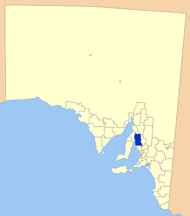
Location of Wakefield Regional Council
|
|||||||||||||||
| • Density | 1,95/km2 (510/sq mi) | ||||||||||||||
| Established | 1 July 1997 | ||||||||||||||
| Area | 3,469.4 km2 (1,339.5 sq mi) | ||||||||||||||
| Mayor | Rodney Reid | ||||||||||||||
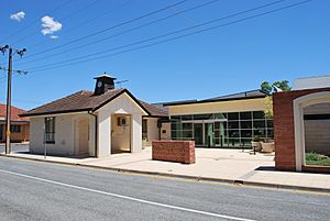
| Council seat | Balaklava | ||||||||||||||
| Region | Yorke and Mid North | ||||||||||||||
| State electorate(s) | Frome, Narungga | ||||||||||||||
| Federal Division(s) | Grey | ||||||||||||||
 |
|||||||||||||||
| Website | Wakefield Regional Council | ||||||||||||||
|
|||||||||||||||
The Wakefield Regional Council is a special area in South Australia that has its own local government. A local government helps manage things like roads, parks, and community services for the people living there. The main office for the council is in the town of Balaklava. This area is part of the larger Yorke and Mid North region.
Contents
Exploring the Wakefield Region
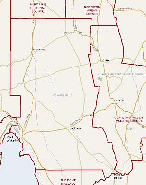
The Wakefield Regional Council area is home to many towns and places. These include Avon, Balaklava, Blyth, Brinkworth, Owen, Port Wakefield, and Snowtown. There are also parts of other towns like Halbury and Hoyleton.
Land and Water Features
On the western side of the council area, you'll find the coast along the north-east of Gulf St Vincent. There are also two mountain ranges, the Hummocks and Barunga ranges. Just east of these ranges, there are several low-lying salt lakes. The biggest of these is Lake Bumbunga, which is quite famous for its pink colour sometimes!
The area also has wide, flat plains that are very good for farming. These plains are located north of the Mount Lofty Ranges on the eastern side. The Wakefield River, which gives the council its name, flows from east to west through the region. A part of the River Light also forms the south-eastern border of the council area.
A Look at History: How the Council Formed
The Wakefield Regional Council was created on 1 July 1997. This happened when two older councils, the District Council of Blyth-Snowtown and the District Council of Wakefield Plains, joined together. This joining of councils is called an "amalgamation."
Why Councils Joined Together
This amalgamation was part of a bigger plan by the South Australian government. They wanted to reduce the number of local councils across the state. By 1999, the number of councils in South Australia went from 118 down to 68. This was done to make local government more efficient.
Before 1983, there were five different councils looking after the area that is now the Wakefield Regional Council. These were the councils of Balaklava, Blyth, Owen, Port Wakefield, and Snowtown. When the new Wakefield Regional Council was formed, it changed how the area was divided up for local government. The old boundaries were replaced with new ones, creating North, Central, and South wards (or sections).
Getting Around: Transport in the Region
The Wakefield Regional Council area has good transport systems. The main roads, like the Princes Highway, are paved and easy to drive on. There are also many well-kept gravel roads for getting around.
While there are no passenger train services in the area, the Adelaide-Port Augusta railway line does pass through the council region. This line is mainly used for freight trains.
Who Lives Here: Population Facts
In 2009, about 6,756 people lived in the Wakefield Regional Council area. Between 1991 and 2001, the population actually went down a little bit, by about 27 people each year.
In 2001, the average age of people living here was 39 years old. This was an increase of 5 years since 1991. This trend shows that the population is getting a bit older over time.
Your Local Leaders: Councillors
The Wakefield Regional Council is led by a group of people called councillors. They are chosen by the people who live in the area to make decisions for the community. The council has a mayor, Rodney Reid, who is directly elected by the voters. There are also other councillors who represent different parts of the region, like the North, South, and Central areas. These councillors work together to manage local services and plan for the future of the Wakefield region.
 | Ernest Everett Just |
 | Mary Jackson |
 | Emmett Chappelle |
 | Marie Maynard Daly |


