Snowtown, South Australia facts for kids
Quick facts for kids SnowtownSouth Australia |
|||||||||||||||
|---|---|---|---|---|---|---|---|---|---|---|---|---|---|---|---|
South-western entrance to Snowtown
|
|||||||||||||||
| Established | 1878 | ||||||||||||||
| Postcode(s) | 5520 | ||||||||||||||
| Elevation | 103 m (338 ft) | ||||||||||||||
| Location | 145 km (90 mi) north of Adelaide | ||||||||||||||
| LGA(s) | Wakefield Regional Council | ||||||||||||||
| County | Daly | ||||||||||||||
| State electorate(s) | Narungga | ||||||||||||||
| Federal Division(s) | Grey | ||||||||||||||
|
|||||||||||||||
|
|||||||||||||||
Snowtown is a town in the Mid North region of South Australia. It is about 145 kilometers (90 miles) north of Adelaide. The town is on the main road and railway lines that connect Adelaide to Perth. These are the Augusta Highway and the Adelaide-Port Augusta railway line. Snowtown is 103 meters (338 feet) above sea level. On average, it gets about 389 millimeters of rain each year.
Contents
History of Snowtown
The area where Snowtown now stands was traditionally the land of the Kaurna people, an Aboriginal group. Non-Indigenous Australians began settling here between 1845 and 1869. They came because grazing (raising animals like sheep) and then farming were growing fast in the north.
In 1866, a guide called Baillière's South Australian gazetteer and road guide described "Hummock's Run." This was a large farm area north of Port Wakefield. It included farms like Barunga, Bumbunga, and Wokurna. The area had salt lakes, thick bushes, grassy plains, and hills.
Before Snowtown was officially started, the area was known as "Black Point" by 1856. This name came from Black Point Hill and Black Point Lagoon, which were important water sources. From 1862, settlers wanted better ways to move their wheat and wool to Kadina. A railway line was planned. In 1870, a paved road was built, and then a railway line in 1878.
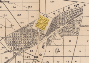
On September 25, 1877, the government decided to create a town at Black Point. The railway line was then extended to this spot.
How Snowtown Got Its Name
The government became interested in the area around 1869. They planned to create new towns and divide the land into smaller farms. Snowtown officially became a government town on December 19, 1878. Governor William Jervois named the town after Thomas Snow. Thomas Snow was a cousin of the Governor and worked as his assistant in South Australia.
The town's first big building, the old Snowtown Pub, was built in 1879. The Snowtown school also opened in 1879. The railway line connecting Snowtown to Kadina opened in October of that year. It was later extended to Brinkworth in 1894.
In 1888, the District Council of Snowtown was formed. This council helped manage the local area. In 1923, the Long Plains railway line reached Snowtown. This brought more train traffic to the town.
St Canice's Catholic Church was built in 1936. It was designed in the Romanesque Revival style.
A school called Salt Lake school used to be at the southern end of the area. It was about 2.4 kilometers east of the Augusta Highway.
During the 1970s and 1980s, a small, independent "micronation" called Bumbunga Province existed. It was on a farm about 15 kilometers south of Snowtown.
Geography and Climate
Snowtown is about 7 kilometers east of Barunga Gap. This gap is a natural opening between the Barunga and Hummocks mountain ranges. Rainwater from these hills flows into Lake Bumbunga, which is south of the town. It also fills smaller lakes north of the town.
East of Snowtown, you'll find the Snowtown Golf Course. There's also a swampy area with plants like saltbush that can grow in salty soil.
Weather in Snowtown
Snowtown has a warm Mediterranean climate. This means it has hot, dry summers and mild, wet winters.
- Summer temperatures are usually around 30°C.
- Winter temperatures are usually around 16°C.
- The town gets about 407.4 millimeters (16 inches) of rain each year. Most of this rain falls in the winter months.
| Climate data for Snowtown | |||||||||||||
|---|---|---|---|---|---|---|---|---|---|---|---|---|---|
| Month | Jan | Feb | Mar | Apr | May | Jun | Jul | Aug | Sep | Oct | Nov | Dec | Year |
| Record high °C (°F) | 46.3 (115.3) |
44.8 (112.6) |
43.0 (109.4) |
39.6 (103.3) |
31.7 (89.1) |
26.7 (80.1) |
27.7 (81.9) |
30.3 (86.5) |
34.4 (93.9) |
40.0 (104.0) |
43.9 (111.0) |
45.0 (113.0) |
46.3 (115.3) |
| Mean daily maximum °C (°F) | 31.1 (88.0) |
30.8 (87.4) |
28.2 (82.8) |
23.6 (74.5) |
19.4 (66.9) |
16.2 (61.2) |
15.4 (59.7) |
16.7 (62.1) |
19.7 (67.5) |
23.2 (73.8) |
26.7 (80.1) |
29.2 (84.6) |
23.3 (73.9) |
| Mean daily minimum °C (°F) | 14.6 (58.3) |
14.7 (58.5) |
12.7 (54.9) |
9.9 (49.8) |
7.8 (46.0) |
6.0 (42.8) |
5.2 (41.4) |
5.6 (42.1) |
6.7 (44.1) |
8.6 (47.5) |
11.1 (52.0) |
13.2 (55.8) |
9.7 (49.5) |
| Record low °C (°F) | 3.8 (38.8) |
2.8 (37.0) |
0.0 (32.0) |
−1.1 (30.0) |
−2.0 (28.4) |
−3.9 (25.0) |
−4.4 (24.1) |
−3.1 (26.4) |
−2.2 (28.0) |
−1.7 (28.9) |
0.6 (33.1) |
2.2 (36.0) |
−4.4 (24.1) |
| Average rainfall mm (inches) | 18.6 (0.73) |
19.0 (0.75) |
17.3 (0.68) |
29.8 (1.17) |
44.4 (1.75) |
52.4 (2.06) |
49.7 (1.96) |
50.2 (1.98) |
43.2 (1.70) |
37.6 (1.48) |
24.8 (0.98) |
20.4 (0.80) |
407.4 (16.04) |
| Average rainy days (≥ 0.2mm) | 3.5 | 3.4 | 4.2 | 7.0 | 10.4 | 12.5 | 13.4 | 13.5 | 10.9 | 9.2 | 6.0 | 4.7 | 98.7 |
| Source: Bureau of Meteorology | |||||||||||||
Governance
Snowtown is managed by the Wakefield Regional Council. This council was formed in 1997 by combining two older councils.
For state elections, Snowtown is part of the Narungga district. For federal elections, it is in the Grey division.
Media
Snowtown used to have its own weekly newspaper called the Broughton Star. It was published from 1909 to 1912. Then, it was taken over by another newspaper called the Stanley Herald. This newspaper ran until 1941, stopping because of rules during World War II. It started again briefly after the war, but stopped for good in 1948 due to a lack of workers.
Since 2002, a group of community volunteers has published a monthly newsletter called Snowtown's View.
Economy
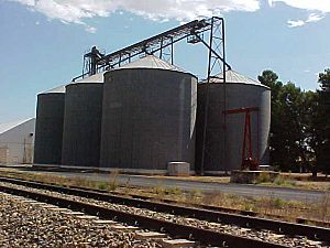
Snowtown is in a "wheat-belt" area. This means its economy mainly relies on growing cereal crops like wheat. Other important industries include:
- Woolgrowing (raising sheep for wool).
- Livestock production (raising other farm animals).
- Salt mining from Lake Bumbunga nearby.
Snowtown also serves as a service center for the local area. It provides important services for people living nearby and for drivers on the Augusta Highway.
Snowtown Wind Farm
In 2008, a company called TrustPower built the first part of the Snowtown Wind Farm. This farm has 47 wind turbines in the Barunga and Hummocks mountains west of Snowtown. Each turbine is 110 meters tall from the ground to the tip of its blade.
Snowtown Wind Farm 2 is one of Australia's most modern wind farms. It started working in 2014. This wind farm makes enough electricity to power 180,000 homes in South Australia!
Buildings and Transport
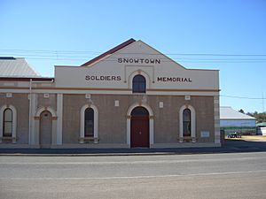
The main street in Snowtown is Fourth Street. Here you'll find most of the town's public buildings. These include the Snowtown Memorial Hall, built in 1919, which is connected to the Old Institute, built in 1885. There's also a monument honoring the first settlers. The town has a population of 467 people.
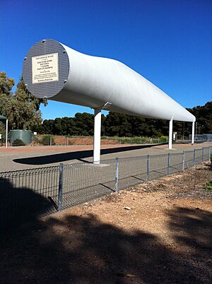
In 2008, a special monument was put up in Snowtown. It's a 44-meter-long wind turbine blade! You can see it where Fourth Street and Railway Terrace East meet.
Transport Routes
The main road running just west of Snowtown became part of Australia's Highway 1 in 1955. The part of this highway that goes past Snowtown was named Augusta Highway in 2011.
The Snowtown-Kadina railway line opened in 1879. It connected Snowtown to the port of Wallaroo. This line was changed over the years and eventually closed in 1993.
The main railway line from Salisbury has run through Snowtown since 1923. This line connects Snowtown directly to Adelaide. In 1982, this railway line was changed to a standard size, making train travel easier.
Snowtown School
In 1879, Mrs. Lamb opened a small school in Snowtown with 14 students. Over the years, the school became well-known for its focus on agricultural science (the study of farming).
In 1961, the school became the Snowtown Area School. It had a large area of land, with 10 hectares used just for farming studies.
During the 1970s and 1980s, students from nearby towns came to Snowtown for its strong agriculture program. The school often entered animals and plants in competitions, especially sheep and beef cattle. For a few years in the early 1980s, the school even had its own Poll Dorset sheep stud (a place for breeding sheep) called 'SASdor'.
In 2006, Snowtown Area School had 118 students. Many students came from nearby places like Lochiel, Barunga Gap, and Redhill. Students could also take classes online through the Open Access College or at bigger schools nearby.
By 2012, fewer students were enrolling, which meant less funding. So, the school stopped accepting older students in 2013. It was then renamed Snowtown Primary School. In 2015, Snowtown Primary School had 52 students.
Notable Residents
- Australian cricketer Lauren Ebsary was born and went to school in Snowtown.
 | Roy Wilkins |
 | John Lewis |
 | Linda Carol Brown |


